Old Maps of Stokesdale, North Carolina for Academic Research
Study the evolution of Stokesdale with 38 high-resolution historic maps. Whether you're teaching, researching, or modeling changes in land use, these maps provide essential visual documentation of urban, environmental, and geographic change.
- Analyze long-term change: Track patterns in development, transportation, and natural features.
- Ideal for environmental or urban studies: Support academic projects with primary historical map data.
- Use in the classroom or lab: Educators and researchers rely on these maps to bring historical context to life.
These maps are a powerful tool for teaching, research, and visualizing how Stokesdale has changed over the decades.
Stokesdale, NC maps
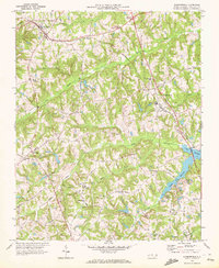
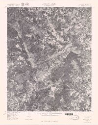
(38)- 1953 Map of Winston-Salem, 1974 Print
 1953 Winston-Salem1974 Print · USGSThe North Carolina Piedmont and Virginia highlands meet in the mid-1950s, a landscape defined by the tobacco and textile hubs of the Blue Ridge foothills. Researchers can trace the rail-and-river geography connecting Winston-Salem to mountain towns like Mount Airy and Galax.2 unique versions available
 - 1953 Map of Greensboro, 1981 Print
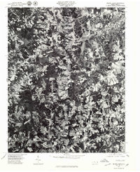
 1953 Greensboro1981 Print · USGSThe Piedmont borderlands of North Carolina and Virginia show a landscape defined by new reservoirs and old rail lines. Trace family roots and the changing river geography through Elon College, the John H Kerr Reservoir, and South Boston.
 - 1954 Map of Greensboro
 1954 Greensboro1954 Print · USGSThe Piedmont borderlands of North Carolina and Virginia come alive in this mid-fifties study of a region defined by its rivers and rails. Researchers can trace the growing Buggs Island Lake or follow the paths of the Southern Ry and Seaboard Air Line RR through towns like Oxford and Reidsville.
 - 1955 Map of Winston-Salem
 1955 Winston-Salem1955 Print · USGSThe Central Blue Ridge and Piedmont transition are captured here in the mid-fifties, from the industrial hub of Winston-Salem to the high peaks of Southwest Virginia. Genealogists can trace family landmarks like Richmond Hill Ch, Siloam Ch, and the old rail stops along the Southern Railway.
 - 1962 Map of Winston-Salem
 1962 Winston-Salem1962 Print · USGSThe North Carolina Piedmont meets the Virginia highlands in the early sixties, showing the rail corridors and mountain gaps of the southern Appalachians. Researchers can trace the Blue Ridge Parkway or locate family sites near Winston-Salem, Mount Airy, and Hanging Rock Mountain.
 - 1962 Map of Greensboro
 1962 Greensboro1962 Print · USGSThe Piedmont region along the Virginia and North Carolina border comes alive in the early 1960s, showing a landscape defined by industry and new reservoirs. Trace the path of the Virginian RR or explore the early development of Greensboro and Durham.
 - 1966 Map of Greensboro
 1966 Greensboro1966 Print · USGSThe North Carolina and Virginia Piedmont thrives during the mid-sixties, showcasing a landscape of textile hubs and expanding river reservoirs. Researchers can trace the rail corridors of the Southern Railway, find local landmarks like Elon College, or locate the extensive Camp Butner Military Reservation.
 - 1969 Map of Summerfield, 1972 Print
 1969 Summerfield1972 Print · USGSGuilford County entered a period of steady growth in the late sixties as traditional crossroads like Summerfield and Oak Ridge expanded. Genealogists can locate family-named landmarks and institutions like Laughlin Sch and Moravia Ch near the banks of Lake Brandt.2 unique versions available
 - 1969 Map of Belews Creek, 1972 Print
 1969 Belews Creek1972 Print · USGSThe rural Piedmont region of Forsyth County is captured here just as the landscape was adapting to post-war growth. Researchers can trace the roots of local communities through landmarks like Crims Crossroads, Pine Ridge Ch, and the waters of Belews Lake.3 unique versions available
 - 1971 Map of Belews Lake, 1973 Print
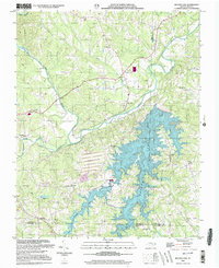
 1971 Belews Lake1973 Print · USGSThe rural borderlands of Stokes and Rockingham counties are captured here in the early 1970s as the landscape transformed around Belews Lake. Researchers can trace old family sites near Pine Hall, Camp Vaughn, and country landmarks like Sycamore Ch.3 unique versions available
 - 1971 Map of Ellisboro, 1974 Print
 1971 Ellisboro1974 Print · USGSRockingham County in the early seventies was a landscape of quiet rural settlements and small-town hubs linked by the Dan River and the rail. Researchers can trace local roots through numerous country landmarks like Comers Chapel, Hayes Chapel, and the Woodland Cem.2 unique versions available
 - 1977 Map of Belews Lake, 1979 Print
 1977 Belews Lake1979 Print · USGSThe Dan River and its surrounding Piedmont landscapes are captured in detail in the late seventies. Researchers can trace the sprawling shoreline of Belews Lake or locate the historic settlement of Pine Hall along the Dan River.
 - 1977 Map of Belews Creek, 1979 Print
 1977 Belews Creek1979 Print · USGSNorth Carolina's central Piedmont is captured here during the late 1970s, showcasing the rural character and emerging development of Forsyth County. Researchers can trace the exact 1977 land-use patterns around Kernersville and the expansive shoreline of Belews Lake.
 - 1984 Map of Greensboro
 1984 Greensboro1984 Print · USGSThe North Carolina Piedmont in the mid-eighties shows a region of growing urban centers and vital water resources. Local historians can trace the development of Greensboro, locate the Elon College campus, or explore the grounds of Guilford Courthouse National Military Park.
 - 1984 Map of Winston-Salem, 1985 Print
 1984 Winston-Salem1985 Print · USGSThe North Carolina Piedmont in the mid-1980s shows the growth of Winston-Salem and the busy rail corridors of the Southern Railway. Genealogists and local historians can trace family-named lands and rural communities from Yadkinville to Mount Airy.2 unique versions available
 - 1997 Map of Ellisboro, 2000 Print
 1997 Ellisboro2000 Print · USGSSouthern Rockingham County in the late 1990s is captured here, showing the rural communities of Ellisboro and Intelligence near the Dan River. Genealogists can locate numerous landmarks including Kallam Grove Ch, Gideon Ch, and Woodland Cem.
 - 2000 Map of Belews Creek, 2003 Print
 2000 Belews Creek2003 Print · USGSThe rolling hills of Forsyth and Guilford Counties are documented here as they appeared at the turn of the century. Genealogists and local historians can trace family locations near Crims Crossroads, White Oak Grove Ch, and the old Oak Spring Ch (Cem).
 - 2000 Map of Belews Lake, 2003 Print
 2000 Belews Lake2003 Print · USGSThe Piedmont landscape at the turn of the millennium shows a fascinating mix of rural tradition and industrial utility where four counties meet. Genealogists and local historians can locate numerous landmarks like Withers Chapel, Camp Vaughn, and the riverside settlement of Pine Hall.
 - 2010 Map of Belews Lake, 2010 Print
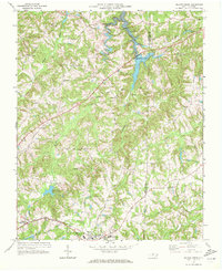
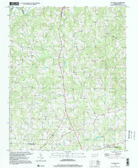
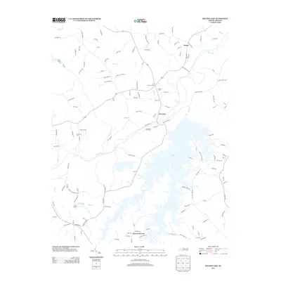
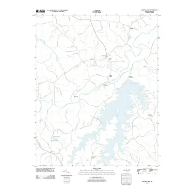 2010 Belews Lake2010 Print · USGSCovers Stokesdale, including Ceramic, Stonewood Acres, and other nearby areas
 - 2010 Map of Belews Creek, 2010 Print
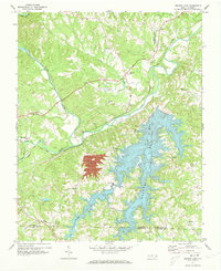
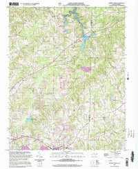
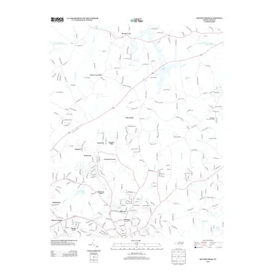
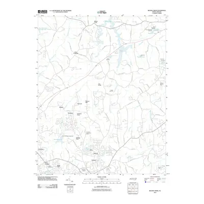 2010 Belews Creek2010 Print · USGSCovers Stokesdale, including Kernersville, Oak Ridge, and other nearby areas
 - 2010 Map of Ellisboro, 2010 Print
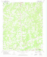
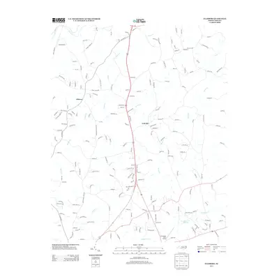
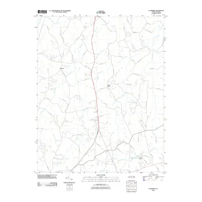 2010 Ellisboro2010 Print · USGSCovers Stokesdale, including Summerfield, Madison, and other nearby areas
 - 2010 Map of Summerfield, 2010 Print
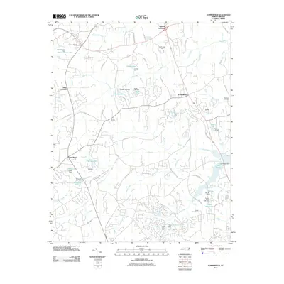 2010 Summerfield2010 Print · USGSCovers Stokesdale, including Greensboro, Summerfield, and other nearby areas
 - 2013 Map of Belews Creek, 2013 Print
 2013 Belews Creek2013 Print · USGSCovers Stokesdale, including Kernersville, Oak Ridge, and other nearby areas
 - 2013 Map of Belews Lake, 2013 Print
 2013 Belews Lake2013 Print · USGSCovers Stokesdale, including Ceramic, Stonewood Acres, and other nearby areas
 - 2013 Map of Ellisboro, 2013 Print
 2013 Ellisboro2013 Print · USGSCovers Stokesdale, including Summerfield, Madison, and other nearby areas
Showing maps 1-25 of 38
Top cities near Stokesdale
- Greensboro historical maps
- Winston-Salem historical maps
- High Point historical maps
- Kernersville historical maps
- Summerfield historical maps
- Walkertown historical maps
See more
Top neighborhoods of Stokesdale
Frequently asked questions
- What are the different types of historical maps available for Stokesdale?
- What is the oldest map of Stokesdale?
- Where can I purchase historical maps of Stokesdale for my home or office?
- Where can I download high-res historical maps of Stokesdale?
- Are there historical topographic maps available for Stokesdale?
- Is there historical aerial imagery available for Stokesdale?
- Where are historical maps of Stokesdale sourced from?