1940s Maps of Iron Duff, North Carolina
Explore 2 historic maps of Iron Duff from the 1940s. These maps offer a rare glimpse into what life looked like during the 1940s — showing old roads, neighborhoods, homes, and landmarks that have changed or disappeared over time.
Whether you're researching your family's past, planning a metal detecting trip, or studying how Iron Duff's landscape evolved across the 1940s, these high-resolution maps are a powerful tool for exploring the history of this region.
- Focus on a specific era: All maps on this page are from the 1940s, giving you a focused view of this time period.
- See what’s changed: Compare century-old streets, trails, and buildings to today's modern landscape using overlays and satellite layers.
- Research with precision: Use these maps for genealogy, historical research, land use analysis, or educational projects.
- View, download, or print: Maps are fully viewable online in high resolution, and can be downloaded or printed for your own records.
Start exploring Iron Duff's history through authentic maps from the 1940s. This is your window into the past.
Iron Duff, NC maps
(2)- 1941 Map of Clyde, 1956 Print
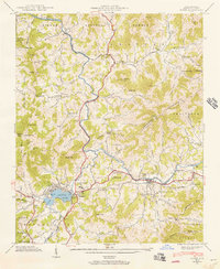 1941 Clyde1956 Print · USGSHaywood County is seen here in the early 1940s, where the Pigeon River and SOUTHERN railroad shaped the local valley economies. Researchers can trace family sites from Lake Junaluska to rural landmarks like Antioch Ch and Bonaventure Cem.
 - 1942 Map of Clyde
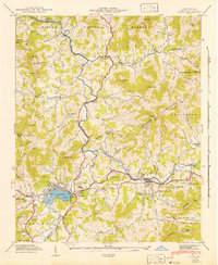 1942 Clyde1942 Print · USGSHaywood County at the start of the 1940s reveals a landscape of tight-knit cove communities and river-valley industry. Genealogists and historians can trace family locations through Lake Junaluska, Old Thickety Ch, and the many coves like Heines Cove.
End of results
Showing maps 1-2 of 2
Top cities near Iron Duff
Frequently asked questions
- What are the different types of historical maps available for Iron Duff?
- What is the oldest map of Iron Duff?
- Where can I purchase historical maps of Iron Duff for my home or office?
- Where can I download high-res historical maps of Iron Duff?
- Are there historical topographic maps available for Iron Duff?
- Is there historical aerial imagery available for Iron Duff?
- Where are historical maps of Iron Duff sourced from?