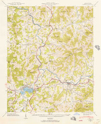
1941 Map of Clyde
USGS Topo · Published 1956About this map
The Pigeon River flows through this mountain landscape of Haywood County, where agricultural valleys and steep timberlands intersect. Centered on the town of Clyde, the map reveals a well-established network of rural communities such as Crabtree and Ironduff. The Southern railroad line follows the river's path, anchoring the local economy and connecting these settlements to the broader region. To the west, the religious and social center of Lake Junaluska stands as a prominent landmark near the boundary of Waynesville.
Find a feature on this map
75 named features on this map. Tap any name to fly to it.
Don’t see what you’re looking for? This feature index may not catch every label — zoom into the map to look around manually.
Map Details
Editions of this 1941 Clyde Map
This is the sole edition of this map. No revisions or reprints were ever made.
Other maps of this area

1891 · Cowee
USGS Topo · 1:125,000

1893 · Mt Guyot
USGS Topo · 1:125,000

1894 · Asheville
USGS Topo · 1:125,000

1897 · Cowee
USGS Topo · 1:125,000

1901 · Asheville
USGS Topo · 1:125,000

1905 · Pisgah
USGS Topo · 1:125,000

1906 · Pisgah
USGS Topo · 1:125,000

1907 · Cowee
USGS Topo · 1:125,000

1912 · Mt Guyot
USGS Topo · 1:125,000

1935 · Cruso
USGS Topo · 1:24,000