1900s (20th Century) Maps of Madison County, North Carolina
Explore 59 historic maps of Madison County from the 1900s (20th Century). These maps offer a rare glimpse into what life looked like during the 1900s — showing old roads, neighborhoods, homes, and landmarks that have changed or disappeared over time.
Whether you're researching your family's past, planning a metal detecting trip, or studying how Madison County's landscape evolved across the 1900s, these high-resolution maps are a powerful tool for exploring the history of this region.
- Focus on a specific era: All maps on this page are from the 1900s, giving you a focused view of this time period.
- See what’s changed: Compare century-old streets, trails, and buildings to today's modern landscape using overlays and satellite layers.
- Research with precision: Use these maps for genealogy, historical research, land use analysis, or educational projects.
- View, download, or print: Maps are fully viewable online in high resolution, and can be downloaded or printed for your own records.
Start exploring Madison County's history through authentic maps from the 1900s. This is your window into the past.
Madison County, NC maps
(59)- 1900 Map of Mount Mitchell, 1963 Print
 1900 Mount Mitchell1963 Print · USGSWestern North Carolina at the turn of the century shows a landscape of high peaks and isolated river settlements before the arrival of modern highways. Genealogists and mountain historians can trace early homesteads along the Cane River or follow the Southern RR through Old Fort and Black Mountain.3 unique versions available
 - 1901 Map of Asheville
 1901 Asheville1901 Print · USGSWestern North Carolina at the turn of the century shows a mountain landscape adapting to the arrival of major railroads. Genealogists and historians can trace family-named peaks and early communities like Mars Hill, Hot Springs, and the estates at Biltmore.9 unique versions available
 - 1902 Map of Mount Mitchell, 1937 Print
 1902 Mount Mitchell1937 Print · USGSThe high peaks of Western North Carolina are captured here at the start of the twentieth century, showing the rail and river corridors that shaped the region. Trace early settlements like Burnsville, Montreat, and the winding Southern Railway.3 unique versions available
 - 1904 Map of Greeneville
 1904 Greeneville1904 Print · USGSEast Tennessee at the turn of the century reveals a land of ridge-valley farms and early educational centers. Genealogists can trace family roots through historic settlements like Surgoinsville, early institutions like Washington College, and landmarks such as Bashors Mill.4 unique versions available
 - 1935 Map of Paint Rock
 1935 Paint Rock1935 Print · USGSThe French Broad River corridor at the Tennessee-North Carolina border comes to life in this mid-1930s survey. Genealogists and local historians can trace family locations near Paint Rock and Harmony Grove or find old community centers like Wolf Creek Sch and Mt Olive Ch.
 - 1935 Map of Bald Creek
 1935 Bald Creek1935 Print · USGSWestern North Carolina's high country is captured here in the mid-1930s, documenting the remote mountain valleys and ridge-top borders of Yancey County. Genealogists can trace family homes near Possumtrot, Bee Log, and rural schools like Horton Hill Sch.
 - 1935 Map of Hot Springs
 1935 Hot Springs1935 Print · USGSThe French Broad River valley and the Tennessee borderlands come alive in the mid-1930s as the Appalachian Trail took shape across these ridges. Genealogists can locate Hot Springs at its rail-and-river peak, along with Fairview Ch and the Odd Fellows Cem.
 - 1935 Map of Barnardsville
 1935 Barnardsville1935 Print · USGSBarnardsville and the surrounding Blue Ridge foothills are captured in the mid-1930s before modern development altered these mountain hollows. Researchers can trace family roots through numerous burial sites like Whitaker Cem and locate vanished centers of community like Just PO and Sodom.
 - 1935 Map of Spring Creek
 1935 Spring Creek1935 Print · USGSThe French Broad River valley and the high ridges of the Appalachian Trail are captured here in the mid-1930s. Genealogists can trace family landmarks like Payne Chapel, Liberty Ch, and the Sandy Bottom Ferry.
 - 1935 Map of Lemon Gap
 1935 Lemon Gap1935 Print · USGSThe high ridges of the Madison County borderlands are shown in the mid-1930s as a network of gap settlements and mountain schools. Genealogists and hikers can trace the Appalachian Trail past early landmarks like the Joe PO. and Ebbs Mill.
 - 1936 Map of Marshall
 1936 Marshall1936 Print · USGSMadison County's river-driven economy is on full display in the mid-1930s, centered on the tight bends of the French Broad River. Researchers can trace old mountain schools and community hubs like Madison Seminary, Redmon Dam, and the Old Station Cem.
 - 1936 Map of Greystone
 1936 Greystone1936 Print · USGSThe Tennessee and North Carolina borderlands in the mid-1930s reveal a landscape of mountain mills and remote forest settlements. Researchers can trace early family sites like Jennings, visit rural centers like Gethsemane Ch, or locate old industrial sites like Water Fork Mill.
 - 1936 Map of Sandymush
 1936 Sandymush1936 Print · USGSBuncombe and Madison Counties are captured in the mid-1930s as high-country communities transitioned toward modern road systems. Researchers can trace family roots through numerous mountain houses and rural landmarks like Sandymush Brick Ch, Gentrys Mill, and Lusk Chapel.
 - 1936 Map of Sams Gap
 1936 Sams Gap1936 Print · USGSThe North Carolina and Tennessee borderlands come alive in the mid-1930s, showing a landscape of high ridges and deep hollows before modern development. Genealogists can trace family landmarks like Shelton Cem, English Bright Hope Sch, and the Flume Mill.
 - 1936 Map of Lake Davy Crockett
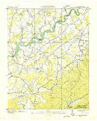 1936 Lake Davy Crockett1936 Print · USGSGreene County is documented here during the mid-1930s as new reservoirs began to alter the river valleys. Local historians can trace the foundations of many vanished community sites, from the Cove Creek Mill to the Tobacco Experimental Station and the original Birds Bridge.
 - 1936 Map of Flag Pond
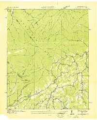 1936 Flag Pond1936 Print · USGSThe Tennessee and North Carolina borderlands come alive in the mid-1930s, showing a landscape of high ridges and secluded valley settlements. Researchers can trace the original path of the Appalachian Trail past family landmarks like Harris Mill and the Clearbranch Post Office.
 - 1936 Map of White Rock
 1936 White Rock1936 Print · USGSMadison County communities are captured here in the mid-1930s, showing a landscape of remote mountain hollows and ridge-top settlements. Researchers can locate family landmarks such as Middle Laurel Ch, Wallin Mill, and the small community of Sodom.
 - 1936 Map of Hepco
 1936 Hepco1936 Print · USGSHaywood and Madison counties are captured here in the mid-1930s, showing a landscape of high ridges and rural valley communities. Genealogists can trace family roots through landmarks like James Chapel Sch, Belmont Ch, and the settlement of Hepco near the Hepco Dam.
 - 1936 Map of Mars Hill
 1936 Mars Hill1936 Print · USGSMadison and Buncombe counties meet in this mid-1930s survey of the Blue Ridge foothills during a period of infrastructure expansion. Researchers can locate dozens of country landmarks like CCC Camp Joe, the Abandoned Power Dam, and Old Bull Creek Ch.
 - 1936 Map of Leicester
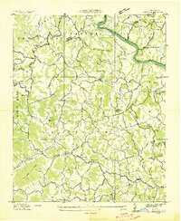 1936 Leicester1936 Print · USGSLeicester and the surrounding Buncombe County townships appear here during the mid-1930s, showing a landscape of mountain farming and river-bound industry. Genealogists can locate family landmarks like Gudger Chapel, Sluder Cem, and the Alexander School.
 - 1939 Map of Bald Creek
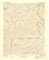 1939 Bald Creek1939 Print · USGSThe North Carolina and Tennessee borderlands appear here in the late 1930s, showing a rugged landscape of high peaks and river-valley settlements. Genealogists can locate family landmarks like Cane River (P.O.), Piney Grove Sch, and Robinson Cem during an era when the Appalachian Trail was newly established.7 unique versions available
 - 1939 Map of Greystone
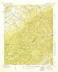 1939 Greystone1939 Print · USGSThe Tennessee and North Carolina borderlands come into focus in the late 1930s, showing a landscape of high ridges and isolated mountain hollows. Genealogists and hikers can trace the Appalachian Trail past family landmarks like Doak Cabin, Shelton Mission, and Dobson Sch.7 unique versions available
 - 1939 Map of Flag Pond
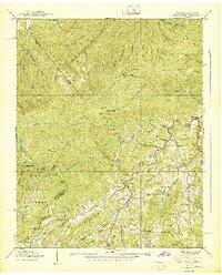 1939 Flag Pond1939 Print · USGSThe Unicoi County mountains at the end of the 1930s reveal a landscape of high-altitude settlements and family-named ridges. Researchers can trace the early Appalachian Trail route past Flag Pond, Harris Mill, and rural sites like Sams Cem.3 unique versions available
 - 1939 Map of Davy Crockett Lake, 1956 Print
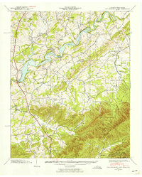 1939 Davy Crockett Lake1956 Print · USGSIn the late 1930s, this Greene County landscape was dominated by the waters of Davy Crockett Lake and the rugged boundary of the Bald Mountains. Researchers can trace old family sites and community roots through landmarks like Staunton Mill, Price Cem, and the path of Lonesome Pine Trail.5 unique versions available
 - 1939 Map of White Rock, 1957 Print
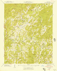 1939 White Rock1957 Print · USGSMadison County high country is documented here just before the war, showing the deep-hollow settlements and family landmarks of the Blue Ridge. Genealogists can trace ancestral sites at Gosnell Cem, the Rice Mill, and small mountain communities like Cutshalltown or Guntertown.5 unique versions available
Showing maps 1-25 of 59
Top cities of Madison County
Frequently asked questions
- What are the different types of historical maps available for Madison County?
- What is the oldest map of Madison County?
- Where can I purchase historical maps of Madison County for my home or office?
- Where can I download high-res historical maps of Madison County?
- Are there historical topographic maps available for Madison County?
- Is there historical aerial imagery available for Madison County?
- Where are historical maps of Madison County sourced from?