1970s Maps of Montgomery County, North Carolina
Explore 12 historic maps of Montgomery County from the 1970s. These maps offer a rare glimpse into what life looked like during the 1970s — showing old roads, neighborhoods, homes, and landmarks that have changed or disappeared over time.
Whether you're researching your family's past, planning a metal detecting trip, or studying how Montgomery County's landscape evolved across the 1970s, these high-resolution maps are a powerful tool for exploring the history of this region.
- Focus on a specific era: All maps on this page are from the 1970s, giving you a focused view of this time period.
- See what’s changed: Compare century-old streets, trails, and buildings to today's modern landscape using overlays and satellite layers.
- Research with precision: Use these maps for genealogy, historical research, land use analysis, or educational projects.
- View, download, or print: Maps are fully viewable online in high resolution, and can be downloaded or printed for your own records.
Start exploring Montgomery County's history through authentic maps from the 1970s. This is your window into the past.
Montgomery County, NC maps
(12)- 1973 Map of Eleazer, 1976 Print
 1973 Eleazer1976 Print · USGSThe rural landscapes of southern Randolph County are captured here in the early seventies, just as the Uwharrie highlands remained a quiet patchwork of forest and farm. Genealogists can trace the locations of historic congregations at Strieby Ch and Mt Lebanon Ch or find the remote settlement of Eleazer.
 - 1973 Map of Seagrove, 1977 Print
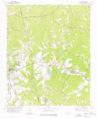
 1973 Seagrove1977 Print · USGSThe rural communities of Randolph and Montgomery counties are captured here in the early 1970s as the local economy transitioned from traditional farming. Genealogists can locate family landmarks such as Center Cross Ch, Fairview Ch, and the crossroads at Whynot.
 - 1974 Map of Candor, 1977 Print
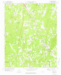
 1974 Candor1977 Print · USGSThe Norfolk Southern line crosses the Sandhills in the mid-1970s, linking the communities of Candor and Eagle Springs. Genealogists and historians can trace local landmarks like Big Oak Academy, Antioch Ch, and the Candor Cem.2 unique versions available
 - 1976 Map of West End
 1976 West End1976 Print · USGSMoore County's sandhills region is seen here in the mid-seventies, showing the intersection of agricultural clearings and dense woodland. Researchers can trace the exact layout of settlements like West End and Jackson Springs or the path of Drowning Creek.
 - 1976 Map of Harrisville, 1978 Print
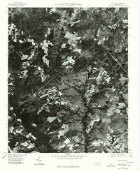
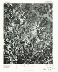
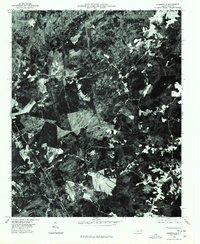 1976 Harrisville1978 Print · USGSMontgomery County land use is frozen in time during the mid-seventies in this detailed aerial orthophoto. Researchers can pinpoint the exact locations of farms and homesteads near Harrisville and the rural crossroads of Covington.
 - 1976 Map of Norman, 1978 Print
 1976 Norman1978 Print · USGSRichmond County in the mid-seventies is documented here through high-resolution aerial imagery rather than traditional line work. You can precisely trace the rural layout of Norman and Plain View or follow the path of Drowning Creek.
 - 1976 Map of Mount Gilead East, 1978 Print
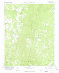
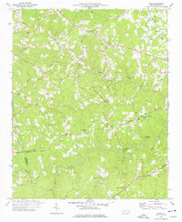
 1976 Mount Gilead East1978 Print · USGSThe area east of Mount Gilead is captured in the mid-seventies, showing the agricultural heart of Montgomery County. You can trace the winding LITTLE RIVER and see how early road networks like 109 and 731 intersected the local landscape.
 - 1977 Map of Spies, 1978 Print
 1977 Spies1978 Print · USGSIn the Piedmont countryside of the late 1970s, this area shows a landscape of family-named landmarks and winding creek branches. Trace local history along the NORFOLK SOUTHERN line through Spies or locate ancestors at Shamburger Cem and Mt Zion Ch.
 - 1977 Map of High Rock, 1979 Print
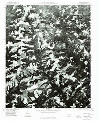
 1977 High Rock1979 Print · USGSCentral North Carolina in the late seventies is captured here through aerial photography, showing the rural riverfront before modern suburban expansion. Researchers can trace land ownership patterns and rural crossroads near Healing Springs, Jackson Hill, and along the banks of the Yadkin River.
 - 1977 Map of Albemarle SE, 1979 Print
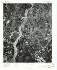 1977 Albemarle SE1979 Print · USGSThe Montgomery County riverfront was evolving in the late seventies as residential life centered on the water. Researchers can trace the exact 1977 shoreline of Lake Tillery and find local settlements like River Haven and Pee Dee.
 - 1977 Map of Albemarle NE, 1979 Print
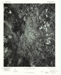 1977 Albemarle NE1979 Print · USGSIn the late 1970s, the Montgomery County landscape was defined by the dense forests of the Uwharrie Mountains and the waters of Badin Lake. Researchers can trace the layout of rural settlements like Eldorado and Blaine through direct aerial imagery.
 - 1977 Map of Albemarle NW, 1979 Print
 1977 Albemarle NW1979 Print · USGSStanly County in the late seventies is shown in remarkable aerial detail, reflecting the transition between rural agriculture and town growth. Trace old property lines and community landmarks like Austins Mill, New London, and the shores of Badin Lake.
End of results
Showing maps 1-12 of 12
Top cities of Montgomery County
- Troy historical maps
- Biscoe historical maps
- Mount Gilead historical maps
- Candor historical maps
- Star historical maps
Frequently asked questions
- What are the different types of historical maps available for Montgomery County?
- What is the oldest map of Montgomery County?
- Where can I purchase historical maps of Montgomery County for my home or office?
- Where can I download high-res historical maps of Montgomery County?
- Are there historical topographic maps available for Montgomery County?
- Is there historical aerial imagery available for Montgomery County?
- Where are historical maps of Montgomery County sourced from?