Old Maps of Montgomery County, North Carolina for Academic Research
Study the evolution of Montgomery County with 150 high-resolution historic maps. Whether you're teaching, researching, or modeling changes in land use, these maps provide essential visual documentation of urban, environmental, and geographic change.
- Analyze long-term change: Track patterns in development, transportation, and natural features.
- Ideal for environmental or urban studies: Support academic projects with primary historical map data.
- Use in the classroom or lab: Educators and researchers rely on these maps to bring historical context to life.
These maps are a powerful tool for teaching, research, and visualizing how Montgomery County has changed over the decades.
Montgomery County, NC maps
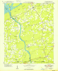
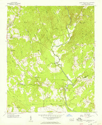
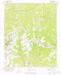
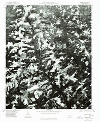
(150)- 1942 Map of Troy
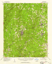
 1942 Troy1942 Print · USGSMid-century central North Carolina comes alive through this 1940s survey of the rail-linked towns between the Uwharrie hills and the Sandhills. Trace the historic Norfolk Southern line through Troy, Star, and Biscoe, or locate the Morrison Training School and local springs.
 - 1949 Map of High Rock
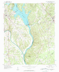
 1949 High Rock1949 Print · USGSDavidson County in the late 1940s is defined by the winding Yadkin River and its rural church communities. Researchers can trace ancestral connections through family-named crossings like Bringle Ferry or find local landmarks such as Lick Creek Ch and Bald Mtn.2 unique versions available
 - 1949 Map of West End, 1953 Print
 1949 West End1953 Print · USGSMoore County at the close of the 1940s reveals a landscape of growing residential pockets and established rail corridors. Genealogists and historians can trace community roots through the West End settlement, local churches like McDonalds Chapel, and the historic Jackson Springs area.3 unique versions available
 - 1949 Map of Jackson Springs, 1954 Print
 1949 Jackson Springs1954 Print · USGSThe North Carolina Sandhills were undergoing a transition in the late 1940s as military footprints expanded alongside rural farming communities. Genealogists and historians can trace the foundations of Camp Mackall and find local landmarks like the Morrison Training Sch and Jackson Springs.
 - 1950 Map of Norman, 1953 Print
 1950 Norman1953 Print · USGSThe town of Norman and the surrounding Sandhills region appear here in the early fifties, showing a rural landscape tied to the Norfolk Southern railroad. Trace family sites at Leakes Sch, the Williamson Cem, or settlements like Wind Blow and Derby.2 unique versions available
 - 1953 Map of Raleigh, 1965 Print
 1953 Raleigh1965 Print · USGSCentral North Carolina in the early sixties shows a landscape of growing towns and military hubs before the full expansion of the interstate system. Genealogists can trace family footprints across the Piedmont through Wake Forest, Siler City, and the large Fort Bragg Military Reservation.4 unique versions available
 - 1953 Map of Charlotte, 1968 Print
 1953 Charlotte1968 Print · USGSThe North Carolina Piedmont and South Carolina borderlands are shown in detail during a period of significant growth and reservoir development. Trace the rail corridors of the Southern Railway or find family roots in towns like China Grove, Misenheimer, and Lincolnton.3 unique versions available
 - 1954 Map of Charlotte
 1954 Charlotte1954 Print · USGSThe North Carolina Piedmont in the mid-1950s shows a region of rapid growth and industrial expansion centered around Charlotte. Trace the era's infrastructure through the Southern railroad lines and locate significant landmarks like the Charlotte Naval Ammunition Depot and Lake Norman.2 unique versions available
 - 1954 Map of Raleigh
 1954 Raleigh1954 Print · USGSThe North Carolina Piedmont and Sandhills are captured in the mid-fifties during a period of steady regional growth. Genealogists and historians can trace the development of towns like Siler City or locate landmarks such as Falls of Neuse and Camp Mackall.
 - 1956 Map of Mount Gilead East, 1957 Print
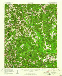
 1956 Mount Gilead East1957 Print · USGSThe Montgomery and Richmond County line comes to life in the mid-1950s, showing a landscape of small farms and historic churches. Researchers can locate the State Town Creek Indian Mound Res, trace the Norfolk Southern rail line, and find old family sites like Littles Mill and Sharon Cem.3 unique versions available
 - 1956 Map of Harrisville, 1957 Print
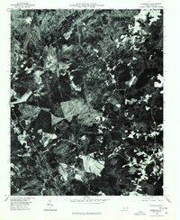
 1956 Harrisville1957 Print · USGSThe rural borderlands of Montgomery and Richmond Counties are captured here in the mid-1950s, showing a landscape of small settlements and mountain peaks. Genealogists can trace family landmarks like Capels Mill, the Parsons-Howell School, and Blackwood Chapel.3 unique versions available
 - 1956 Map of Mount Gilead West, 1957 Print
 1956 Mount Gilead West1957 Print · USGSThe area surrounding the Pee Dee and Rocky rivers shows a landscape of rail-connected towns and riverside power in the mid-1950s. Genealogists can trace family roots through numerous local parishes like Providence Ch and the rural community of Cedar Hill.3 unique versions available
 - 1957 Map of Albemarle, 1958 Print
 1957 Albemarle1958 Print · USGSThe Stanly County landscape in the mid-fifties is defined by the growing city of Albemarle and the newly formed reservoirs along the Yadkin River. Genealogists and historians can trace family locations near Bethel Ch, Goggins Mine, and the old Austins Mill.2 unique versions available
 - 1957 Map of Denton, 1958 Print
 1957 Denton1958 Print · USGSIn the foothills of Davidson County during the late fifties, rural life centered on the banks of the Yadkin and the local rail lines. Researchers can trace family sites like Jackson Hill, rural congregations at New Jerusalem Ch, and the workings of the Silver Mine.
 - 1957 Map of Troy, 1958 Print
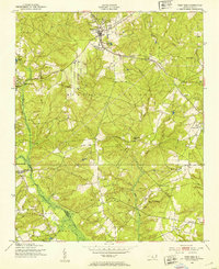
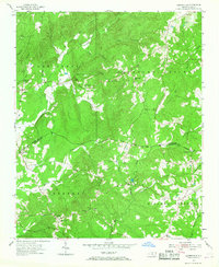
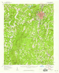
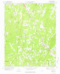
 1957 Troy1958 Print · USGSMontgomery County was a landscape of river-valley settlements and rural industry in the late fifties. Genealogists and historians can trace family-named landmarks and remote communities like Ophir or Flint Hill, along with dozens of local steeples including Clarks Grove Ch and Ropers Grove Ch.2 unique versions available
 - 1957 Map of Asheboro, 1959 Print
 1957 Asheboro1959 Print · USGSRandolph County's rural and industrial character is captured here during the late fifties, centered on the growing town of Asheboro. Researchers can trace old family roots at Whynot, locate the State Prison (Camp 406), or find numerous rural landmarks like Tabernacle Sch and Callicutts Ch.2 unique versions available
 - 1957 Map of Jackson Springs, 1961 Print
 1957 Jackson Springs1961 Print · USGSMoore and Richmond counties in the late 1950s reflect a mix of military presence and quiet rural life. Researchers can trace families near Jackson Springs, locate the old Hoffman High Sch, or find rural landmarks like Marcus Grove Ch and Millstone Lake.
 - 1960 Map of Charlotte
 1960 Charlotte1960 Print · USGSMid-century North Carolina and South Carolina meet in this 1960 survey of the Piedmont's industrial and textile heartland. Trace the growth of Charlotte alongside historic landmarks like Kings Mountain National Military Park and the Charlotte Naval Ammunition Depot.2 unique versions available
 - 1962 Map of Charlotte
 1962 Charlotte1962 Print · USGSThe North Carolina Piedmont in the early sixties showcases a landscape transformed by massive reservoirs and industrial growth. Researchers can trace the development of Lake Norman, locate the Charlotte Naval Ammunition Depot, or find family landmarks like Wesley Chapel and Brown & Norcott Mills.
 - 1973 Map of Eleazer, 1976 Print
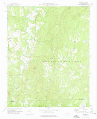 1973 Eleazer1976 Print · USGSThe rural landscapes of southern Randolph County are captured here in the early seventies, just as the Uwharrie highlands remained a quiet patchwork of forest and farm. Genealogists can trace the locations of historic congregations at Strieby Ch and Mt Lebanon Ch or find the remote settlement of Eleazer.
 - 1973 Map of Seagrove, 1977 Print
 1973 Seagrove1977 Print · USGSThe rural communities of Randolph and Montgomery counties are captured here in the early 1970s as the local economy transitioned from traditional farming. Genealogists can locate family landmarks such as Center Cross Ch, Fairview Ch, and the crossroads at Whynot.
 - 1974 Map of Candor, 1977 Print
 1974 Candor1977 Print · USGSThe Norfolk Southern line crosses the Sandhills in the mid-1970s, linking the communities of Candor and Eagle Springs. Genealogists and historians can trace local landmarks like Big Oak Academy, Antioch Ch, and the Candor Cem.2 unique versions available
 - 1976 Map of West End
 1976 West End1976 Print · USGSMoore County's sandhills region is seen here in the mid-seventies, showing the intersection of agricultural clearings and dense woodland. Researchers can trace the exact layout of settlements like West End and Jackson Springs or the path of Drowning Creek.
 - 1976 Map of Harrisville, 1978 Print
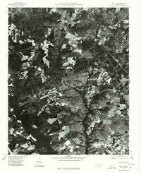
 1976 Harrisville1978 Print · USGSMontgomery County land use is frozen in time during the mid-seventies in this detailed aerial orthophoto. Researchers can pinpoint the exact locations of farms and homesteads near Harrisville and the rural crossroads of Covington.
 - 1976 Map of Norman, 1978 Print
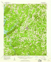
 1976 Norman1978 Print · USGSRichmond County in the mid-seventies is documented here through high-resolution aerial imagery rather than traditional line work. You can precisely trace the rural layout of Norman and Plain View or follow the path of Drowning Creek.
Showing maps 1-25 of 150
Top cities of Montgomery County
- Troy historical maps
- Biscoe historical maps
- Mount Gilead historical maps
- Candor historical maps
- Star historical maps
Frequently asked questions
- What are the different types of historical maps available for Montgomery County?
- What is the oldest map of Montgomery County?
- Where can I purchase historical maps of Montgomery County for my home or office?
- Where can I download high-res historical maps of Montgomery County?
- Are there historical topographic maps available for Montgomery County?
- Is there historical aerial imagery available for Montgomery County?
- Where are historical maps of Montgomery County sourced from?