1990s Maps of Pasquotank County, North Carolina
Explore 7 historic maps of Pasquotank County from the 1990s. These maps offer a rare glimpse into what life looked like during the 1990s — showing old roads, neighborhoods, homes, and landmarks that have changed or disappeared over time.
Whether you're researching your family's past, planning a metal detecting trip, or studying how Pasquotank County's landscape evolved across the 1990s, these high-resolution maps are a powerful tool for exploring the history of this region.
- Focus on a specific era: All maps on this page are from the 1990s, giving you a focused view of this time period.
- See what’s changed: Compare century-old streets, trails, and buildings to today's modern landscape using overlays and satellite layers.
- Research with precision: Use these maps for genealogy, historical research, land use analysis, or educational projects.
- View, download, or print: Maps are fully viewable online in high resolution, and can be downloaded or printed for your own records.
Start exploring Pasquotank County's history through authentic maps from the 1990s. This is your window into the past.
Pasquotank County, NC maps
(7)- 1997 Map of Stevenson Point, 2000 Print
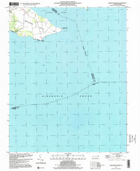 1997 Stevenson Point2000 Print · USGSThe coastal reaches of Perquimans County are captured here in the late nineties as they front the sound. Genealogists and local historians can trace the shoreline of Durants Neck from Leighs Temple down to the Seawall at Reed Point.
 - 1997 Map of Lynchs Corner, 2000 Print
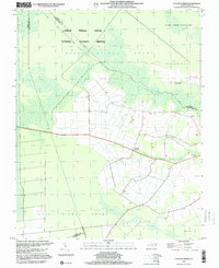 1997 Lynchs Corner2000 Print · USGSPasquotank County at the close of the twentieth century shows a landscape defined by the vast Great Dismal Swamp National Wildlife Refuge. Genealogists and local historians can locate rural landmarks like Ramoth Gilead Ch, Mt Carmel Ch, and the crossroads at Lynchs Corner.
 - 1997 Map of Chapanoke, 2000 Print
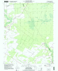 1997 Chapanoke2000 Print · USGSCoastal Perquimans County at the end of the century remains a landscape of deep timber and quiet crossroads settlements. Researchers can trace the Old Railroad Grade through the Great Dismal Swamp and locate rural landmarks like Up River Ch and Chapanoke.
 - 1997 Map of Elizabeth City, 2000 Print
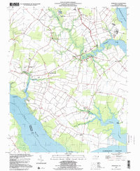
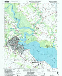 1997 Elizabeth City2000 Print · USGSElizabeth City and its surroundings in the late twentieth century highlight a riverfront community shaped by maritime traffic and aviation. Genealogists and local historians can trace family locations near Sawyers Creek Church, New Oak Grove Cemetery, or the rural crossroads at Hastings Corner.
 - 1997 Map of Weeksville, 2000 Print
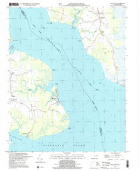
 1997 Weeksville2000 Print · USGSThe Pasquotank River peninsula comes into focus in the late nineties, showing a coastal landscape defined by its waters and military presence. Genealogists and local historians can trace family-named landmarks and old congregations like Symonds Creek Tabernacle, Listers Corner, and Newbegun Ch.
 - 1999 Map of Wade Point, 2002 Print
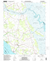
 1999 Wade Point2002 Print · USGSCoastal Camden County is documented here at the end of the century as the Pasquotank River meets the Albemarle Sound. Genealogists can locate several country churches, including Flatty Creek Ch and Gentile Ch, alongside landmarks like Old Trap and Sound Landing.
 - 1999 Map of Shiloh, 2003 Print
 1999 Shiloh2003 Print · USGSCamden County's river-bounded landscape is captured here at the end of the century, showing a region defined by its swamps and coastal reaches. Researchers can locate numerous family cemeteries and early church sites such as New Shiloh Ch and Smiths Corner.
End of results
Showing maps 1-7 of 7
Top cities of Pasquotank County
Frequently asked questions
- What are the different types of historical maps available for Pasquotank County?
- What is the oldest map of Pasquotank County?
- Where can I purchase historical maps of Pasquotank County for my home or office?
- Where can I download high-res historical maps of Pasquotank County?
- Are there historical topographic maps available for Pasquotank County?
- Is there historical aerial imagery available for Pasquotank County?
- Where are historical maps of Pasquotank County sourced from?