Old Maps of Pasquotank County, North Carolina for Hiking & Exploration
Hike through history with 83 historic maps of Pasquotank County. Explore old trails, ghost towns, and forgotten backroads — perfect for outdoor adventurers and local explorers.
- Rediscover forgotten places: Map out old mining camps, roads, and footpaths that no longer exist on modern maps.
- Layer with modern tools: Combine with LiDAR or satellite views to plan hikes through historical terrain.
- Made for exploration: Popular among hikers, overlanders, and local history lovers.
Use these maps to find adventure and explore the hidden past of Pasquotank County.
Pasquotank County, NC maps
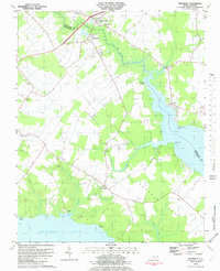
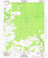
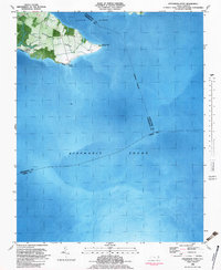
(83)- 1906 Map of Hertford
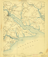 1906 Hertford1906 Print · USGSThe coastal plains of North Carolina near the Albemarle Sound are captured here during a period of river-reliant commerce and early rail growth. Researchers can trace the waterfront legacy of Hertford, the routes of the Norfolk and Southern RR, and rural post offices like Durants Neck PO.3 unique versions available
 - 1940 Map of Hertford
 1940 Hertford1940 Print · USGSThe coastal necks of Perquimans County are caught here in the early 1940s, showing a landscape defined by its deep relationship with the Albemarle Sound. Researchers can trace the waterfront history of Hertford or locate rural sites like the Durants Neck P O and Pleasant Grove Church.2 unique versions available
 - 1940 Map of Lake Drummond, 1964 Print
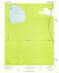
 1940 Lake Drummond1964 Print · USGSThe Great Dismal Swamp and its drainage canals are captured here in the 1940s, showing a landscape defined by timber extraction and transit. Genealogists and historians can trace old schools and landings from Jacks Camp to Wallaceton Sch and the Lumber RR.
 - 1940 Map of Wade Point, 1973 Print
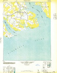
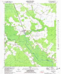
 1940 Wade Point1973 Print · USGSCoastal Pasquotank County at the start of the 1940s shows a landscape of tidewater farming and strategic military aviation. Genealogists and historians can trace family locations near Weeksville, the Air Base, and the fishing grounds of the Frog Island Fishing Club.
 - 1940 Map of South Mills, 1976 Print
 1940 South Mills1976 Print · USGSCamden and Pasquotank counties are shown in the early 1940s as communities navigated the edges of the Dismal Swamp. Genealogists can locate family-named hubs like Pierceville and Johnsons Corner or trace the Norfolk Southern Railroad line.
 - 1943 Map of Wade Point
 1943 Wade Point1943 Print · USGSThe North Carolina tidewater during the mid-forties is captured here as coastal defense and local life intersect along the Pasquotank River. Trace wartime activity at the Naval Air Base or explore rural settlements like Old Trap, Weeksville, and Listers Corner.
 - 1945 Map of Lake Drummond
 1945 Lake Drummond1945 Print · USGSThe Dismal Swamp straddles the Virginia-North Carolina line in the 1940s, revealing a landscape defined by timber extraction and historic waterways. Researchers can trace the Intracoastal Waterway, the Lumber RR, and local centers like Wallaceton and Deep Creek.
 - 1948 Map of Wade Point
 1948 Wade Point1948 Print · USGSCoastal Pasquotank County is seen here in the late 1940s, where the river-rich landscape meets the sound. Genealogists can trace family names and small hubs like Weeksville, Listers Corner, and the Frog Island Fishing Club along the intricate marshes and creeks.2 unique versions available
 - 1948 Map of Elizabeth City
 1948 Elizabeth City1948 Print · USGSCoastal North Carolina at the end of the 1940s reveals a landscape of massive swamps and vital rail corridors. Genealogists and historians can trace family-named crossroads like Hastings Corner and Smiths Corner, or locate the old Lumber Mill and Norfolk Southern Railroad stops.2 unique versions available
 - 1952 Map of South Mills
 1952 South Mills1952 Print · USGSCoastal North Carolina at mid-century reveals a complex network of timber mills and canal-side hamlets bordering the great wetlands. Trace ancestral roots and early industry through family landmarks like Lynchs Corner, the Dismal Swamp Canal, and Burnt Mills.
 - 1953 Map of Norfolk, 1954 Print
 1953 Norfolk1954 Print · USGSCoastal Virginia and northeastern North Carolina appear here during the post-war industrial boom, showing the critical rail-and-sea connections of Hampton Roads. Genealogists can trace family roots through rural landmarks like Gethsemane Ch, the Caledonia State Prison Farm, and the vast interior of the Dismal Swamp.4 unique versions available
 - 1954 Map of Lake Drummond, 1956 Print
 1954 Lake Drummond1956 Print · USGSThe Dismal Swamp interior and its border with North Carolina are captured here in the mid-fifties, showing the intersection of historic waterways and early settlements. Trace the vital connections between Lake Drummond, the Feeder Ditch, and the Dismal Swamp Canal near Wallaceton.2 unique versions available
 - 1977 Map of Lake Drummond, 1978 Print
 1977 Lake Drummond1978 Print · USGSThe Great Dismal Swamp and Lake Drummond are captured here in the late seventies, showing the complex boundary between Virginia and North Carolina. Genealogists and researchers can trace the old settlements of Wallaceton and Arbuckle Landing along the George Washington Highway.2 unique versions available
 - 1982 Map of Nixonton
 1982 Nixonton1982 Print · USGSEastern North Carolina's tidewater landscape appears in the early 1980s as a patchwork of riverfront landings and rural crossroads. Genealogists can trace family names through sites like Wilson Cem, Godfrey Cem, and the riverfront settlement at Nixonton.
 - 1982 Map of South Mills
 1982 South Mills1982 Print · USGSThe Great Dismal Swamp and its historic canal network define this coastal North Carolina landscape in the early eighties. Researchers can trace rural lineages through sites like Morgans Corners, Trinity Ch, and the Memory Gardens Cemetery.
 - 1982 Map of Weeksville
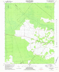
 1982 Weeksville1982 Print · USGSCoastal Pasquotank County is seen here in the early eighties as a landscape of tidewater creeks and established rural communities. Trace the grounds of the USCG Airbase or locate local landmarks like Newbegun Ch and Listers Corner near the Albemarle Sound.
 - 1982 Map of Pasquotank
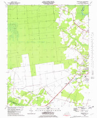 1982 Pasquotank1982 Print · USGSIn the early 1980s, the edge of the Great Dismal Swamp met the expanding infrastructure of Elizabeth City and the Pasquotank River. Researchers can trace the layout of community landmarks like Albemarle Academy, Samuel Chapel, and the industrial corridors of the NORFOLK SOUTHERN railroad.
 - 1982 Map of Chapanoke
 1982 Chapanoke1982 Print · USGSPerquimans County in the early eighties was defined by the intersection of rural settlements and the southern edge of the Great Dismal Swamp. Genealogists and local historians can trace family roots at Up River Ch or locate the paths of the Norfolk Southern and an Old Railroad Grade.
 - 1982 Map of Lynchs Corner
 1982 Lynchs Corner1982 Print · USGSThe Pasquotank County wetlands in the early eighties were a complex mosaic of conservation and remote settlements. Researchers can trace the legacy of the swamp through the Old Railroad Grade and find local landmarks like Ramoth Gilead Ch and Lynchs Corner.
 - 1982 Map of Shiloh, 1983 Print
 1982 Shiloh1983 Print · USGSCamden County's river-dependent landscape is documented in the early eighties as agriculture and the tidal wetlands met along the Pasquotank. Genealogists can locate family burial plots and community landmarks like New Shiloh Ch, Smiths Corner, and the Belcross Lookout Tower.
 - 1982 Map of Elizabeth City, 1983 Print
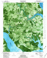
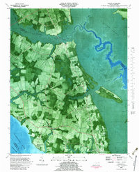
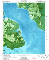
 1982 Elizabeth City1983 Print · USGSElizabeth City and its surroundings are captured in the early 1980s during a period of steady growth along the Pasquotank River. Genealogists and historians can trace the foundations of Elizabeth City State University, the U S Coast Guard Air Base, and community landmarks like Sawyers Creek Ch.2 unique versions available
 - 1982 Map of Stevenson Point, 1983 Print
 1982 Stevenson Point1983 Print · USGSCoastal Perquimans County is documented here in the early eighties as the peninsula of Durants Neck meets the sound. Researchers can trace shoreline developments like Carolina Shores or locate landmarks such as Leighs Temple and Reed Point.
 - 1982 Map of Wade Point, 1983 Print
 1982 Wade Point1983 Print · USGSCamden and Pasquotank counties meet where the river meets the sound in the early eighties. Researchers can trace rural lineages through sites like Old Trap, Wesley Ch, and New Salem Ch, or follow the Intracoastal Waterway past Frog Island.2 unique versions available
 - 1985 Map of Elizabeth City
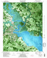
 1985 Elizabeth City1985 Print · USGSCoastal North Carolina's rivers and sounds define the landscape of the mid-eighties, from the vast swamps to the historical waterfronts of Elizabeth City and Edenton. Researchers can trace the rail lines of the Southern Ry or locate landmarks like Beaver Hill Cem and South Mills.2 unique versions available
 - 1985 Map of Norfolk, 1986 Print
 1985 Norfolk1986 Print · USGSThe Tidewater region in the mid-eighties shows the dense urban expansion of the coastal cities alongside the preservation of the Great Dismal Swamp. Researchers can trace rural family-named crossroads and historic transit routes like the Seaboard Coast Line or find Somerton and Lake Drummond.3 unique versions available
Showing maps 1-25 of 83
Top cities of Pasquotank County
Frequently asked questions
- What are the different types of historical maps available for Pasquotank County?
- What is the oldest map of Pasquotank County?
- Where can I purchase historical maps of Pasquotank County for my home or office?
- Where can I download high-res historical maps of Pasquotank County?
- Are there historical topographic maps available for Pasquotank County?
- Is there historical aerial imagery available for Pasquotank County?
- Where are historical maps of Pasquotank County sourced from?