Old Maps of Penderlea, North Carolina for Hiking & Exploration
Hike through history with 11 historic maps of Penderlea. Explore old trails, ghost towns, and forgotten backroads — perfect for outdoor adventurers and local explorers.
- Rediscover forgotten places: Map out old mining camps, roads, and footpaths that no longer exist on modern maps.
- Layer with modern tools: Combine with LiDAR or satellite views to plan hikes through historical terrain.
- Made for exploration: Popular among hikers, overlanders, and local history lovers.
Use these maps to find adventure and explore the hidden past of Penderlea.
Penderlea, NC maps
(11)- 1953 Map of Florence, 1964 Print
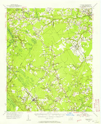
 1953 Florence1964 Print · USGSThe Carolina borderlands in the mid-fifties were a landscape of vast river swamps and rising rail towns. Trace the legacy of the Seaboard Air Line through Florence or explore the wetlands surrounding Lake Waccamaw and the Green Swamp.3 unique versions available
 - 1954 Map of Florence
 1954 Florence1954 Print · USGSThe Carolinas borderlands come alive in the early fifties, showing the vital rail-and-river networks of the coastal plain. Genealogists can trace family footprints across the Green Swamp or through settlements like Red Springs, Chadbourn, and McColl.
 - 1955 Map of Atkinson, 1957 Print
 1955 Atkinson1957 Print · USGSCoastal plain life in the mid-1950s revolves around the timberlands and rail-stops between the Black River and Moores Creek. Genealogists and historians can trace family ties through dozens of rural landmarks like Newtons Crossroads, St. Marys Ch, and Bland High Sch.2 unique versions available
 - 1982 Map of Elizabethtown, 1983 Print
 1982 Elizabethtown1983 Print · USGSSoutheastern North Carolina's coastal plain is captured here in the early eighties, showcasing a landscape defined by the Cape Fear River and mysterious Carolina Bays. Genealogists and researchers can trace the rail network of the Seaboard Coast Line through rural communities like Autryville, Ivanhoe, and the recreational hub of White Lake.
 - 1984 Map of Wallace West
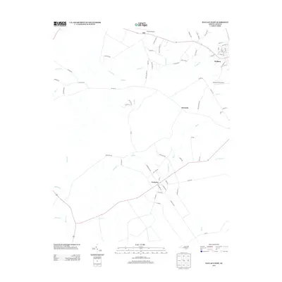
 1984 Wallace West1984 Print · USGSIn the 1980s, the Pender County countryside reflected a mix of New Deal planning and deep-rooted family history. Trace the layout of Penderlea or locate family sites like Alderman Cem and Newkirk Chapel along the Rockfish Creek basin.
 - 1997 Map of Wallace West, 2001 Print
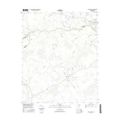
 1997 Wallace West2001 Print · USGSCoastal plain life in the late nineties is defined by the rural settlements and creek systems of Pender and Duplin counties. Genealogists and historians can trace family roots through sites like Alderman Cem, the planned community layout of Penderlea, and an Old Railroad Grade.
 - 2010 Map of Wallace West, 2010 Print
 2010 Wallace West2010 Print · USGSCovers Penderlea, including Sunnyside, Safe, and other nearby areas
 - 2013 Map of Wallace West, 2013 Print
 2013 Wallace West2013 Print · USGSCovers Penderlea, including Sunnyside, Safe, and other nearby areas
 - 2016 Map of Wallace West, 2016 Print
 2016 Wallace West2016 Print · USGSCovers Penderlea, including Sunnyside, Safe, and other nearby areas
 - 2019 Map of Wallace West, 2019 Print
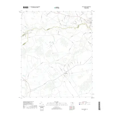 2019 Wallace West2019 Print · USGSCovers Penderlea, including Sunnyside, Safe, and other nearby areas
 - 2022 Map of Wallace West, 2022 Print
 2022 Wallace West2022 Print · USGSThe coastal plain of Pender and Duplin Counties appears here in the early 2020s, showing a landscape of rural crossroads and intricate stream networks. Genealogists can locate family burial sites like Gurganus Cem and White Cem or trace the lands near Penderlea.
End of results
Showing maps 1-11 of 11
Top cities near Penderlea
- Burgaw historical maps
- Rose Hill historical maps
- Greenevers historical maps
- Delway historical maps
- Atkinson historical maps
- Teachey historical maps
See more
Frequently asked questions
- What are the different types of historical maps available for Penderlea?
- What is the oldest map of Penderlea?
- Where can I purchase historical maps of Penderlea for my home or office?
- Where can I download high-res historical maps of Penderlea?
- Are there historical topographic maps available for Penderlea?
- Is there historical aerial imagery available for Penderlea?
- Where are historical maps of Penderlea sourced from?