Old Maps of Piney Wood, North Carolina for Genealogy
Trace your family roots with 10 historic maps of Piney Wood. These high-res maps reveal old neighborhoods, homesites, landmarks, and streets — helping you uncover where your ancestors lived and how the area evolved over time.
- Explore historic neighborhoods: Identify where your relatives may have lived in the 1800s or 1900s.
- Compare maps over time: Trace the changes in streets, buildings, and landmarks for multi-generational research.
- Perfect for genealogy & ancestry research: Used by family historians and researchers to map out lineage and migration.
These maps are an incredible resource for exploring your personal connection to Piney Wood's past.
Piney Wood, NC maps
(10)- 1953 Map of Florence, 1964 Print
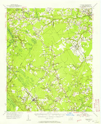
 1953 Florence1964 Print · USGSThe Carolina borderlands in the mid-fifties were a landscape of vast river swamps and rising rail towns. Trace the legacy of the Seaboard Air Line through Florence or explore the wetlands surrounding Lake Waccamaw and the Green Swamp.3 unique versions available
 - 1954 Map of Florence
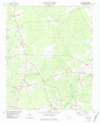
 1954 Florence1954 Print · USGSThe Carolinas borderlands come alive in the early fifties, showing the vital rail-and-river networks of the coastal plain. Genealogists can trace family footprints across the Green Swamp or through settlements like Red Springs, Chadbourn, and McColl.
 - 1955 Map of Atkinson, 1957 Print
 1955 Atkinson1957 Print · USGSCoastal plain life in the mid-1950s revolves around the timberlands and rail-stops between the Black River and Moores Creek. Genealogists and historians can trace family ties through dozens of rural landmarks like Newtons Crossroads, St. Marys Ch, and Bland High Sch.2 unique versions available
 - 1982 Map of Elizabethtown, 1983 Print
 1982 Elizabethtown1983 Print · USGSSoutheastern North Carolina's coastal plain is captured here in the early eighties, showcasing a landscape defined by the Cape Fear River and mysterious Carolina Bays. Genealogists and researchers can trace the rail network of the Seaboard Coast Line through rural communities like Autryville, Ivanhoe, and the recreational hub of White Lake.
 - 1984 Map of Costin
 1984 Costin1984 Print · USGSPender County's rural interior during the early eighties is captured here, showing a landscape of timbered lowlands and crossroads hamlets. Genealogists and researchers can trace local family landmarks from Wards Corner to Costin, including Walker Cem and Shiloh Ch.
 - 2010 Map of Costin, 2010 Print
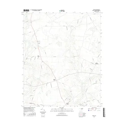
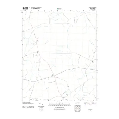 2010 Costin2010 Print · USGSCovers Piney Wood, including Costin, Rhyne Crossroad, and other nearby areas
 - 2013 Map of Costin, 2013 Print
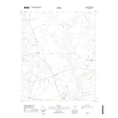
 2013 Costin2013 Print · USGSCovers Piney Wood, including Costin, Rhyne Crossroad, and other nearby areas
 - 2016 Map of Costin, 2016 Print
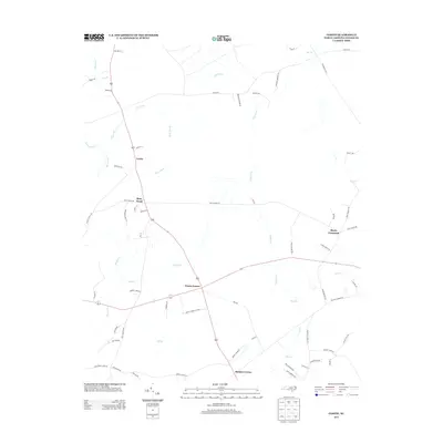
 2016 Costin2016 Print · USGSCovers Piney Wood, including Costin, Rhyne Crossroad, and other nearby areas
 - 2019 Map of Costin, 2019 Print
 2019 Costin2019 Print · USGSCovers Piney Wood, including Costin, Rhyne Crossroad, and other nearby areas
 - 2022 Map of Costin, 2022 Print
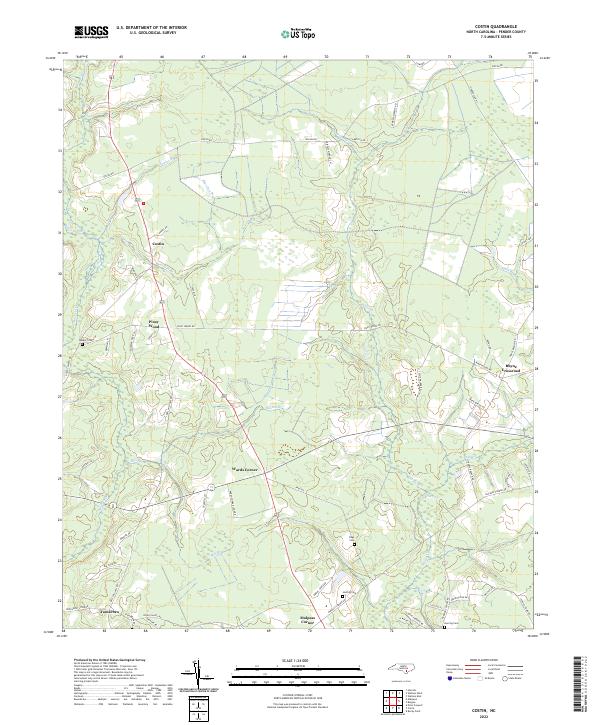 2022 Costin2022 Print · USGSPender County is shown in the early 2020s as a landscape of rural communities and intricate wetlands. Genealogists can locate family landmarks like Walker Cemetery, Herring Cemetery, and old settlements at Costin and Wards Corner.
End of results
Showing maps 1-10 of 10
Top cities near Piney Wood
- Burgaw historical maps
- Northwest historical maps
- East Arcadia historical maps
- Sandyfield historical maps
- Atkinson historical maps
- Teachey historical maps
See more
Frequently asked questions
- What are the different types of historical maps available for Piney Wood?
- What is the oldest map of Piney Wood?
- Where can I purchase historical maps of Piney Wood for my home or office?
- Where can I download high-res historical maps of Piney Wood?
- Are there historical topographic maps available for Piney Wood?
- Is there historical aerial imagery available for Piney Wood?
- Where are historical maps of Piney Wood sourced from?