1960s Maps of Person County, North Carolina
Explore 12 historic maps of Person County from the 1960s. These maps offer a rare glimpse into what life looked like during the 1960s — showing old roads, neighborhoods, homes, and landmarks that have changed or disappeared over time.
Whether you're researching your family's past, planning a metal detecting trip, or studying how Person County's landscape evolved across the 1960s, these high-resolution maps are a powerful tool for exploring the history of this region.
- Focus on a specific era: All maps on this page are from the 1960s, giving you a focused view of this time period.
- See what’s changed: Compare century-old streets, trails, and buildings to today's modern landscape using overlays and satellite layers.
- Research with precision: Use these maps for genealogy, historical research, land use analysis, or educational projects.
- View, download, or print: Maps are fully viewable online in high resolution, and can be downloaded or printed for your own records.
Start exploring Person County's history through authentic maps from the 1960s. This is your window into the past.
Person County, NC maps
(12)- 1962 Map of Greensboro
 1962 Greensboro1962 Print · USGSThe Piedmont region along the Virginia and North Carolina border comes alive in the early 1960s, showing a landscape defined by industry and new reservoirs. Trace the path of the Virginian RR or explore the early development of Greensboro and Durham.
 - 1966 Map of Greensboro
 1966 Greensboro1966 Print · USGSThe North Carolina and Virginia Piedmont thrives during the mid-sixties, showcasing a landscape of textile hubs and expanding river reservoirs. Researchers can trace the rail corridors of the Southern Railway, find local landmarks like Elon College, or locate the extensive Camp Butner Military Reservation.
 - 1967 Map of Cedar Grove, 1969 Print
 1967 Cedar Grove1969 Print · USGSNorthern Orange County's rolling hills and headwaters are captured in the late sixties as rural communities and new reservoirs shaped the land. Genealogists can trace family roots through landmarks like Harmony Cem, Mt Zion Ch, and the school at Cedar Grove.
 - 1968 Map of Leasburg, 1969 Print
 1968 Leasburg1969 Print · USGSCaswell County in the late sixties shows a landscape transformed by the newly formed Hyco Lake and its sprawling fingers. Genealogists and local historians can trace family locations along Hesters Store Road or find rural landmarks like Blanch Prison, Semora, and New Hope Ch.3 unique versions available
 - 1968 Map of Caldwell, 1970 Print
 1968 Caldwell1970 Print · USGSOrange County and the surrounding Piedmont country are captured here in the late sixties as a network of crossroads communities and small farms. Genealogists can trace family footprints across Caldwell, Schley, and numerous rural churches like Berrys Grove Ch and Olive Chapel.
 - 1968 Map of Ridgeville, 1971 Print
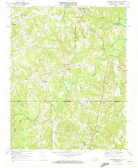
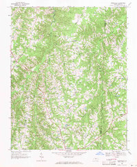 1968 Ridgeville1971 Print · USGSThe rural borderlands of Caswell and Person counties come into focus during the late sixties, a landscape of family-run stores and country parishes. Researchers can trace the heritage of Prospect Hill and Ridgeville or locate historic sites like Lea Bethel Ch and Hesters Store.2 unique versions available
 - 1968 Map of Hurdle Mills, 1971 Print
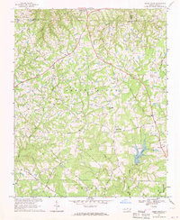
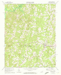
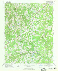 1968 Hurdle Mills1971 Print · USGSPerson County’s rural landscape is captured here in the late sixties, showing a community defined by its river forks and crossroads settlements. Genealogists can locate family landmarks like Paynes Tavern, Oak Lane Sch, and numerous country churches including Clement Ch.
 - 1968 Map of Alton, 1972 Print
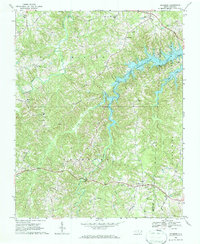
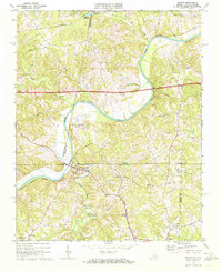
 1968 Alton1972 Print · USGSHalifax County, Virginia, and Person County, North Carolina, meet at the shores of Hyco Lake in the late sixties. Genealogists and local historians can trace family roots at McGehees Mill or explore old crossroads like Turbeville and Alton.3 unique versions available
 - 1968 Map of Cluster Springs, 1972 Print
 1968 Cluster Springs1972 Print · USGSCrossing the Virginia and North Carolina border in the late sixties, this area shows a landscape of rail-connected hamlets and riverside farms. Genealogists can trace family landmarks like Bethel Hill High Sch, Traynham Grove Ch, and the rural community of Denniston.3 unique versions available
 - 1968 Map of Milton, 1972 Print
 1968 Milton1972 Print · USGSThe Dan River valley near the Virginia-North Carolina state line is shown here in the late sixties, as rural life centered on crossroads like Milton and Semora. Genealogists and historians can locate numerous rural churches and schools, such as White Stone Ch and New Dotmond Sch.3 unique versions available
 - 1968 Map of Virgilina, 1972 Print
 1968 Virgilina1972 Print · USGSVirgilina straddles the state line in the late sixties, where the Virginia and North Carolina borderlands meet along the Norfolk Franklin and Danville tracks. Researchers can trace rural life through landmarks like Zion Hill Sch, the Ragland Cem, and the Old Railroad Grade.3 unique versions available
 - 1968 Map of Olive Hill, 1994 Print
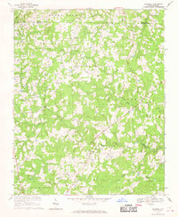
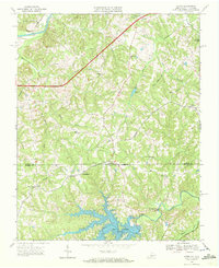
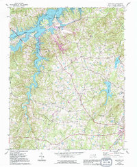 1968 Olive Hill1994 Print · USGSPerson County life in the late sixties centers on the newly formed Hyco Lake and the expanding infrastructure near Roxboro. Genealogists and local historians can trace family-named landmarks and rural hubs like Longs Store, Ceffo, and Woodland Sch.
End of results
Showing maps 1-12 of 12
Top cities of Person County
Frequently asked questions
- What are the different types of historical maps available for Person County?
- What is the oldest map of Person County?
- Where can I purchase historical maps of Person County for my home or office?
- Where can I download high-res historical maps of Person County?
- Are there historical topographic maps available for Person County?
- Is there historical aerial imagery available for Person County?
- Where are historical maps of Person County sourced from?