2020s Maps of Person County, North Carolina
Explore 16 historic maps of Person County from the 2020s. These maps offer a rare glimpse into what life looked like during the 2020s — showing old roads, neighborhoods, homes, and landmarks that have changed or disappeared over time.
Whether you're researching your family's past, planning a metal detecting trip, or studying how Person County's landscape evolved across the 2020s, these high-resolution maps are a powerful tool for exploring the history of this region.
- Focus on a specific era: All maps on this page are from the 2020s, giving you a focused view of this time period.
- See what’s changed: Compare century-old streets, trails, and buildings to today's modern landscape using overlays and satellite layers.
- Research with precision: Use these maps for genealogy, historical research, land use analysis, or educational projects.
- View, download, or print: Maps are fully viewable online in high resolution, and can be downloaded or printed for your own records.
Start exploring Person County's history through authentic maps from the 2020s. This is your window into the past.
Person County, NC maps
(16)- 2022 Map of Timberlake, 2022 Print
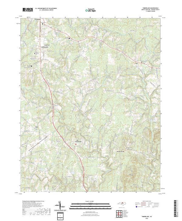 2022 Timberlake2022 Print · USGSPerson County's rural landscape comes into focus in this recent survey of the communities south of Roxboro. Genealogists and local historians can trace family locations through numerous sites like Burchwood Cem, Brookland Church Cem, and the settlement of Timberlake.
 - 2022 Map of Cedar Grove, 2022 Print
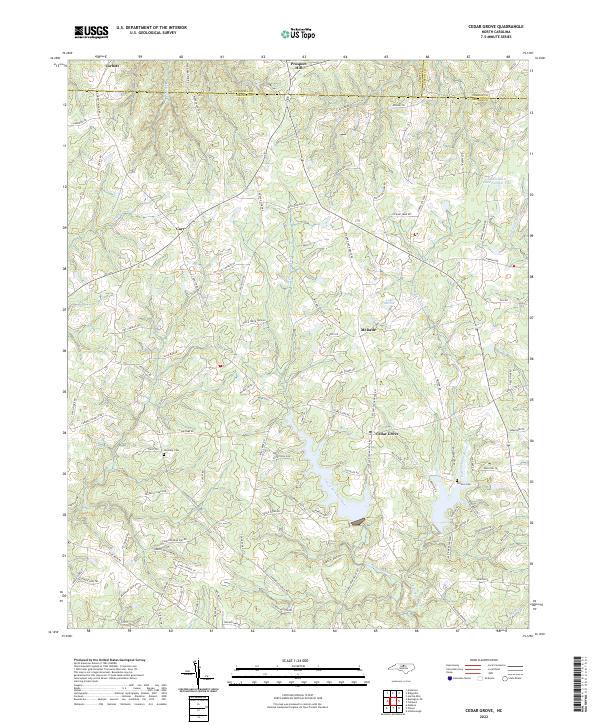 2022 Cedar Grove2022 Print · USGSNorthern Orange County at the start of the 2020s remains a landscape of old crossroads and river headwaters. Researchers can trace ancestral sites at Harmony Cem and Old Eno Cem or explore the rural hubs of Cedar Grove and McDade.
 - 2022 Map of Caldwell, 2022 Print
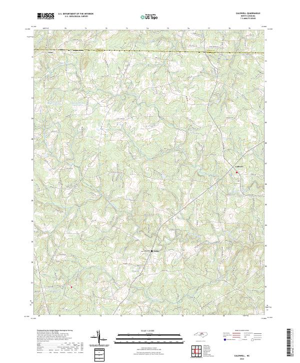 2022 Caldwell2022 Print · USGSOrange County's rural northern reaches are documented here as the twenty-first century began, centered on the crossroads of Caldwell and Schley. Local history researchers can trace the Payne Chapel AME Church Cem and family lands along Wagner Dairy Rd and Guess Rd.
 - 2022 Map of Hurdle Mills, 2022 Print
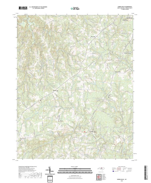 2022 Hurdle Mills2022 Print · USGSPerson County’s rural crossroads and river basins come into focus in this contemporary survey of the Piedmont landscape. Genealogists can trace family connections at Mount Zion United Methodist Cem and the small settlements of Bushy Fork and Allens Level.
 - 2022 Map of Leasburg, 2022 Print
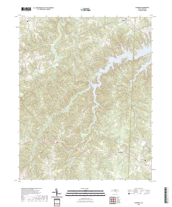 2022 Leasburg2022 Print · USGSNorthern Caswell County is shown here in the early 2020s, dominated by the winding waters of the Hyco River. Researchers can trace local lineage through Ebenezer Church Cem or follow old routes like Longs Mill Rd and Slaughter Rd.
 - 2022 Map of Roxboro, 2022 Print
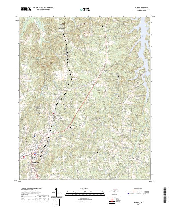 2022 Roxboro2022 Print · USGSPerson County’s seat and surrounding countryside are captured here in the early twenty-first century, showing a landscape of deep-rooted communities and winding creeks. Genealogists can trace family heritage through the Allen Family Cem, Rock Grove Cem, and the historic Shiloh Church Cem.
 - 2022 Map of Olive Hill, 2022 Print
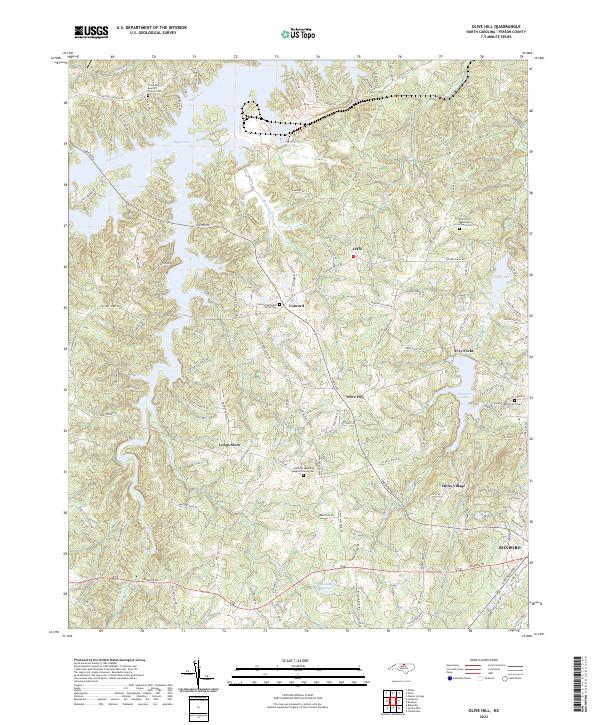 2022 Olive Hill2022 Print · USGSPerson County at the start of the 2020s shows a landscape where rural crossroads meet modern utility. Genealogists can trace family sites at Longs Store, Hicks Village, and the Stories Creek Church Cem.
 - 2022 Map of Ridgeville, 2022 Print
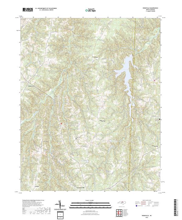 2022 Ridgeville2022 Print · USGSNorth Carolina's Piedmont region near the Caswell and Person County line shows a landscape of family-named roads and rural settlements in this modern survey. Genealogists can locate family landmarks like Salem United Methodist Church Cem and Cooper Cemetery near Frogsboro.
 - 2022 Map of Milton, 2022 Print
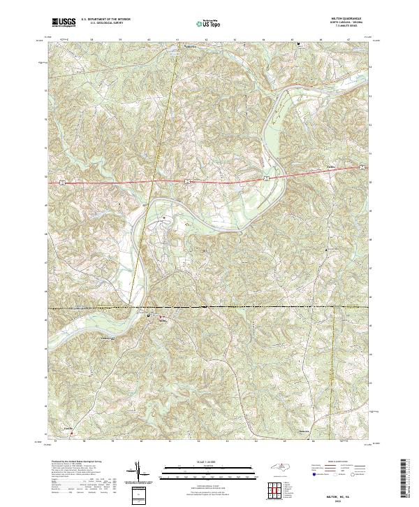 2022 Milton2022 Print · USGSThe Virginia and North Carolina borderlands come alive in this survey, showcasing the rural landscapes of Caswell and Halifax counties. Researchers can trace historical routes like the Tobacco Heritage Trl and locate family burial sites at Mercy Seat Cem or Cedars Cem.
 - 2022 Map of Rougemont, 2022 Print
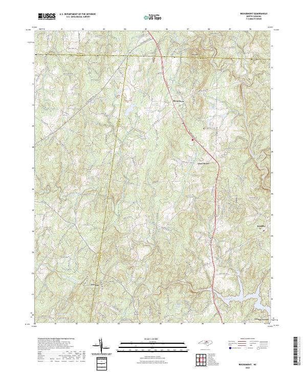 2022 Rougemont2022 Print · USGSThe northern reaches of Durham and Orange counties appear here in the early 2020s, a landscape defined by rolling hills and significant reservoirs. Genealogists and local historians can trace the areas around Bahama, Rougemont, and the historic Orange Factory site.
 - 2022 Map of Alton, 2022 Print
 2022 Alton2022 Print · USGSThe Virginia-North Carolina borderlands near Alton are captured here as modern reservoirs meet traditional farming communities. Trace family roots at Cunningham Cem and Chestnut Grove Baptist Church Cem, or locate historic mill sites like McGehees Mill.
 - 2022 Map of Triple Springs, 2022 Print
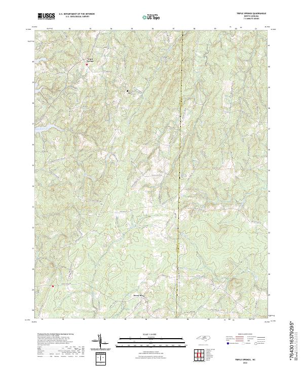 2022 Triple Springs2022 Print · USGSPerson and Granville counties appear in this modern survey, capturing the rural landscape where the Tar River originates. Genealogists and historians can trace family road names and local landmarks like Olive Branch Baptist Church Cem or the mining history indicated by Dirgie Mine Rd.
 - 2022 Map of Lake Michie, 2022 Print
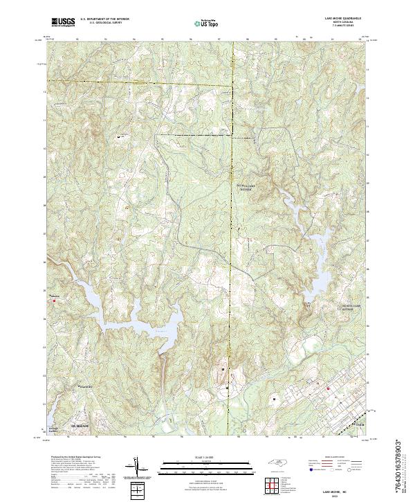 2022 Lake Michie2022 Print · USGSNear the intersection of three counties in the early 2020s, this area shows a landscape defined by the Flat River and local rural centers. Researchers can trace family history at Carrington Cem or explore the developed grids of Willardville and Butner.
 - 2022 Map of Moriah, 2022 Print
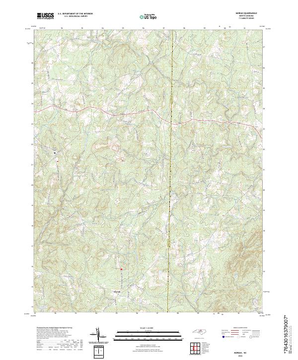 2022 Moriah2022 Print · USGSThe rural borderlands between Person and Granville counties come to life in this recent survey. Researchers can locate family landmarks like the Mount Harmony Cem and trace the industrial footprint of the Pyrophyllite Mine near the banks of the Tar River.
 - 2022 Map of Cluster Springs, 2022 Print
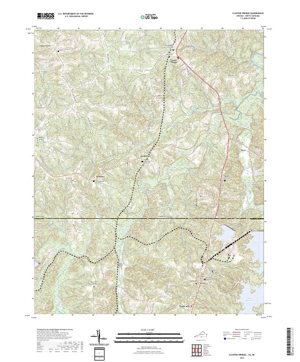 2022 Cluster Springs2022 Print · USGSThe Virginia and North Carolina borderlands come to life in this modern survey of the rural Hyco River valley. Genealogists and historians can trace numerous family-named landmarks and historical church sites such as Black Walnut Cem, Mayo, and Vaughan Airport.
 - 2022 Map of Virgilina, 2022 Print
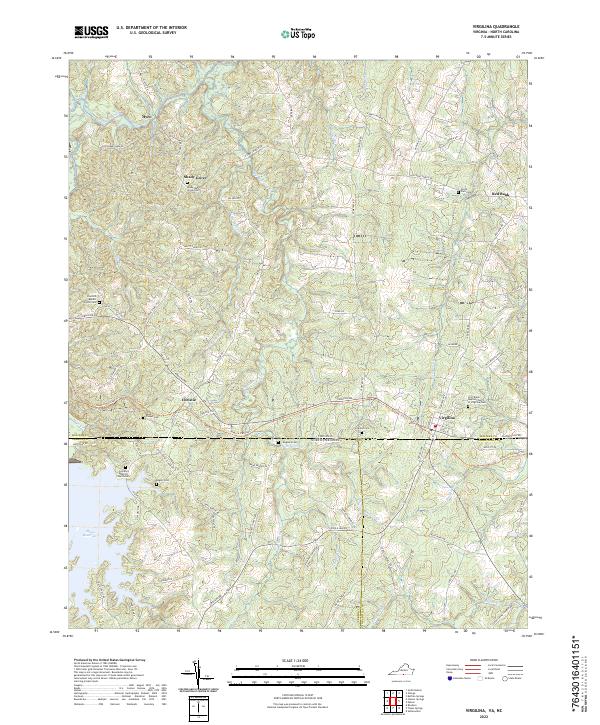 2022 Virgilina2022 Print · USGSVirgilina and the Virginia-North Carolina borderlands appear in the early 2020s, showing a landscape of traditional crossroads and reservoir waters. Researchers can trace ancestral sites at Shady Grove Cem, Mayo Chapel Cem, and the First Black Baptist Church of Virgilina Cem.
End of results
Showing maps 1-16 of 16
Top cities of Person County
Frequently asked questions
- What are the different types of historical maps available for Person County?
- What is the oldest map of Person County?
- Where can I purchase historical maps of Person County for my home or office?
- Where can I download high-res historical maps of Person County?
- Are there historical topographic maps available for Person County?
- Is there historical aerial imagery available for Person County?
- Where are historical maps of Person County sourced from?