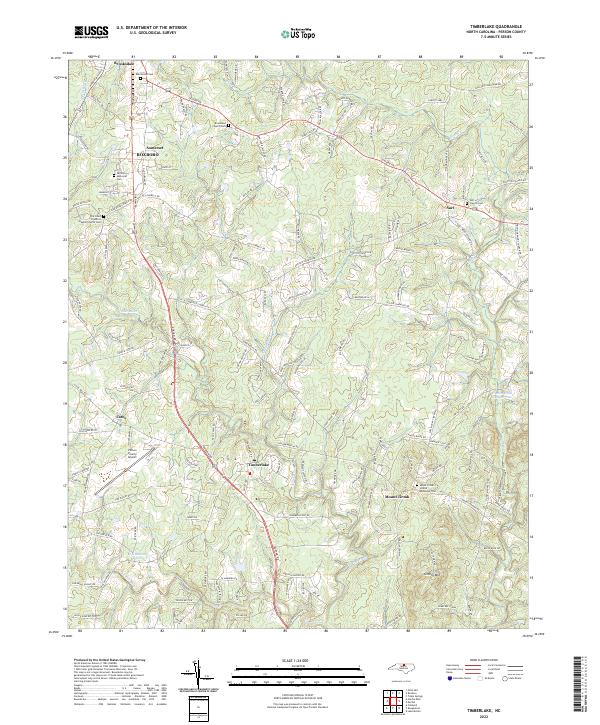
2022 Map of Timberlake
USGS Topo · Published 2022About this map
The N Flat River and South Flat River converge southwest of Timberlake, shaping a landscape of Piedmont ridges and small-scale agriculture south of Roxboro. This 2022 survey documents a rural corridor in Person County where family-named roads and localized community centers like Cates and Surl persist. The presence of numerous historic burial grounds, including the Flat River Primitive Baptist Church Cem and Mount Tirzah United Methodist Cem, provides a detailed record for genealogical research in this long-settled part of North Carolina.
Find a feature on this map
148 named features on this map. Tap any name to fly to it.
Don’t see what you’re looking for? This feature index may not catch every label — zoom into the map to look around manually.
Map Details
Editions of this 2022 Timberlake Map
This is the sole edition of this map. No revisions or reprints were ever made.
Other maps of this area

1943 · Roxboro
USGS Topo · 1:62,500

1951 · Durham North
USGS Topo · 1:62,500

1953 · Greensboro
USGS Topo · 1:250,000

1954 · Greensboro
USGS Topo · 1:250,000

1962 · Greensboro
USGS Topo · 1:250,000

1966 · Greensboro
USGS Topo · 1:250,000

1968 · Caldwell
USGS Topo · 1:24,000

1968 · Hurdle Mills
USGS Topo · 1:24,000
1968 · Olive Hill
USGS Topo · 1:24,000
1974 · Rougemont
USGS Topo · 1:24,000