Old Maps of Person County, North Carolina for Academic Research
Study the evolution of Person County with 115 high-resolution historic maps. Whether you're teaching, researching, or modeling changes in land use, these maps provide essential visual documentation of urban, environmental, and geographic change.
- Analyze long-term change: Track patterns in development, transportation, and natural features.
- Ideal for environmental or urban studies: Support academic projects with primary historical map data.
- Use in the classroom or lab: Educators and researchers rely on these maps to bring historical context to life.
These maps are a powerful tool for teaching, research, and visualizing how Person County has changed over the decades.
Person County, NC maps
(115)- 1943 Map of Roxboro, 1956 Print
 1943 Roxboro1956 Print · USGSPerson and Granville counties are captured here during the Second World War as rural life intersected with military expansion. Genealogists can locate numerous family-run landmarks and early institutions like Dixon Store, Mt Tirzah Ch, and Allensville Sch.2 unique versions available
 - 1951 Map of Durham North, 1953 Print
 1951 Durham North1953 Print · USGSThe northern reaches of Durham and Orange Counties are captured here in the early fifties, just as post-war development began to meet the region's agricultural roots. Genealogists can trace family landmarks like the Duke Homestead and rural hubs such as Bahama, Rougemont, and the Orange Factory.3 unique versions available
 - 1952 Map of Milton, 1953 Print
 1952 Milton1953 Print · USGSThe Dan River valley at the start of the 1950s reveals a landscape of tobacco farms and rural schoolhouses across the Virginia-North Carolina line. Genealogists and local historians can trace family roots through landmarks like Sutherlin Millpond, Mercy Seat Ch, and the Tan-yard.
 - 1953 Map of South Boston, 1955 Print
 1953 South Boston1955 Print · USGSThe Virginia Southside in the early fifties shows a bustling rail-and-river economy centered on the tobacco and textile hub of South Boston. Genealogists and historians can trace family locations through numerous rural landmarks like Berry Hill, the Wall Mine, and Orange Grove Sch.2 unique versions available
 - 1953 Map of Greensboro, 1981 Print
 1953 Greensboro1981 Print · USGSThe Piedmont borderlands of North Carolina and Virginia show a landscape defined by new reservoirs and old rail lines. Trace family roots and the changing river geography through Elon College, the John H Kerr Reservoir, and South Boston.
 - 1954 Map of Greensboro
 1954 Greensboro1954 Print · USGSThe Piedmont borderlands of North Carolina and Virginia come alive in this mid-fifties study of a region defined by its rivers and rails. Researchers can trace the growing Buggs Island Lake or follow the paths of the Southern Ry and Seaboard Air Line RR through towns like Oxford and Reidsville.
 - 1956 Map of Milton, 1957 Print
 1956 Milton1957 Print · USGSThe borderlands of Caswell County and southern Virginia are captured here in the mid-1950s as a landscape of river-driven commerce and rail depots. Researchers can trace family sites from Milton to Ghent, locating landmarks like Sutherlin Millpond and the Archibald Murphy Sch.2 unique versions available
 - 1957 Map of South Boston, 1958 Print
 1957 South Boston1958 Print · USGSSouth Boston and the surrounding borderlands of Virginia and North Carolina are captured here in the mid-fifties, centered on the confluence of the Banister and Dan Rivers. Genealogists and historians can trace numerous rural landmarks, including the Wolf Mine Sch, Five Forks Cem, and the settlement of Virgilina.3 unique versions available
 - 1962 Map of Greensboro
 1962 Greensboro1962 Print · USGSThe Piedmont region along the Virginia and North Carolina border comes alive in the early 1960s, showing a landscape defined by industry and new reservoirs. Trace the path of the Virginian RR or explore the early development of Greensboro and Durham.
 - 1966 Map of Greensboro
 1966 Greensboro1966 Print · USGSThe North Carolina and Virginia Piedmont thrives during the mid-sixties, showcasing a landscape of textile hubs and expanding river reservoirs. Researchers can trace the rail corridors of the Southern Railway, find local landmarks like Elon College, or locate the extensive Camp Butner Military Reservation.
 - 1967 Map of Cedar Grove, 1969 Print
 1967 Cedar Grove1969 Print · USGSNorthern Orange County's rolling hills and headwaters are captured in the late sixties as rural communities and new reservoirs shaped the land. Genealogists can trace family roots through landmarks like Harmony Cem, Mt Zion Ch, and the school at Cedar Grove.
 - 1968 Map of Leasburg, 1969 Print
 1968 Leasburg1969 Print · USGSCaswell County in the late sixties shows a landscape transformed by the newly formed Hyco Lake and its sprawling fingers. Genealogists and local historians can trace family locations along Hesters Store Road or find rural landmarks like Blanch Prison, Semora, and New Hope Ch.3 unique versions available
 - 1968 Map of Caldwell, 1970 Print
 1968 Caldwell1970 Print · USGSOrange County and the surrounding Piedmont country are captured here in the late sixties as a network of crossroads communities and small farms. Genealogists can trace family footprints across Caldwell, Schley, and numerous rural churches like Berrys Grove Ch and Olive Chapel.
 - 1968 Map of Ridgeville, 1971 Print
 1968 Ridgeville1971 Print · USGSThe rural borderlands of Caswell and Person counties come into focus during the late sixties, a landscape of family-run stores and country parishes. Researchers can trace the heritage of Prospect Hill and Ridgeville or locate historic sites like Lea Bethel Ch and Hesters Store.2 unique versions available
 - 1968 Map of Hurdle Mills, 1971 Print
 1968 Hurdle Mills1971 Print · USGSPerson County’s rural landscape is captured here in the late sixties, showing a community defined by its river forks and crossroads settlements. Genealogists can locate family landmarks like Paynes Tavern, Oak Lane Sch, and numerous country churches including Clement Ch.
 - 1968 Map of Alton, 1972 Print
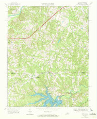 1968 Alton1972 Print · USGSHalifax County, Virginia, and Person County, North Carolina, meet at the shores of Hyco Lake in the late sixties. Genealogists and local historians can trace family roots at McGehees Mill or explore old crossroads like Turbeville and Alton.3 unique versions available
 - 1968 Map of Cluster Springs, 1972 Print
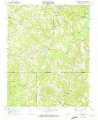 1968 Cluster Springs1972 Print · USGSCrossing the Virginia and North Carolina border in the late sixties, this area shows a landscape of rail-connected hamlets and riverside farms. Genealogists can trace family landmarks like Bethel Hill High Sch, Traynham Grove Ch, and the rural community of Denniston.3 unique versions available
 - 1968 Map of Milton, 1972 Print
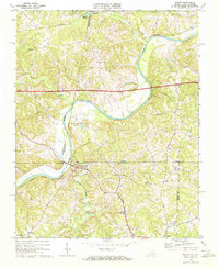 1968 Milton1972 Print · USGSThe Dan River valley near the Virginia-North Carolina state line is shown here in the late sixties, as rural life centered on crossroads like Milton and Semora. Genealogists and historians can locate numerous rural churches and schools, such as White Stone Ch and New Dotmond Sch.3 unique versions available
 - 1968 Map of Virgilina, 1972 Print
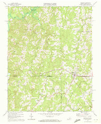 1968 Virgilina1972 Print · USGSVirgilina straddles the state line in the late sixties, where the Virginia and North Carolina borderlands meet along the Norfolk Franklin and Danville tracks. Researchers can trace rural life through landmarks like Zion Hill Sch, the Ragland Cem, and the Old Railroad Grade.3 unique versions available
 - 1968 Map of Olive Hill, 1994 Print
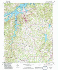 1968 Olive Hill1994 Print · USGSPerson County life in the late sixties centers on the newly formed Hyco Lake and the expanding infrastructure near Roxboro. Genealogists and local historians can trace family-named landmarks and rural hubs like Longs Store, Ceffo, and Woodland Sch.
 - 1974 Map of Rougemont, 1976 Print
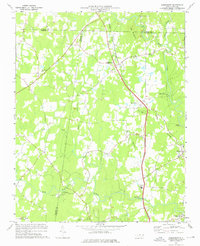 1974 Rougemont1976 Print · USGSIn the mid-seventies, this pocket of the North Carolina Piedmont remained a landscape of railway hamlets and riverside industry. Researchers can trace historic family landmarks from the Orange Factory to rural congregations like Red Mountain Ch and Union Grove Ch.3 unique versions available
 - 1977 Map of Lake Michie
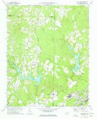 1977 Lake Michie1977 Print · USGSThe Flat River valley in the late seventies reveals a landscape of growing towns and significant public institutions between Durham and Granville. Researchers can trace the footprints of Bahama and Butner, alongside family landmarks like the Carrington Cem and Ellis Chapel.2 unique versions available
 - 1980 Map of Triple Springs, 1981 Print
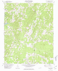 1980 Triple Springs1981 Print · USGSNorth Carolina’s Piedmont borderlands are shown here in the late seventies, just after the creation of the reservoir. Researchers can trace rural life through the locations of Denny Store, the Olive Branch Ch, and the waters of Mayo Reservoir.
 - 1981 Map of Moriah
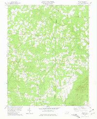 1981 Moriah1981 Print · USGSIn the early eighties, this rural corridor between Person and Granville counties remained a landscape of scattered family farms and country churches. Researchers can trace local roots through numerous cemeteries and landmarks like Trinity Ch, Moriah, and Siloam Ch.2 unique versions available
 - 1981 Map of Timberlake, 1982 Print
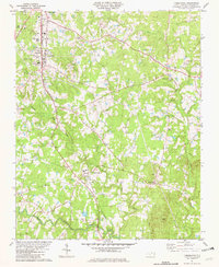 1981 Timberlake1982 Print · USGSPerson County life in the early eighties revolves around the rail and river network. Genealogists and local historians can trace family ties through Person Memorial Cem, Helena Sch, and rural hubs like Timberlake and Brooksdale.2 unique versions available
Showing maps 1-25 of 115
Top cities of Person County
Frequently asked questions
- What are the different types of historical maps available for Person County?
- What is the oldest map of Person County?
- Where can I purchase historical maps of Person County for my home or office?
- Where can I download high-res historical maps of Person County?
- Are there historical topographic maps available for Person County?
- Is there historical aerial imagery available for Person County?
- Where are historical maps of Person County sourced from?