1970s Maps of Richmond County, North Carolina
Explore 19 historic maps of Richmond County from the 1970s. These maps offer a rare glimpse into what life looked like during the 1970s — showing old roads, neighborhoods, homes, and landmarks that have changed or disappeared over time.
Whether you're researching your family's past, planning a metal detecting trip, or studying how Richmond County's landscape evolved across the 1970s, these high-resolution maps are a powerful tool for exploring the history of this region.
- Focus on a specific era: All maps on this page are from the 1970s, giving you a focused view of this time period.
- See what’s changed: Compare century-old streets, trails, and buildings to today's modern landscape using overlays and satellite layers.
- Research with precision: Use these maps for genealogy, historical research, land use analysis, or educational projects.
- View, download, or print: Maps are fully viewable online in high resolution, and can be downloaded or printed for your own records.
Start exploring Richmond County's history through authentic maps from the 1970s. This is your window into the past.
Richmond County, NC maps
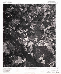
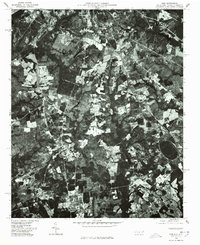
(19)- 1971 Map of Diggs, 1973 Print
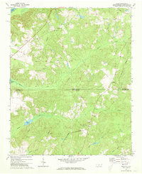 1971 Diggs1973 Print · USGSThe North and South Carolina borderlands come to life in the early 1970s, showing a landscape of railroad towns and rural parishes. Genealogists can trace family footprints at St Stephens Cem, Fulton, and along the historic Old Wire Road.2 unique versions available
 - 1971 Map of Morven East, 1973 Print
 1971 Morven East1973 Print · USGSThe North Carolina and South Carolina borderlands meet along the river in the early 1970s. Genealogists can trace family footprints through rural landmarks like Old Sneedsboro, Galilee Ch, and the mills at Brocks Mill and Everetts Mill.2 unique versions available
 - 1976 Map of West End
 1976 West End1976 Print · USGSMoore County's sandhills region is seen here in the mid-seventies, showing the intersection of agricultural clearings and dense woodland. Researchers can trace the exact layout of settlements like West End and Jackson Springs or the path of Drowning Creek.
 - 1976 Map of Rockingham, 1978 Print
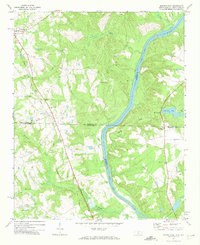
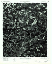
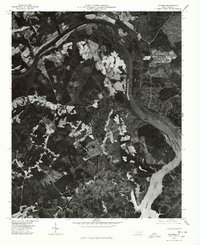
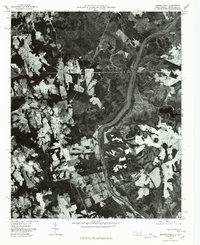
 1976 Rockingham1978 Print · USGSThe Pee Dee River basin and the evolving landscape of Richmond County are captured in this mid-seventies aerial survey. Local historians can trace the development of settlements like Cordova and Pine Grove as they appeared decades ago.
 - 1976 Map of Hamlet, 1978 Print
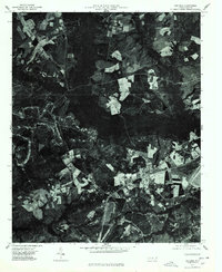
 1976 Hamlet1978 Print · USGSHamlet and the surrounding Richmond County countryside are shown from a birds-eye perspective in the mid-1970s. Genealogists and researchers can trace the shoreline of Ledbetter Lake and the development around the settlement of Ledbetter.
 - 1976 Map of Harrisville, 1978 Print
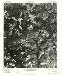
 1976 Harrisville1978 Print · USGSMontgomery County land use is frozen in time during the mid-seventies in this detailed aerial orthophoto. Researchers can pinpoint the exact locations of farms and homesteads near Harrisville and the rural crossroads of Covington.
 - 1976 Map of Millstone Lake, 1978 Print
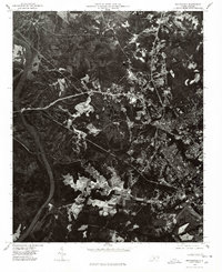
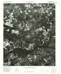
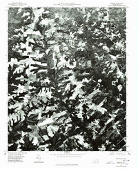
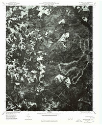 1976 Millstone Lake1978 Print · USGSNorth Carolina's sandhills region is captured in the mid-seventies through this detailed aerial survey of Richmond County. Genealogists and land historians can trace property boundaries and land use near Millstone Lake and the valley of Beaver Creek.
 - 1976 Map of Lilesville, 1978 Print
 1976 Lilesville1978 Print · USGSThe Anson County landscape in the mid-seventies is revealed through this aerial orthophoto, centered on the town of Lilesville. Researchers can trace the shoreline of Blewett Falls Lake and locate smaller settlements like Cairo among the forest and fields.
 - 1976 Map of Pinebluff, 1978 Print
 1976 Pinebluff1978 Print · USGSThe Moore County landscape near Aberdeen is captured in sharp detail in the mid-1970s through this aerial survey. Researchers and local historians can trace the exact footprint of early neighborhoods, road networks, and agricultural boundaries surrounding the town.
 - 1976 Map of Marston, 1978 Print
 1976 Marston1978 Print · USGSMarston and the surrounding Carolina Sandhills are shown in detail during the mid-seventies via this aerial orthophotoquad. You can trace the rural boundaries of Marston and Cognac or locate the wooded shores of Gum Swamp Lake.
 - 1976 Map of Mangum, 1978 Print
 1976 Mangum1978 Print · USGSThe rural landscapes of Anson County are seen from above in the mid-seventies, showing the detailed layout of farms and timberland. Genealogists and historians can trace the small settlements of Mangum and Ingram near the banks of Blewett Falls Lake.
 - 1976 Map of Diggs, 1978 Print
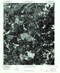
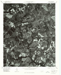
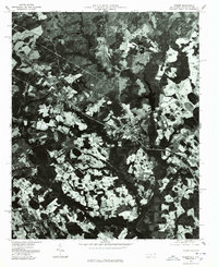
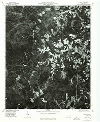
 1976 Diggs1978 Print · USGSThe rural landscapes of Richmond County are seen here in the mid-1970s through a detailed aerial orthophoto. Researchers can pinpoint specific farmsteads and rural crossroads near Diggs, Ellerbe Grove, and Osborne during this era.
 - 1976 Map of Morven East, 1978 Print
 1976 Morven East1978 Print · USGSAnson County and the borderlands of the Carolinas are captured in the mid-1970s as the Pee Dee River winds through rural farmland. Local historians can trace the footprints of established settlements like Morven and Mc Farlan alongside Everetts Lake.
 - 1976 Map of Norman, 1978 Print
 1976 Norman1978 Print · USGSRichmond County in the mid-seventies is documented here through high-resolution aerial imagery rather than traditional line work. You can precisely trace the rural layout of Norman and Plain View or follow the path of Drowning Creek.
 - 1976 Map of Hoffman, 1978 Print
 1976 Hoffman1978 Print · USGSHoffman and the surrounding Richmond County timberlands are captured here in the mid-1970s through high-altitude aerial photography. Trace the path of the Seaboard Coast Line railroad as it passes through Hoffman or locate the dense woodlands flanking Drowning Creek.
 - 1976 Map of Gibson, 1978 Print
 1976 Gibson1978 Print · USGSScotland County's rural landscape is frozen in time during the mid-seventies in this detailed aerial perspective. Genealogists and researchers can trace the exact footprints of settlements like Gibson and Laurel Hill or locate the shoreline of Richmond Mill Lake.
 - 1976 Map of Ghio, 1978 Print
 1976 Ghio1978 Print · USGSThe North Carolina-South Carolina border region comes to life in the mid-1970s through this detailed orthophoto. Researchers can trace the rural layouts of New Town and Ghio or locate landmarks like Krinshaw Pond among the timber and farm fields.
 - 1976 Map of Mount Gilead East, 1978 Print
 1976 Mount Gilead East1978 Print · USGSThe area east of Mount Gilead is captured in the mid-seventies, showing the agricultural heart of Montgomery County. You can trace the winding LITTLE RIVER and see how early road networks like 109 and 731 intersected the local landscape.
 - 1976 Map of Ellerbe, 1978 Print
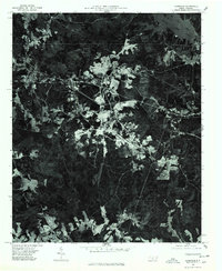
 1976 Ellerbe1978 Print · USGSRichmond County in the mid-seventies is documented here through high-altitude aerial photography. Genealogists and local historians can trace the street layout of Ellerbe, follow the course of the Pee Dee River, or locate family properties near Sandy Ridge.
End of results
Showing maps 1-19 of 19
Top cities of Richmond County
- Rockingham historical maps
- Hamlet historical maps
- Cordova historical maps
- Ellerbe historical maps
- Dobbins Heights historical maps
- Hoffman historical maps
See more
Frequently asked questions
- What are the different types of historical maps available for Richmond County?
- What is the oldest map of Richmond County?
- Where can I purchase historical maps of Richmond County for my home or office?
- Where can I download high-res historical maps of Richmond County?
- Are there historical topographic maps available for Richmond County?
- Is there historical aerial imagery available for Richmond County?
- Where are historical maps of Richmond County sourced from?