Old Maps of Laurinburg, North Carolina for Genealogy
Trace your family roots with 19 historic maps of Laurinburg. These high-res maps reveal old neighborhoods, homesites, landmarks, and streets — helping you uncover where your ancestors lived and how the area evolved over time.
- Explore historic neighborhoods: Identify where your relatives may have lived in the 1800s or 1900s.
- Compare maps over time: Trace the changes in streets, buildings, and landmarks for multi-generational research.
- Perfect for genealogy & ancestry research: Used by family historians and researchers to map out lineage and migration.
These maps are an incredible resource for exploring your personal connection to Laurinburg's past.
Laurinburg, NC maps
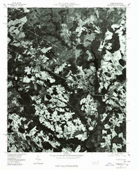
(19)- 1942 Map of Rockingham, 1944 Print
 1942 Rockingham1944 Print · USGSThe North Carolina and South Carolina borderlands come alive in this wartime survey of the Pee Dee River valley. Researchers can trace historic mill sites like Burnt Factory Pond or locate family landmarks such as Roberdell and Old Sneedsboro.
 - 1949 Map of Gibson, 1953 Print
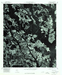
 1949 Gibson1953 Print · USGSThe North Carolina and South Carolina borderlands come alive in the late 1940s, centered on the rail hub of Gibson. Trace the heritage of mill settlements and family plots like Richmond Mill, Old Hundred, and the Pate Cem.3 unique versions available
 - 1949 Map of Laurinburg, 1953 Print
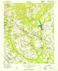
 1949 Laurinburg1953 Print · USGSScotland County's rail hubs and rural townships are captured here at the peak of the post-war era. Researchers can identify family cemeteries and early local landmarks like Gibsons Mill, State Prison Camp No 610, and the Louisville Sch.
 - 1949 Map of Hamlet, 1954 Print
 1949 Hamlet1954 Print · USGSNorth Carolina's Sandhills come alive in the late 1940s, centered on the busy rail hub of Hamlet and its sprawling network of tracks. Researchers can trace numerous local schools and cemeteries, from Sneads Grove School to the Tabernacle Cemetery.2 unique versions available
 - 1949 Map of Laurinburg, 1954 Print
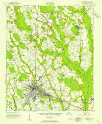
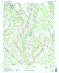
 1949 Laurinburg1954 Print · USGSThe mid-century landscape of Scotland County comes alive in this survey of a growing rail hub and its rural surroundings. Researchers can trace the lines of the Seaboard Air Line, locate historic institutions like Flora College, or find family landmarks such as McNeill Cem and Gaineys Place.
 - 1953 Map of Florence, 1964 Print
 1953 Florence1964 Print · USGSThe Carolina borderlands in the mid-fifties were a landscape of vast river swamps and rising rail towns. Trace the legacy of the Seaboard Air Line through Florence or explore the wetlands surrounding Lake Waccamaw and the Green Swamp.3 unique versions available
 - 1954 Map of Florence
 1954 Florence1954 Print · USGSThe Carolinas borderlands come alive in the early fifties, showing the vital rail-and-river networks of the coastal plain. Genealogists can trace family footprints across the Green Swamp or through settlements like Red Springs, Chadbourn, and McColl.
 - 1957 Map of Laurinburg, 1960 Print
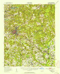
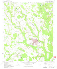
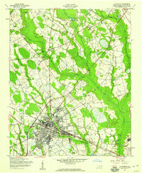 1957 Laurinburg1960 Print · USGSMid-century Scotland County centers on the rail hub of LAURINBURG, where the Seaboard Air Line and local short lines shaped the town's industrial footprint. Genealogists and local historians can trace family-named sites such as McFarland Cem, Gibson Mill, and Shaw High Sch.2 unique versions available
 - 1971 Map of Johns, 1975 Print
 1971 Johns1975 Print · USGSThe borderlands of North and South Carolina in the early seventies are captured here during a period of steady rural development. Genealogists and local historians can trace the foundations of St Andrews College or locate family sites near Stewartsville Cem and Zion Hill Ch.2 unique versions available
 - 1972 Map of Mc Coll, 1975 Print
 1972 Mc Coll1975 Print · USGSMarlboro County’s borderlands are shown here in the 1970s, centered on the railroad town of McColl and the agricultural hub of Tatum. Genealogists can trace family landmarks like Newton Cemetery, McLaurins Millpond, and Fletchers Chapel.2 unique versions available
 - 1976 Map of Johns, 1978 Print
 1976 Johns1978 Print · USGSScotland County's agrarian landscape is captured in the mid-seventies, showing the intersection of rural life and regional transport. Genealogists and historians can trace old property lines and farmsteads near Laurinburg, Johns, and Mc Arthur Crossroads.
 - 1976 Map of Mc Coll, 1978 Print
 1976 Mc Coll1978 Print · USGSMarlboro County near the state line comes into sharp focus in the mid-1970s through this aerial-based survey. Researchers can trace land boundaries and farmsteads near Mc Coll and Tatum, or identify the rural junctions at Masons Crossroads.
 - 1976 Map of Gibson, 1978 Print
 1976 Gibson1978 Print · USGSScotland County's rural landscape is frozen in time during the mid-seventies in this detailed aerial perspective. Genealogists and researchers can trace the exact footprints of settlements like Gibson and Laurel Hill or locate the shoreline of Richmond Mill Lake.
 - 1976 Map of Laurinburg, 1978 Print
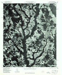
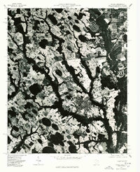
 1976 Laurinburg1978 Print · USGSLaurinburg and Scotland County are captured in the mid-seventies through this detailed aerial orthophotograph. Researchers can trace the development of Laurinburg alongside the distinct communities of East Laurinburg and Sugar Hill.
 - 1983 Map of Laurinburg, 1984 Print
 1983 Laurinburg1984 Print · USGSThe Carolina borderlands come into focus in the early 1980s, showcasing a landscape defined by the Sandhills Game Land and major river systems. Genealogists and rail historians can trace the paths of the Seaboard Coast Line Railroad through Hamlet or locate St Andrews College and Cheraw State Park.2 unique versions available
 - 2022 Map of Laurinburg, 2022 Print
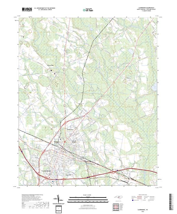 2022 Laurinburg2022 Print · USGSLaurinburg and the surrounding Scotland County landscape are captured here in the early 2020s, detailing the city's residential expansions and civic center. Researchers can trace local lineage through several family and community burial sites like Hillside Cem and Leach Cem, or locate the historic Scotland County Courthouse.
 - 2022 Map of Gibson, 2022 Print
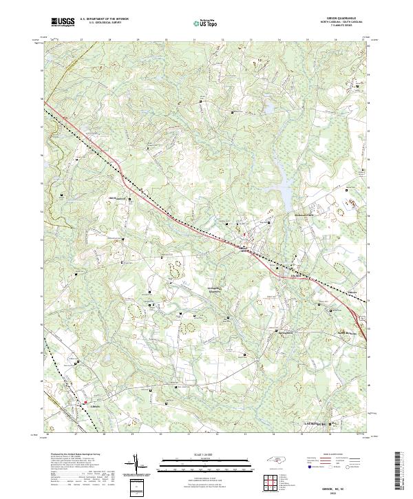 2022 Gibson2022 Print · USGSThe North Carolina borderlands around Gibson and LAURINBURG were shaped by a legacy of mills and family-run homesteads. Historians can trace early industry and kinship through Richmond Mill, Ida Mill, and numerous burial grounds like Old Hundred Cem and Saint Johns Cem.
 - 2022 Map of Johns, 2022 Print
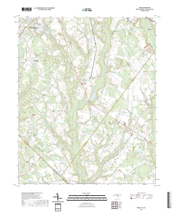 2022 Johns2022 Print · USGSThe North Carolina and South Carolina borderlands come into focus in this contemporary study of the Laurinburg and Johns area. Researchers can trace local heritage at Stewartsville Cem and explore community landmarks like Saint Andrews University and Johns Pond.
 - 2024 Map of McColl, 2024 Print
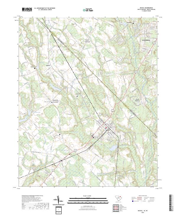 2024 McColl2024 Print · USGSThe borderlands of Marlboro County and Scotland County come into focus in this contemporary survey of the McColl and Tatum areas. Researchers can trace local lineage through numerous family burial sites like Manship Cem and Tatum Cem or explore the creek networks of Panther Creek and Gum Swamp Creek.
End of results
Showing maps 1-19 of 19
Top cities near Laurinburg
- Bennettsville historical maps
- Hamlet historical maps
- Raeford historical maps
- Maxton historical maps
- McColl historical maps
- Laurel Hill historical maps
See more
Top neighborhoods of Laurinburg
- Norman Heights historical maps
- Stewartville Acres historical maps
- Sunny Acres historical maps
- Westland Forest historical maps
- Hammon Heights historical maps
- Lincoln Heights historical maps
See more
Frequently asked questions
- What are the different types of historical maps available for Laurinburg?
- What is the oldest map of Laurinburg?
- Where can I purchase historical maps of Laurinburg for my home or office?
- Where can I download high-res historical maps of Laurinburg?
- Are there historical topographic maps available for Laurinburg?
- Is there historical aerial imagery available for Laurinburg?
- Where are historical maps of Laurinburg sourced from?