2020s Maps of Stanly County, North Carolina
Explore 15 historic maps of Stanly County from the 2020s. These maps offer a rare glimpse into what life looked like during the 2020s — showing old roads, neighborhoods, homes, and landmarks that have changed or disappeared over time.
Whether you're researching your family's past, planning a metal detecting trip, or studying how Stanly County's landscape evolved across the 2020s, these high-resolution maps are a powerful tool for exploring the history of this region.
- Focus on a specific era: All maps on this page are from the 2020s, giving you a focused view of this time period.
- See what’s changed: Compare century-old streets, trails, and buildings to today's modern landscape using overlays and satellite layers.
- Research with precision: Use these maps for genealogy, historical research, land use analysis, or educational projects.
- View, download, or print: Maps are fully viewable online in high resolution, and can be downloaded or printed for your own records.
Start exploring Stanly County's history through authentic maps from the 2020s. This is your window into the past.
Stanly County, NC maps
(15)- 2022 Map of Locust, 2022 Print
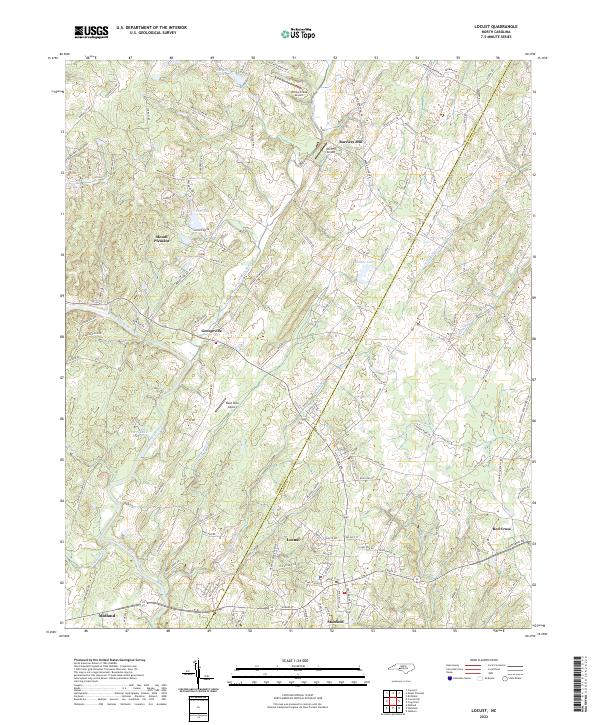 2022 Locust2022 Print · USGSThe Cabarrus and Stanly county border comes alive in this modern survey of the North Carolina Piedmont. Researchers can trace the layout of growing towns like Locust and Stanfield alongside aviation sites such as Reed Mine Airport and Wolf Pit Airport.
 - 2022 Map of Mount Pleasant, 2022 Print
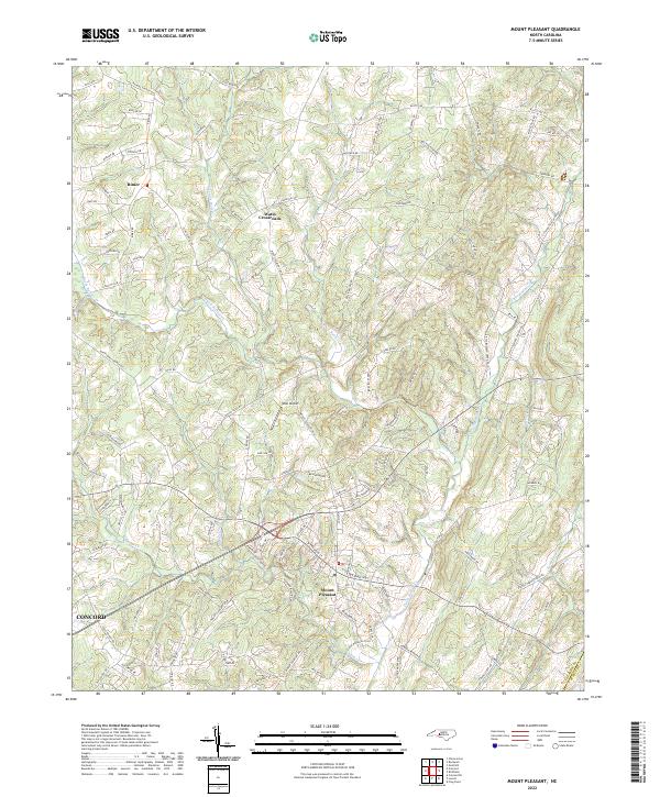 2022 Mount Pleasant2022 Print · USGSMount Pleasant and the surrounding Cabarrus County countryside are shown here in detail during the early 2020s. Researchers can trace family landmarks along Phaniel Church Rd, locate the West Airport, or follow the Buffalo Creek Preserve Trail.
 - 2022 Map of Stanfield, 2022 Print
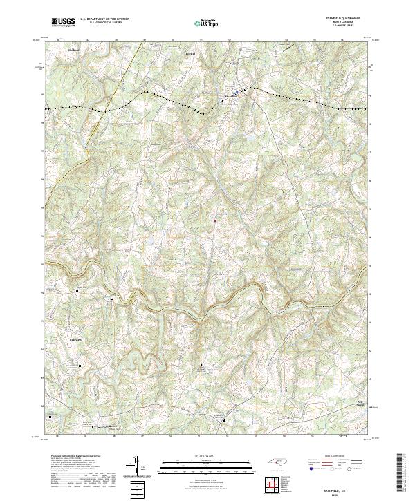 2022 Stanfield2022 Print · USGSThe Piedmont landscape at the intersection of Stanly and Cabarrus counties is defined by the winding Rocky River and rural crossroads. Genealogists can trace family roots at the Austin Family Cem, Biggers Cem, or Antioch Methodist Church Cem.
 - 2022 Map of Frog Pond, 2022 Print
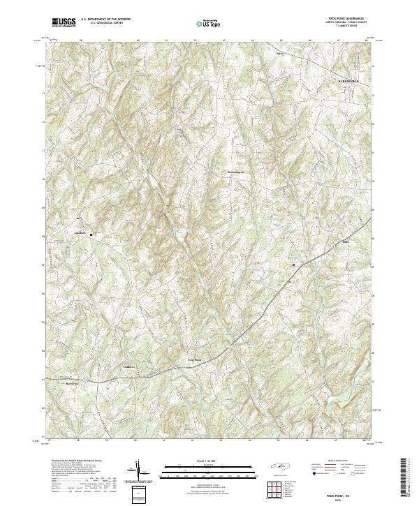 2022 Frog Pond2022 Print · USGSStanly County’s southern landscapes appear in detail here during the early 2020s, showing the rural communities between the Rocky River forks. Researchers can trace family-named locations from Frog Pond to Red Cross or locate Ridgecrest Cem and Nelson Mountain.
 - 2022 Map of Gold Hill, 2022 Print
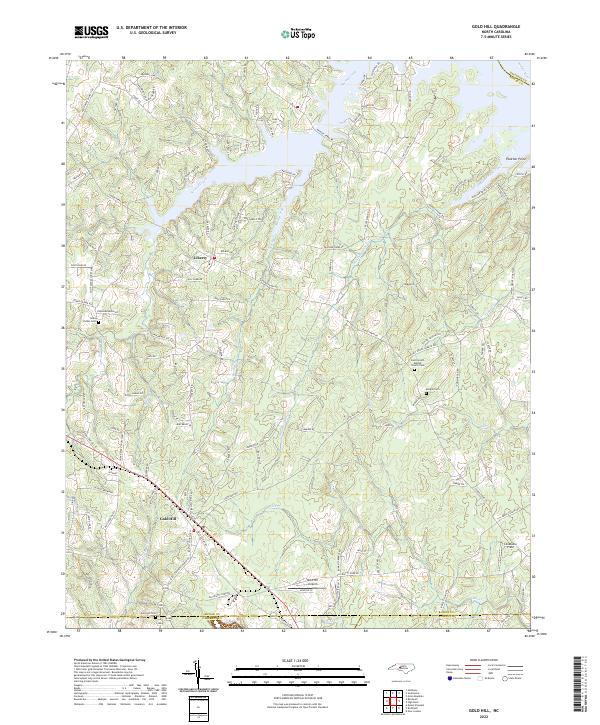 2022 Gold Hill2022 Print · USGSThe borderlands of Rowan, Cabarrus, and Stanly counties come into focus in this recent survey. Local historians can trace family burial sites like Morgan Cem and rural landmarks such as Gold Hill Airport and Liberty.
 - 2022 Map of Midland, 2022 Print
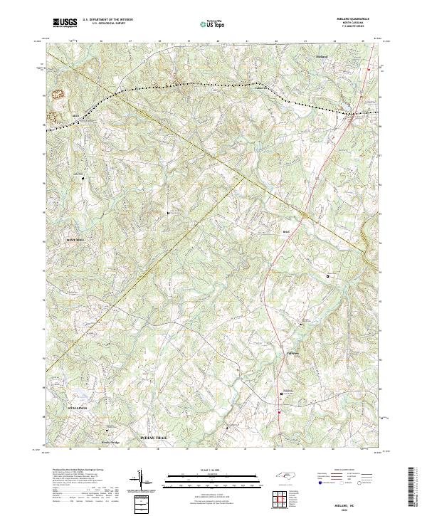 2022 Midland2022 Print · USGSMidland and the surrounding Piedmont countryside are shown here at a time of steady suburban growth along the county borders. Genealogists can locate several historic burial sites, including Dulins Grove Advent Christian Church Cem and Rock Hill Church Cem.
 - 2022 Map of Albemarle, 2022 Print
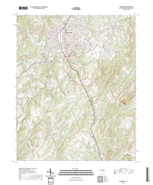 2022 Albemarle2022 Print · USGSAlbemarle and the surrounding Stanly County countryside are captured here in the early 2020s, centered on the historic county seat. Researchers can locate numerous local landmarks, from the Stanly County Courthouse to rural sites like Bethesda Cem and Poplins Grove Church.
 - 2022 Map of Badin, 2022 Print
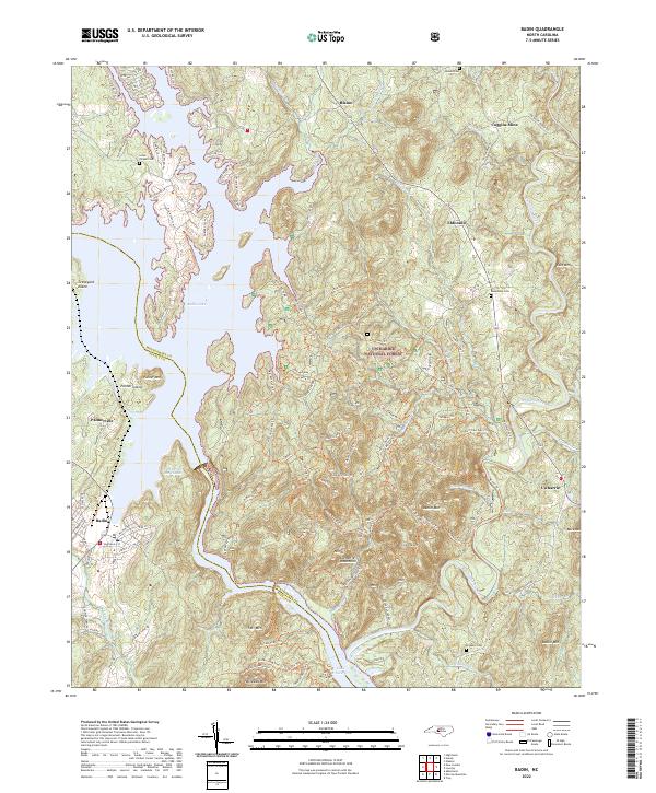 2022 Badin2022 Print · USGSThe border of Stanly and Montgomery counties comes alive in this 2022 survey of the North Carolina backcountry. Genealogists and historians can trace family plots at Lanes Chapel Cem and Macedonia Cem or explore the industrial legacy of the Coggins Mine near Eldorado.
 - 2022 Map of Morrow Mountain, 2022 Print
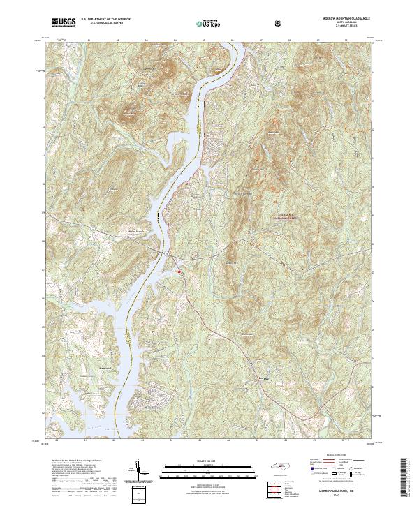 2022 Morrow Mountain2022 Print · USGSThe central Uwharrie Mountains meet the Pee Dee River in the early 2020s, showing a mix of protected forest and riverside growth. Trace family names and local landmarks from Morrow Mountain to settlements at Norwood and Pee Dee.
 - 2022 Map of High Rock, 2022 Print
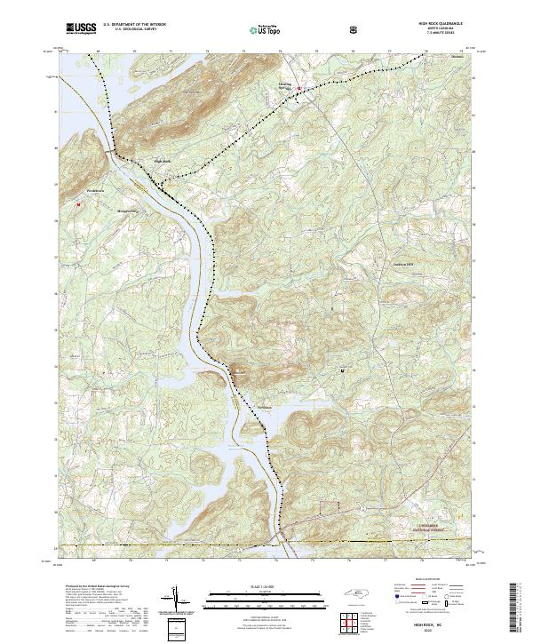 2022 High Rock2022 Print · USGSDavidson County's riverfront landscape is captured here in the early 2020s, showcasing the intersection of the Yadkin River and rural crossroads. Genealogists can trace family landmarks and local heritage near Newsom Cem, Healing Springs, and Jackson Hill.
 - 2022 Map of Aquadale, 2022 Print
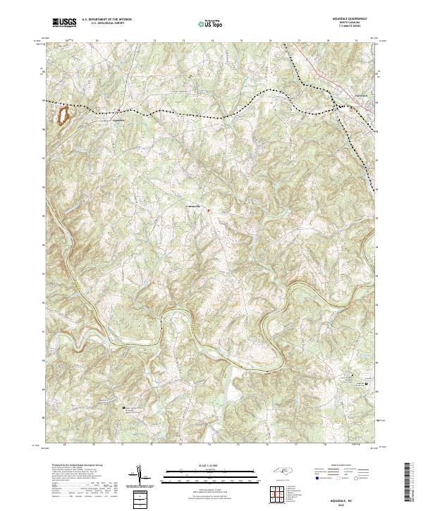 2022 Aquadale2022 Print · USGSThe rural borderlands of Stanly and Anson counties are meticulously detailed in the early twenty-first century. Researchers can trace historic family routes like Gaddy's Ferry Rd or locate ancestral burial sites at Concord-United Methodist Church Cem.
 - 2022 Map of Oakboro, 2022 Print
 2022 Oakboro2022 Print · USGSThe rural landscapes of Stanly and Union counties are documented here in the early twenty-first century, centered on the crossroads of Oakboro. Researchers can locate family landmarks like Pleasant Hill Church Cem, Mount Moriah Church, and the winding Rocky River.
 - 2022 Map of Richfield, 2022 Print
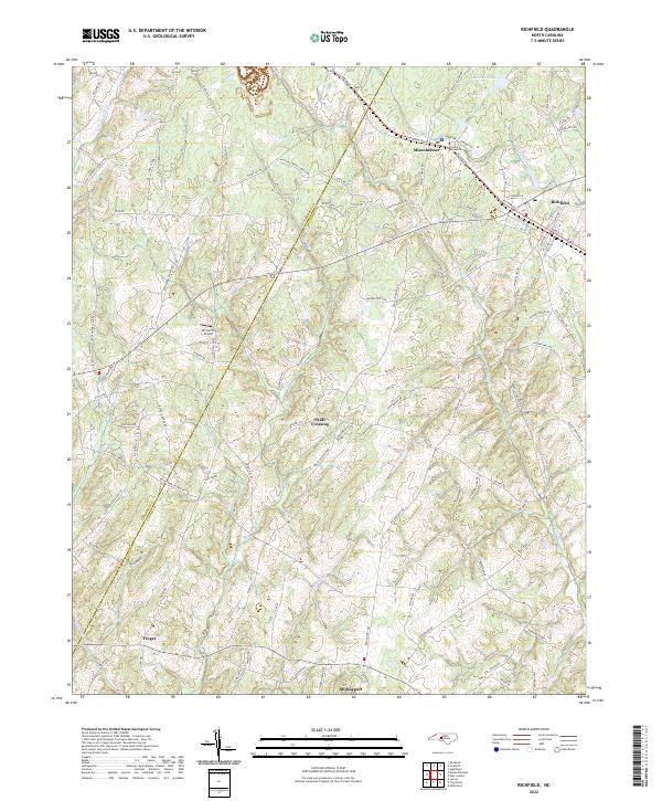 2022 Richfield2022 Print · USGSRichfield and Misenheimer are shown in detail during the early 2020s, highlighting the enduring rural character of the Stanly and Cabarrus county border. Genealogists can trace family connections along Mattons Grove Church Rd and locate landmarks like Pfeiffer University and Pauls Crossing.
 - 2022 Map of New London, 2022 Print
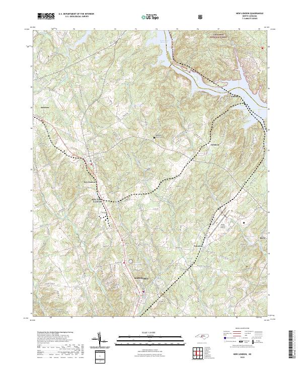 2022 New London2022 Print · USGSStanly County at the edge of the Uwharrie hills shows a landscape shaped by water and rail in this recent survey. Researchers can trace the Winston-Salem Southbound tracks through New London and Richfield or locate local landmarks like the Bethel (United Methodist Church) Cem.
 - 2022 Map of Mount Gilead West, 2022 Print
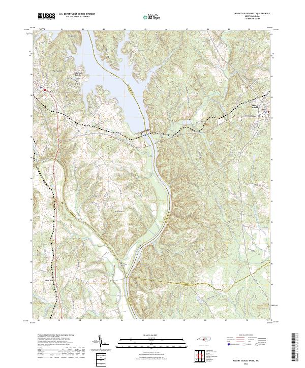 2022 Mount Gilead West2022 Print · USGSThe river borders of the North Carolina Piedmont come to life in this survey of the Stanly and Montgomery county lines. Genealogists and local historians can trace the rail corridor of the Winston-Salem Southbound RR or locate family sites near Fork Section and Norwood Cem.
End of results
Showing maps 1-15 of 15
Top cities of Stanly County
- Albemarle historical maps
- Norwood historical maps
- Stanfield historical maps
- Badin historical maps
- Oakboro historical maps
- Red Cross historical maps
See more
Frequently asked questions
- What are the different types of historical maps available for Stanly County?
- What is the oldest map of Stanly County?
- Where can I purchase historical maps of Stanly County for my home or office?
- Where can I download high-res historical maps of Stanly County?
- Are there historical topographic maps available for Stanly County?
- Is there historical aerial imagery available for Stanly County?
- Where are historical maps of Stanly County sourced from?