Old Maps of Harts Store, North Carolina for Academic Research
Study the evolution of Harts Store with 12 high-resolution historic maps. Whether you're teaching, researching, or modeling changes in land use, these maps provide essential visual documentation of urban, environmental, and geographic change.
- Analyze long-term change: Track patterns in development, transportation, and natural features.
- Ideal for environmental or urban studies: Support academic projects with primary historical map data.
- Use in the classroom or lab: Educators and researchers rely on these maps to bring historical context to life.
These maps are a powerful tool for teaching, research, and visualizing how Harts Store has changed over the decades.
Harts Store, NC maps
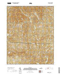
(12)- 1928 Map of Stuart
 1928 Stuart1928 Print · USGSThe Blue Ridge foothills of the late twenties are captured here as a network of mountain settlements and river-powered industry. Genealogists can trace family roots through numerous country landmarks like Greaseys Chapel, Stonewall Jackson School, and Carters Mill.2 unique versions available
 - 1931 Map of Stuart
 1931 Stuart1931 Print · USGSThe Blue Ridge plateau meets the Piedmont in the late 1920s, showing a landscape of mountain farming and river-driven milling. Genealogists can trace family roots through numerous local landmarks like Meadows of Dan, Stonewall Jackson Sch, and Three Forks Mill.3 unique versions available
 - 1953 Map of Winston-Salem, 1974 Print
 1953 Winston-Salem1974 Print · USGSThe North Carolina Piedmont and Virginia highlands meet in the mid-1950s, a landscape defined by the tobacco and textile hubs of the Blue Ridge foothills. Researchers can trace the rail-and-river geography connecting Winston-Salem to mountain towns like Mount Airy and Galax.2 unique versions available
 - 1955 Map of Winston-Salem
 1955 Winston-Salem1955 Print · USGSThe Central Blue Ridge and Piedmont transition are captured here in the mid-fifties, from the industrial hub of Winston-Salem to the high peaks of Southwest Virginia. Genealogists can trace family landmarks like Richmond Hill Ch, Siloam Ch, and the old rail stops along the Southern Railway.
 - 1962 Map of Winston-Salem
 1962 Winston-Salem1962 Print · USGSThe North Carolina Piedmont meets the Virginia highlands in the early sixties, showing the rail corridors and mountain gaps of the southern Appalachians. Researchers can trace the Blue Ridge Parkway or locate family sites near Winston-Salem, Mount Airy, and Hanging Rock Mountain.
 - 1968 Map of Stuart SE, 1970 Print
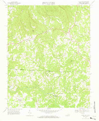 1968 Stuart SE1970 Print · USGSPatrick County and the North Carolina borderlands are captured in the late sixties, showing a landscape of river-bottom mills and highland chapels. Genealogists can trace family names through landmarks like Jessup Mill, Francisco, and Creaseys Chapel.3 unique versions available
 - 1986 Map of Galax
 1986 Galax1986 Print · USGSThe Virginia and North Carolina borderlands are captured here in the mid-1980s as the region balanced mountain agriculture with new recreational tourism. Researchers can locate remote family landmarks and rural institutions, from Ferrum Jr College and Siloam Ch to the Pinnacles Powerplant and Archies Mill.2 unique versions available
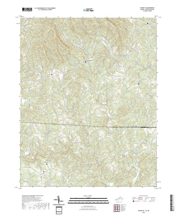
 - 2010 Map of Stuart SE, 2010 Print
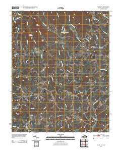 2010 Stuart SE2010 Print · USGSCovers Harts Store, including Stuart, Collinstown, and other nearby areas
 - 2013 Map of Stuart SE, 2013 Print
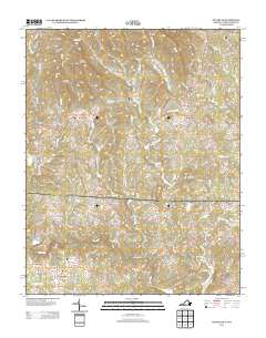 2013 Stuart SE2013 Print · USGSCovers Harts Store, including Stuart, Collinstown, and other nearby areas
 - 2016 Map of Stuart SE, 2016 Print
 2016 Stuart SE2016 Print · USGSCovers Harts Store, including Stuart, Collinstown, and other nearby areas
 - 2019 Map of Stuart SE, 2019 Print
 2019 Stuart SE2019 Print · USGSCovers Harts Store, including Stuart, Collinstown, and other nearby areas
 - 2022 Map of Stuart SE, 2022 Print
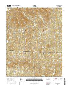
 2022 Stuart SE2022 Print · USGSThe Virginia and North Carolina borderlands are captured in this modern survey, showing a landscape defined by the Dan River. Genealogists can locate Beasley Cem and country churches like Five Forks Wesleyan Church.
End of results
Showing maps 1-12 of 12
Top cities near Harts Store
- Walnut Cove historical maps
- Pilot Mountain historical maps
- Stuart historical maps
- Danbury historical maps
Frequently asked questions
- What are the different types of historical maps available for Harts Store?
- What is the oldest map of Harts Store?
- Where can I purchase historical maps of Harts Store for my home or office?
- Where can I download high-res historical maps of Harts Store?
- Are there historical topographic maps available for Harts Store?
- Is there historical aerial imagery available for Harts Store?
- Where are historical maps of Harts Store sourced from?