1900s (20th Century) Maps of MacGregor Downs, Cary
Explore 10 historic maps of MacGregor Downs from the 1900s (20th Century). These maps offer a rare glimpse into what life looked like during the 1900s — showing old roads, neighborhoods, homes, and landmarks that have changed or disappeared over time.
Whether you're researching your family's past, planning a metal detecting trip, or studying how MacGregor Downs's landscape evolved across the 1900s, these high-resolution maps are a powerful tool for exploring the history of this region.
- Focus on a specific era: All maps on this page are from the 1900s, giving you a focused view of this time period.
- See what’s changed: Compare century-old streets, trails, and buildings to today's modern landscape using overlays and satellite layers.
- Research with precision: Use these maps for genealogy, historical research, land use analysis, or educational projects.
- View, download, or print: Maps are fully viewable online in high resolution, and can be downloaded or printed for your own records.
Start exploring MacGregor Downs's history through authentic maps from the 1900s. This is your window into the past.
MacGregor Downs, Cary maps
(10)- 1943 Map of Durham South
 1943 Durham South1943 Print · USGSDurham and its southern reaches are captured here in the early 1940s, showing a tobacco-and-rail landscape at its peak. Genealogists and local historians can trace legacy sites like Beechwood Cem, Lowes Grove, and Roger Grove Ch.2 unique versions available
 - 1951 Map of Durham South, 1953 Print
 1951 Durham South1953 Print · USGSThe mid-century landscape south of Durham shows a region on the cusp of modernization as the airport and highway networks began to expand. Genealogists and historians can locate rural landmarks such as Pearsontown, Lowes Grove, and Holland Chapel among the busy rail corridors of the Norfolk Southern.3 unique versions available
 - 1953 Map of Raleigh, 1965 Print
 1953 Raleigh1965 Print · USGSCentral North Carolina in the early sixties shows a landscape of growing towns and military hubs before the full expansion of the interstate system. Genealogists can trace family footprints across the Piedmont through Wake Forest, Siler City, and the large Fort Bragg Military Reservation.4 unique versions available
 - 1954 Map of Raleigh
 1954 Raleigh1954 Print · USGSThe North Carolina Piedmont and Sandhills are captured in the mid-fifties during a period of steady regional growth. Genealogists and historians can trace the development of towns like Siler City or locate landmarks such as Falls of Neuse and Camp Mackall.
 - 1973 Map of Cary, 1975 Print
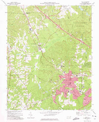 1973 Cary1975 Print · USGSCary and its neighboring communities are shown during a decade of growth as the Research Triangle region expanded in the early seventies. Genealogists and historians can locate family landmarks such as Hill Crest Cem, Christa Sanctified Holy Ch, and the rural crossing at Morrisville.5 unique versions available
 - 1974 Map of Apex, 1977 Print
 1974 Apex1977 Print · USGSWake County rail and rural life are at a crossroads in the mid-seventies, centered on the busy junction at Apex. Trace the paths of the Durham and Southern railroad through Feltonville and Holly Springs or locate St Marys Ch and Shelba Airport.5 unique versions available
 - 1984 Map of Raleigh, 1985 Print
 1984 Raleigh1985 Print · USGSThe North Carolina Research Triangle is shown during a decade of rapid growth, from the sprawl of Raleigh to the expanding waters of Falls Lake. Genealogists and historians can trace rail lines like the Seaboard Coast Line or locate landmark sites like Dorothea Dix State Hospital and Fuquay-Varina.
 - 1990 Map of Raleigh, 1991 Print
 1990 Raleigh1991 Print · USGSGreater Raleigh and the Research Triangle entered a period of significant suburban growth during the 1990s. Researchers can trace the development of towns like Fuquay-Varina and Wake Forest or locate landmarks such as the State Prison and Harris Reservoir.2 unique versions available
 - 1993 Map of Cary, 1999 Print
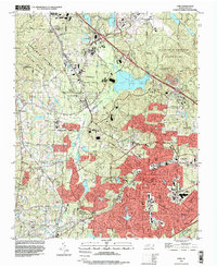 1993 Cary1999 Print · USGSThe Research Triangle is shown in its era of peak expansion, transitioning from quiet rural communities to a major regional hub. Genealogists and historians can trace local landmarks like Shiloh Ch, Carpenter, and the old Durham and Southern rail line.
 - 1993 Map of Apex, 1999 Print
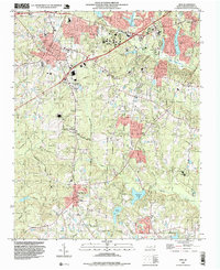 1993 Apex1999 Print · USGSThis survey of western Wake County records the growth of Apex and Holly Springs during the mid-1990s expansion. Genealogists and researchers can trace family roots at Felton Grove Ch, Matthew Chapel, and the community of Feltonville.
End of results
Showing maps 1-10 of 10
Frequently asked questions
- What are the different types of historical maps available for MacGregor Downs?
- What is the oldest map of MacGregor Downs?
- Where can I purchase historical maps of MacGregor Downs for my home or office?
- Where can I download high-res historical maps of MacGregor Downs?
- Are there historical topographic maps available for MacGregor Downs?
- Is there historical aerial imagery available for MacGregor Downs?
- Where are historical maps of MacGregor Downs sourced from?