1990s Maps of Raleigh, North Carolina
Explore 11 historic maps of Raleigh from the 1990s. These maps offer a rare glimpse into what life looked like during the 1990s — showing old roads, neighborhoods, homes, and landmarks that have changed or disappeared over time.
Whether you're researching your family's past, planning a metal detecting trip, or studying how Raleigh's landscape evolved across the 1990s, these high-resolution maps are a powerful tool for exploring the history of this region.
- Focus on a specific era: All maps on this page are from the 1990s, giving you a focused view of this time period.
- See what’s changed: Compare century-old streets, trails, and buildings to today's modern landscape using overlays and satellite layers.
- Research with precision: Use these maps for genealogy, historical research, land use analysis, or educational projects.
- View, download, or print: Maps are fully viewable online in high resolution, and can be downloaded or printed for your own records.
Start exploring Raleigh's history through authentic maps from the 1990s. This is your window into the past.
Raleigh, NC maps
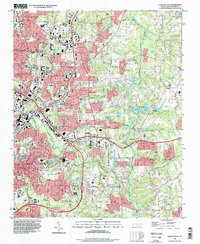
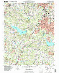
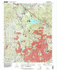
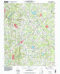
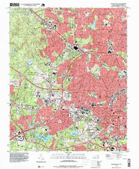
(11)- 1990 Map of Raleigh, 1991 Print
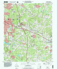
 1990 Raleigh1991 Print · USGSGreater Raleigh and the Research Triangle entered a period of significant suburban growth during the 1990s. Researchers can trace the development of towns like Fuquay-Varina and Wake Forest or locate landmarks such as the State Prison and Harris Reservoir.2 unique versions available
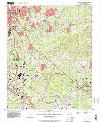
 - 1993 Map of Raleigh East, 1998 Print
 1993 Raleigh East1998 Print · USGSThe eastern edges of Raleigh and the growing community of Knightdale meet in the 1990s as residential subdivisions spread through the Neuse river valley. Researchers can trace the development of older settlements like Millbrook and Milburnie alongside landmarks like St Augustines College.
 - 1993 Map of Southeast Durham, 1998 Print
 1993 Southeast Durham1998 Print · USGSThe corridor between Durham and Raleigh is captured here in the early nineties during a period of significant suburban and industrial growth. Researchers can trace the development of Research Triangle Park and locate local landmarks like Lynn Crossroads, Southern High Sch, and Woodlawn Memorial Park Cemetery.
 - 1993 Map of Bayleaf, 1999 Print
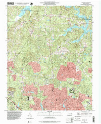 1993 Bayleaf1999 Print · USGSNorth of Raleigh in the early nineties, this survey captures a landscape transforming from rural hills to suburban communities. Researchers can trace the growth of Leesville and Bayleaf or locate family-named landmarks like Union Grove Ch and New Bethel Ch.
 - 1993 Map of Wake Forest, 1999 Print
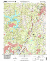 1993 Wake Forest1999 Print · USGSThe area surrounding Wake Forest and northern Raleigh is shown here as suburban expansion met rural crossroads in the early nineties. Researchers can trace family-named landmarks like Walkers Crossroads and local centers including Mt Pleasant Ch.
 - 1993 Map of Lake Wheeler, 1999 Print
 1993 Lake Wheeler1999 Print · USGSWake County's southern expansion is captured here as suburban growth reaches toward Lake Wheeler and Lake Benson. Genealogists and historians can trace family roots through the numerous family cemeteries like Stephens Cem and historic sites such as Yates Millpond.
 - 1993 Map of Cary, 1999 Print
 1993 Cary1999 Print · USGSThe Research Triangle is shown in its era of peak expansion, transitioning from quiet rural communities to a major regional hub. Genealogists and historians can trace local landmarks like Shiloh Ch, Carpenter, and the old Durham and Southern rail line.
 - 1993 Map of Rolesville, 1999 Print
 1993 Rolesville1999 Print · USGSWake County and Franklin County show a landscape of traditional crossroads and developing reservoirs in the 1990s. Genealogists and local historians can trace rural family legacies at Mitchell Cem, Corinth United Ch, and the historic Mitchell Millpond.
 - 1993 Map of Knightdale, 1999 Print
 1993 Knightdale1999 Print · USGSWake County's rural and suburban interface comes into focus in the 1990s, highlighting the established town centers and surrounding crossroads. Local historians can trace the foundations of the community through Lizard Lick, Lake Myra, and the Wendell-Knightdale Airport.
 - 1993 Map of Raleigh West, 1999 Print
 1993 Raleigh West1999 Print · USGSRaleigh and Cary are shown during a period of rapid westward expansion in the early nineties. Researchers can trace the layout of North Carolina State University and find historic landmarks like the State Capitol and Dorothea Dix State Hospital.
 - 1993 Map of Garner, 1999 Print
 1993 Garner1999 Print · USGSWake County undergoes a period of rapid suburban expansion in the 1990s as the suburbs of the state capital extend southward. Genealogists and historians can trace numerous family landmarks like Mitchiner Cem and Sauls Cem or the local roots of Auburn and Emerald Village.
End of results
Showing maps 1-11 of 11
Top cities near Raleigh
- Durham historical maps
- Cary historical maps
- Apex historical maps
- Wake Forest historical maps
- Fuquay-Varina historical maps
- Clayton historical maps
See more
Top neighborhoods of Raleigh
- Wake Crossroads historical maps
- Neuse Crossroads historical maps
- Isle Forest historical maps
- Tysonville historical maps
- Markwood historical maps
- Orchards historical maps
See more
Frequently asked questions
- What are the different types of historical maps available for Raleigh?
- What is the oldest map of Raleigh?
- Where can I purchase historical maps of Raleigh for my home or office?
- Where can I download high-res historical maps of Raleigh?
- Are there historical topographic maps available for Raleigh?
- Is there historical aerial imagery available for Raleigh?
- Where are historical maps of Raleigh sourced from?