Old Maps of Raleigh, North Carolina for Metal Detecting
Plan your next treasure hunt with 82 historic maps of Raleigh. Find old homesites, ghost towns, trails, and gathering spots that may be lost to time — perfect for identifying promising metal detecting locations.
- Locate forgotten sites: Uncover places like long-lost settlements, abandoned rail lines, or gathering spots.
- Plan better hunts: Use map overlays combined with LiDAR or satellite views to narrow in on historically rich areas.
- Made for detectorists: Thousands of hobbyists use these maps to discover relics, coins, and hidden history.
Use these historic maps to boost your research and find new opportunities beneath the surface of Raleigh.
Raleigh, NC maps
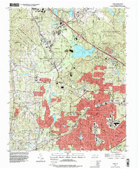
(82)- 1943 Map of Durham South
 1943 Durham South1943 Print · USGSDurham and its southern reaches are captured here in the early 1940s, showing a tobacco-and-rail landscape at its peak. Genealogists and local historians can trace legacy sites like Beechwood Cem, Lowes Grove, and Roger Grove Ch.2 unique versions available
 - 1943 Map of Raleigh
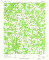
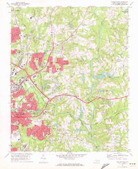
 1943 Raleigh1943 Print · USGSRaleigh and its surrounding Wake County townships are captured here in the early 1940s as a bustling nexus of rail and industry. Genealogists can trace family names through rural landmarks like Lassiters Mill, Method, and numerous country churches like Mt Bethel Church.2 unique versions available
 - 1951 Map of Raleigh, 1952 Print
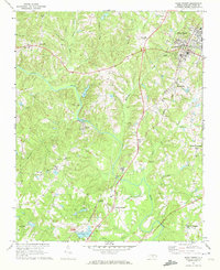
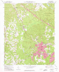
 1951 Raleigh1952 Print · USGSMid-century Raleigh and its surrounding rural townships are shown here as the capital city expanded toward the Neuse River. Genealogists can trace family-named schools and crossroads like Lovely Hill Sch, Six Forks, and the historic mill at Lassiters Mill.3 unique versions available
 - 1951 Map of Durham South, 1953 Print
 1951 Durham South1953 Print · USGSThe mid-century landscape south of Durham shows a region on the cusp of modernization as the airport and highway networks began to expand. Genealogists and historians can locate rural landmarks such as Pearsontown, Lowes Grove, and Holland Chapel among the busy rail corridors of the Norfolk Southern.3 unique versions available
 - 1953 Map of Raleigh, 1965 Print
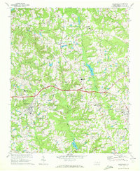
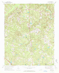
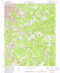
 1953 Raleigh1965 Print · USGSCentral North Carolina in the early sixties shows a landscape of growing towns and military hubs before the full expansion of the interstate system. Genealogists can trace family footprints across the Piedmont through Wake Forest, Siler City, and the large Fort Bragg Military Reservation.4 unique versions available
 - 1954 Map of Raleigh
 1954 Raleigh1954 Print · USGSThe North Carolina Piedmont and Sandhills are captured in the mid-fifties during a period of steady regional growth. Genealogists and historians can trace the development of towns like Siler City or locate landmarks such as Falls of Neuse and Camp Mackall.
 - 1964 Map of Lake Wheeler, 1965 Print
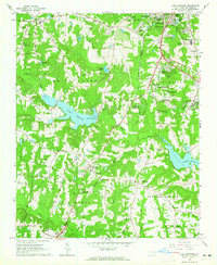 1964 Lake Wheeler1965 Print · USGSWake County south of the capital city shows a mix of rapid suburban growth and deep-rooted rural history during the mid-sixties. Genealogists and local historians can trace family sites like Franklin Cem alongside landmarks such as Yates Millpond and McCullers Crossroads.5 unique versions available
 - 1964 Map of Garner, 1965 Print
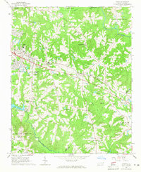 1964 Garner1965 Print · USGSGarner and the surrounding townships of Wake County are shown in the mid-sixties as the rail-side communities began to expand. Researchers can locate family landmarks and rural hubs like Hayes Chapel, Rand Cem, and the State Agriculture Experiment Station near Clayton.4 unique versions available
 - 1964 Map of Garner, 1965 Print
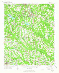 1964 Garner1965 Print · USGSThe rural landscapes south of Raleigh were transitioning from farm to suburb in the mid-sixties. Researchers can trace family roots at numerous country churches like Wooten Chapel Ch or locate sites such as McCullers, Willow Springs, and the historic McGee Mill.
 - 1967 Map of Knightdale, 1972 Print
 1967 Knightdale1972 Print · USGSEastern Wake County comes into focus in the mid-1960s, showing the rural character and emerging infrastructure between the capital and the coastal plain. Genealogists and local historians can trace family locations near Lizard Lick, Eagle Rock, and Hephzibah Ch.4 unique versions available
 - 1967 Map of Rolesville, 1972 Print
 1967 Rolesville1972 Print · USGSWake County and Franklin County are captured in the late sixties as traditional agricultural crossroads begin to meet modern utility. Genealogists and local historians can trace family roots through Rolesville Cem or locate old community centers like Fowlers Crossroads and Harris Crossroads.3 unique versions available
 - 1967 Map of Wake Forest, 1972 Print
 1967 Wake Forest1972 Print · USGSNorthern Wake County in the late sixties shows a landscape of growing crossroads and river communities centered around Wake Forest. Genealogists can locate family landmarks at Stony Hill Ch, Forestville, and the historic Southeastern Theological Seminary campus.6 unique versions available
 - 1967 Map of Bayleaf, 1972 Print
 1967 Bayleaf1972 Print · USGSNorthern Wake County appears here in the late sixties, just before the rapid suburban growth of Raleigh began to transform these rural communities. Researchers can trace family sites near Wake-Minster, find the Soapstone Quarry, and locate old landmarks like Six Forks and Hickory Grove Ch.4 unique versions available
 - 1968 Map of Raleigh West, 1972 Print
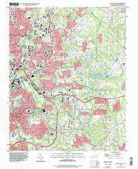
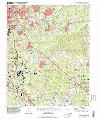
 1968 Raleigh West1972 Print · USGSRaleigh in the late sixties reveals a city in rapid transition between its traditional downtown core and expanding suburban neighborhoods. Genealogists and historians can trace institutional landmarks like North Carolina State University alongside local settlements like Method and Asbury.6 unique versions available
 - 1968 Map of Raleigh East, 1972 Print
 1968 Raleigh East1972 Print · USGSThe eastern expansion of Raleigh in the late sixties reveals a city emerging into the countryside near Milburnie and New Hope. Genealogists and historians can trace institutional sites like St Augustines College or local landmarks like Millbrook High Sch and Pet Crossroads.4 unique versions available
 - 1973 Map of Cary, 1975 Print
 1973 Cary1975 Print · USGSCary and its neighboring communities are shown during a decade of growth as the Research Triangle region expanded in the early seventies. Genealogists and historians can locate family landmarks such as Hill Crest Cem, Christa Sanctified Holy Ch, and the rural crossing at Morrisville.5 unique versions available
 - 1973 Map of Southeast Durham, 1982 Print
 1973 Southeast Durham1982 Print · USGSSoutheast Durham and the Research Triangle transition from rural communities to a regional hub during the early seventies. Genealogists and researchers can locate family burial sites at Woodlawn Memorial Park and trace early crossroads like Bethesda and Nelson.2 unique versions available
 - 1984 Map of Raleigh, 1985 Print
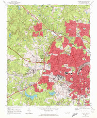
 1984 Raleigh1985 Print · USGSThe North Carolina Research Triangle is shown during a decade of rapid growth, from the sprawl of Raleigh to the expanding waters of Falls Lake. Genealogists and historians can trace rail lines like the Seaboard Coast Line or locate landmark sites like Dorothea Dix State Hospital and Fuquay-Varina.
 - 1990 Map of Raleigh, 1991 Print
 1990 Raleigh1991 Print · USGSGreater Raleigh and the Research Triangle entered a period of significant suburban growth during the 1990s. Researchers can trace the development of towns like Fuquay-Varina and Wake Forest or locate landmarks such as the State Prison and Harris Reservoir.2 unique versions available
 - 1993 Map of Raleigh East, 1998 Print
 1993 Raleigh East1998 Print · USGSThe eastern edges of Raleigh and the growing community of Knightdale meet in the 1990s as residential subdivisions spread through the Neuse river valley. Researchers can trace the development of older settlements like Millbrook and Milburnie alongside landmarks like St Augustines College.
 - 1993 Map of Southeast Durham, 1998 Print
 1993 Southeast Durham1998 Print · USGSThe corridor between Durham and Raleigh is captured here in the early nineties during a period of significant suburban and industrial growth. Researchers can trace the development of Research Triangle Park and locate local landmarks like Lynn Crossroads, Southern High Sch, and Woodlawn Memorial Park Cemetery.
 - 1993 Map of Bayleaf, 1999 Print
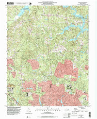 1993 Bayleaf1999 Print · USGSNorth of Raleigh in the early nineties, this survey captures a landscape transforming from rural hills to suburban communities. Researchers can trace the growth of Leesville and Bayleaf or locate family-named landmarks like Union Grove Ch and New Bethel Ch.
 - 1993 Map of Wake Forest, 1999 Print
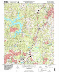 1993 Wake Forest1999 Print · USGSThe area surrounding Wake Forest and northern Raleigh is shown here as suburban expansion met rural crossroads in the early nineties. Researchers can trace family-named landmarks like Walkers Crossroads and local centers including Mt Pleasant Ch.
 - 1993 Map of Lake Wheeler, 1999 Print
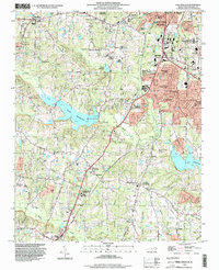 1993 Lake Wheeler1999 Print · USGSWake County's southern expansion is captured here as suburban growth reaches toward Lake Wheeler and Lake Benson. Genealogists and historians can trace family roots through the numerous family cemeteries like Stephens Cem and historic sites such as Yates Millpond.
 - 1993 Map of Cary, 1999 Print
 1993 Cary1999 Print · USGSThe Research Triangle is shown in its era of peak expansion, transitioning from quiet rural communities to a major regional hub. Genealogists and historians can trace local landmarks like Shiloh Ch, Carpenter, and the old Durham and Southern rail line.
Showing maps 1-25 of 82
Top cities near Raleigh
- Durham historical maps
- Cary historical maps
- Apex historical maps
- Wake Forest historical maps
- Fuquay-Varina historical maps
- Clayton historical maps
See more
Top neighborhoods of Raleigh
- Wake Crossroads historical maps
- Neuse Crossroads historical maps
- Isle Forest historical maps
- Tysonville historical maps
- Markwood historical maps
- Orchards historical maps
See more
Frequently asked questions
- What are the different types of historical maps available for Raleigh?
- What is the oldest map of Raleigh?
- Where can I purchase historical maps of Raleigh for my home or office?
- Where can I download high-res historical maps of Raleigh?
- Are there historical topographic maps available for Raleigh?
- Is there historical aerial imagery available for Raleigh?
- Where are historical maps of Raleigh sourced from?