Old Maps of Elams, North Carolina for Hiking & Exploration
Hike through history with 12 historic maps of Elams. Explore old trails, ghost towns, and forgotten backroads — perfect for outdoor adventurers and local explorers.
- Rediscover forgotten places: Map out old mining camps, roads, and footpaths that no longer exist on modern maps.
- Layer with modern tools: Combine with LiDAR or satellite views to plan hikes through historical terrain.
- Made for exploration: Popular among hikers, overlanders, and local history lovers.
Use these maps to find adventure and explore the hidden past of Elams.
Elams, NC maps
(12)- 1919 Map of White Plains
 1919 White Plains1919 Print · USGSSouthern Virginia and the North Carolina borderlands are captured here at the close of the Great War. Genealogists can trace early twentieth-century communities through family-named landmarks like Vincents Store, Hicks Mill, and Holly Springs Church.
 - 1920 Map of White Plains
 1920 White Plains1920 Print · USGSThe Virginia and North Carolina borderlands come to life in this 1920 survey of the Meherrin and Roanoke river basins. Genealogists can trace family names at Drumgoole Store and Phipps Store, or locate old schoolhouse sites like Meherrin School and Webb School.4 unique versions available
 - 1953 Map of Norfolk, 1954 Print
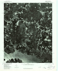
 1953 Norfolk1954 Print · USGSCoastal Virginia and northeastern North Carolina appear here during the post-war industrial boom, showing the critical rail-and-sea connections of Hampton Roads. Genealogists can trace family roots through rural landmarks like Gethsemane Ch, the Caledonia State Prison Farm, and the vast interior of the Dismal Swamp.4 unique versions available
 - 1963 Map of Gasburg, 1964 Print
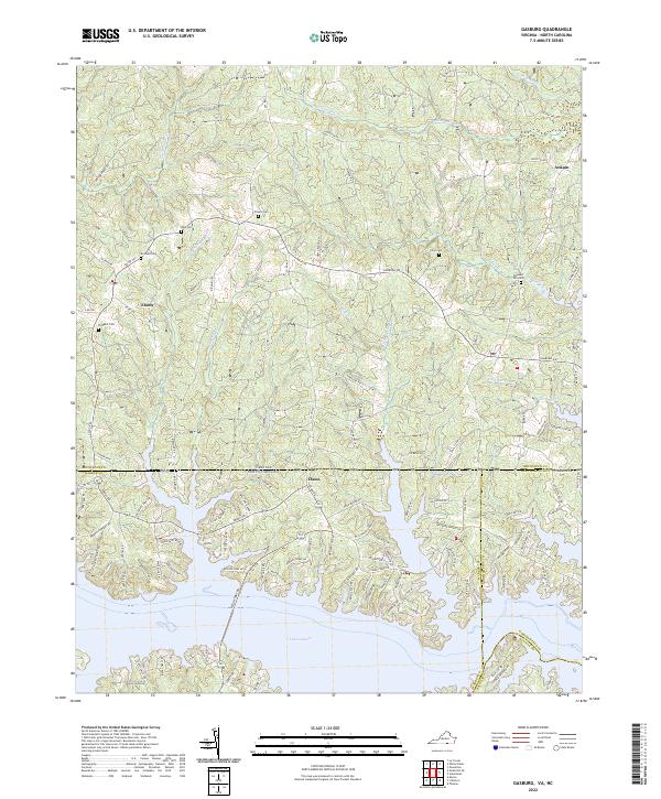
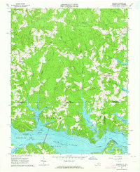 1963 Gasburg1964 Print · USGSThe Virginia and North Carolina borderlands appear in transition during the early sixties as the newly formed Lake Gaston reshapes the landscape. Local historians can trace family roots through numerous sites like Ebony, St Pauls Chapel, and Kirkland Cem.4 unique versions available
 - 1977 Map of Gasburg, 1979 Print
 1977 Gasburg1979 Print · USGSThe Virginia and North Carolina borderlands come into focus in the late seventies as reservoir living begins to shape the rural landscape. Researchers can trace land use patterns around Lake Gaston and the settlements of Gasburg and Ebony.
 - 1984 Map of Emporia, 1986 Print
 1984 Emporia1986 Print · USGSSouthside Virginia and the North Carolina borderlands are captured here in the mid-1980s, centered on the transit hub of Emporia. Researchers can trace old rail corridors like the Seaboard System or locate historic sites including Fort Christanna and White Oak Ch.
 - 1990 Map of Emporia
 1990 Emporia1990 Print · USGSThe Southside Virginia borderlands are captured here in the late twentieth century, showing the critical rail and river networks of the region. Genealogists and local historians can trace family roots through rural communities like Alberta, Boykins, and Dolphin along the Meherrin River.
 - 2010 Map of Gasburg, 2010 Print
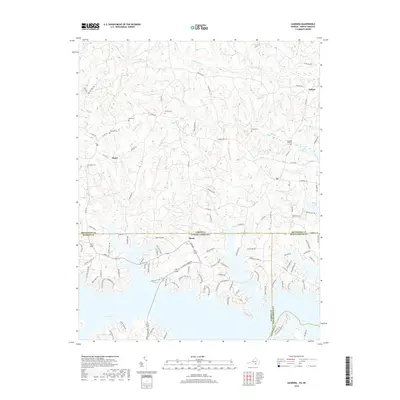
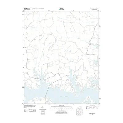 2010 Gasburg2010 Print · USGSCovers Elams, including Gasburg, Ebony, and other nearby areas
 - 2013 Map of Gasburg, 2013 Print
 2013 Gasburg2013 Print · USGSCovers Elams, including Gasburg, Ebony, and other nearby areas
 - 2016 Map of Gasburg, 2016 Print
 2016 Gasburg2016 Print · USGSCovers Elams, including Gasburg, Ebony, and other nearby areas
 - 2019 Map of Gasburg, 2019 Print
 2019 Gasburg2019 Print · USGSCovers Elams, including Gasburg, Ebony, and other nearby areas
 - 2022 Map of Gasburg, 2022 Print
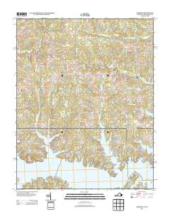
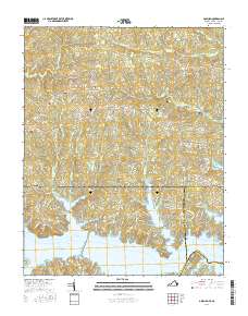
 2022 Gasburg2022 Print · USGSThe Virginia and North Carolina border comes alive in this 2022 survey of the rural landscape surrounding the upper reaches of Lake Gaston. Researchers can locate several family burial grounds like Pleasant Hill Cem and trace the small-town layouts of Ebony and Ankum.
End of results
Showing maps 1-12 of 12
Top cities near Elams
- South Hill historical maps
- Bracey historical maps
- Lawrenceville historical maps
- Warrenton historical maps
- La Crosse historical maps
- Gasburg historical maps
See more
Frequently asked questions
- What are the different types of historical maps available for Elams?
- What is the oldest map of Elams?
- Where can I purchase historical maps of Elams for my home or office?
- Where can I download high-res historical maps of Elams?
- Are there historical topographic maps available for Elams?
- Is there historical aerial imagery available for Elams?
- Where are historical maps of Elams sourced from?