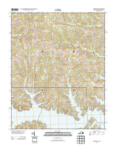
2013 Map of Gasburg
USGS Topo · Published 2013About this map
Lake Gaston dominates the southern portion of this landscape, its intricate shoreline defining the character of several residential developments like Wilson Oaks. The map records a transition from traditional rural crossroad settlements such as Ebony, Gasburg, and Elams to a more recreation-focused geography along the water. Significant drainage systems, including Pea Hill Cr, Rattlesnake Cr, and Pigeonroost Cr, feed the lake from the north, illustrating the complex hydrology of the Virginia-North Carolina borderlands. Numerous local roads such as Robinson Ferry Rd and Ebony Rd provide access to these waterfront coves, reflecting how the area’s layout has evolved around the flooded topography of the basin.
Find a feature on this map
124 named features on this map. Tap any name to fly to it.
Don’t see what you’re looking for? This feature index may not catch every label — zoom into the map to look around manually.
Map Details
Editions of this 2013 Gasburg Map
This is the sole edition of this map. No revisions or reprints were ever made.
Other maps of this area

1919 · White Plains
USGS Topo · 1:48,000

1920 · White Plains
USGS Topo · 1:62,500

1953 · Norfolk
USGS Topo · 1:250,000

1953 · Greensboro
USGS Topo · 1:250,000

1954 · Greensboro
USGS Topo · 1:250,000

1962 · Greensboro
USGS Topo · 1:250,000

1963 · Powellton
USGS Topo · 1:24,000

1963 · Gasburg
USGS Topo · 1:24,000

1963 · Valentines
USGS Topo · 1:24,000

1963 · White Plains
USGS Topo · 1:24,000