
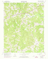
1963 Map of White Plains
USGS Topo · Published 1965About this map
The Meherrin River meanders across this Brunswick County landscape, defining the northern and eastern borders of a region deeply connected to its rural crossroads and family legacies. In the early 1960s, settlements like White Plains, Gholsonville, and Merchant served as central points for the surrounding agricultural community. The landscape is carved by numerous tributaries, including Genito Creek and Hicks Creek, which historically powered local industry as evidenced by Hicks Mill.
Find a feature on this map
40 named features on this map. Tap any name to fly to it.
Don’t see what you’re looking for? This feature index may not catch every label — zoom into the map to look around manually.
Map Details
Editions of this 1963 White Plains Map
2 editions found
Other maps of this area

1918 · Lawrenceville
USGS Topo · 1:62,500

1919 · White Plains
USGS Topo · 1:48,000

1920 · Lawrenceville
USGS Topo · 1:48,000

1920 · White Plains
USGS Topo · 1:62,500

1921 · Lawrenceville
USGS Topo · 1:62,500

1942 · Lawrenceville
USGS Topo · 1:62,500

1953 · Norfolk
USGS Topo · 1:250,000

1953 · Greensboro
USGS Topo · 1:250,000

1954 · Greensboro
USGS Topo · 1:250,000

1955 · Kenbridge
USGS Topo · 1:62,500