1970s Maps of Lickskillet, North Carolina
Explore 1 historic maps of Lickskillet from the 1970s. These maps offer a rare glimpse into what life looked like during the 1970s — showing old roads, neighborhoods, homes, and landmarks that have changed or disappeared over time.
Whether you're researching your family's past, planning a metal detecting trip, or studying how Lickskillet's landscape evolved across the 1970s, these high-resolution maps are a powerful tool for exploring the history of this region.
- Focus on a specific era: All maps on this page are from the 1970s, giving you a focused view of this time period.
- See what’s changed: Compare century-old streets, trails, and buildings to today's modern landscape using overlays and satellite layers.
- Research with precision: Use these maps for genealogy, historical research, land use analysis, or educational projects.
- View, download, or print: Maps are fully viewable online in high resolution, and can be downloaded or printed for your own records.
Start exploring Lickskillet's history through authentic maps from the 1970s. This is your window into the past.
Lickskillet, NC maps
(1)- 1971 Map of Afton, 1973 Print
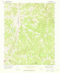 1971 Afton1973 Print · USGSThe rural communities of Warren County come into focus in the early 1970s, organized around country roads and woodland creeks. Genealogists can trace family roots through numerous sites like Warren Academy, Sulphur Springs Ch, and the settlement at Elberon.
End of results
Showing maps 1-1 of 1
Top cities near Lickskillet
- Henderson historical maps
- Louisburg historical maps
- Red Oak historical maps
- Norlina historical maps
- Warrenton historical maps
- Castalia historical maps
See more
Frequently asked questions
- What are the different types of historical maps available for Lickskillet?
- What is the oldest map of Lickskillet?
- Where can I purchase historical maps of Lickskillet for my home or office?
- Where can I download high-res historical maps of Lickskillet?
- Are there historical topographic maps available for Lickskillet?
- Is there historical aerial imagery available for Lickskillet?
- Where are historical maps of Lickskillet sourced from?