1900s (20th Century) Maps of Montclair, Wilson
Explore 6 historic maps of Montclair from the 1900s (20th Century). These maps offer a rare glimpse into what life looked like during the 1900s — showing old roads, neighborhoods, homes, and landmarks that have changed or disappeared over time.
Whether you're researching your family's past, planning a metal detecting trip, or studying how Montclair's landscape evolved across the 1900s, these high-resolution maps are a powerful tool for exploring the history of this region.
- Focus on a specific era: All maps on this page are from the 1900s, giving you a focused view of this time period.
- See what’s changed: Compare century-old streets, trails, and buildings to today's modern landscape using overlays and satellite layers.
- Research with precision: Use these maps for genealogy, historical research, land use analysis, or educational projects.
- View, download, or print: Maps are fully viewable online in high resolution, and can be downloaded or printed for your own records.
Start exploring Montclair's history through authentic maps from the 1900s. This is your window into the past.
Montclair, Wilson maps
(6)- 1904 Map of Wilson, 1942 Print
 1904 Wilson1942 Print · USGSCoastal plain settlements and tobacco-country rail lines emerge in this turn-of-the-century look at eastern North Carolina. Genealogists and historians can trace the early footprints of Wilson, Stantonsburg, and Eureka alongside the Atlantic Coast Line railroad.3 unique versions available
 - 1953 Map of Rocky Mount, 1964 Print
 1953 Rocky Mount1964 Print · USGSEastern North Carolina in the mid-fifties is defined by its deep river basins and the vast wetlands of the Tidewater. Genealogists can trace family roots through hubs like Kinston and New Bern or explore the wilderness of Pettigrew State Park and Lake Mattamuskeet.4 unique versions available
 - 1954 Map of Rocky Mount
 1954 Rocky Mount1954 Print · USGSEastern North Carolina is mapped in the mid-fifties, showing a landscape of sounds, swamps, and steam-era rail lines. Genealogists can trace the rural road networks and rail spurs connecting towns like Tarboro, Greenville, and the remote Columbia.
 - 1978 Map of Wilson, 1979 Print
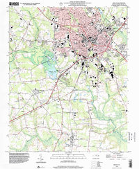
 1978 Wilson1979 Print · USGSThe city of WILSON and its outlying communities are captured in the late seventies as a busy rail and institutional hub. Researchers can trace the legacy of local education and faith through sites like Atlantic Christian College, Darden High Sch, and Lower Black Creek Ch.
 - 1985 Map of Rocky Mount
 1985 Rocky Mount1985 Print · USGSThe eastern North Carolina coastal plain in the mid-eighties shows a landscape defined by its river-and-rail heritage. Genealogists and local historians can trace the development of Rocky Mount, Greenville, and Wilson, or locate landmarks like East Carolina University and the Voice of America site.2 unique versions available
 - 1998 Map of Wilson, 2001 Print
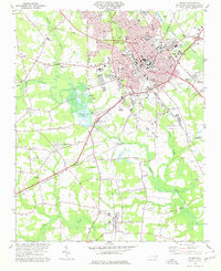
 1998 Wilson2001 Print · USGSWilson and the surrounding coastal plain thrive at the close of the century, balancing urban expansion with its deep agricultural roots. Researchers can trace the footprints of community life at Barton College, the rural crossroads of Boswellville, and historic sites like Maplewood Cem.
End of results
Showing maps 1-6 of 6
Top cities near Montclair
- Rocky Mount historical maps
- Wilson historical maps
- Nashville historical maps
- Sharpsburg historical maps
- Fremont historical maps
- Kenly historical maps
See more
Frequently asked questions
- What are the different types of historical maps available for Montclair?
- What is the oldest map of Montclair?
- Where can I purchase historical maps of Montclair for my home or office?
- Where can I download high-res historical maps of Montclair?
- Are there historical topographic maps available for Montclair?
- Is there historical aerial imagery available for Montclair?
- Where are historical maps of Montclair sourced from?