1970s Maps of Hettinger, North Dakota
Explore 3 historic maps of Hettinger from the 1970s. These maps offer a rare glimpse into what life looked like during the 1970s — showing old roads, neighborhoods, homes, and landmarks that have changed or disappeared over time.
Whether you're researching your family's past, planning a metal detecting trip, or studying how Hettinger's landscape evolved across the 1970s, these high-resolution maps are a powerful tool for exploring the history of this region.
- Focus on a specific era: All maps on this page are from the 1970s, giving you a focused view of this time period.
- See what’s changed: Compare century-old streets, trails, and buildings to today's modern landscape using overlays and satellite layers.
- Research with precision: Use these maps for genealogy, historical research, land use analysis, or educational projects.
- View, download, or print: Maps are fully viewable online in high resolution, and can be downloaded or printed for your own records.
Start exploring Hettinger's history through authentic maps from the 1970s. This is your window into the past.
Hettinger, ND maps
(3)- 1974 Map of Hettinger North, 1978 Print
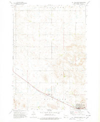 1974 Hettinger North1978 Print · USGSThe railroad corridor through Adams County comes into focus in the 1970s, centered on the growing town of Hettinger. Researchers can trace the Chicago Milwaukee St Paul and Pacific line or locate rural landmarks like Immanuel Ch and the Townhall.
 - 1974 Map of Hettinger South, 1978 Print
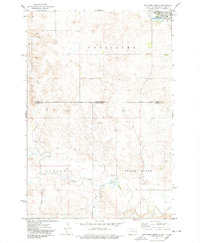 1974 Hettinger South1978 Print · USGSThe North Dakota and South Dakota borderlands come into focus in the mid-1970s, centered on the expansion of Hettinger. Genealogists and researchers can trace the drainages of Billy Young Creek and Hook Creek or locate local landmarks like Mirror Lake and the Claypit.
 - 1974 Map of Kid Rich Butte, 1978 Print
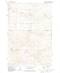 1974 Kid Rich Butte1978 Print · USGSThe high plains of the North Dakota-South Dakota border come into focus in the mid-1970s, showing a landscape defined by river forks and rail lines. Researchers can trace the path of the Chicago Milwaukee St Paul and Pacific railroad or locate landmarks like Kid Rich Butte and Castle Butte.
End of results
Showing maps 1-3 of 3
Top cities near Hettinger
Frequently asked questions
- What are the different types of historical maps available for Hettinger?
- What is the oldest map of Hettinger?
- Where can I purchase historical maps of Hettinger for my home or office?
- Where can I download high-res historical maps of Hettinger?
- Are there historical topographic maps available for Hettinger?
- Is there historical aerial imagery available for Hettinger?
- Where are historical maps of Hettinger sourced from?