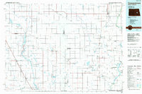
1900s (20th Century) Maps of Edna Township, North Dakota
Explore 8 historic maps of Edna Township from the 1900s (20th Century). These maps offer a rare glimpse into what life looked like during the 1900s — showing old roads, neighborhoods, homes, and landmarks that have changed or disappeared over time.
Whether you're researching your family's past, planning a metal detecting trip, or studying how Edna Township's landscape evolved across the 1900s, these high-resolution maps are a powerful tool for exploring the history of this region.
- Focus on a specific era: All maps on this page are from the 1900s, giving you a focused view of this time period.
- See what’s changed: Compare century-old streets, trails, and buildings to today's modern landscape using overlays and satellite layers.
- Research with precision: Use these maps for genealogy, historical research, land use analysis, or educational projects.
- View, download, or print: Maps are fully viewable online in high resolution, and can be downloaded or printed for your own records.
Start exploring Edna Township's history through authentic maps from the 1900s. This is your window into the past.
Edna Township, ND maps
(8)- 1952 Map of New Rockford, 1968 Print
 1952 New Rockford1968 Print · USGSThe North Dakota prairie during the mid-1950s was a landscape of rail-dependent farm towns and vast wildlife refuges. Genealogists and historians can trace the foundations of local communities at Fort Totten Indian Agenc, Concordia Lutheran Church, and the Bowdon Country Church and Cemetery.3 unique versions available
 - 1956 Map of New Rockford
 1956 New Rockford1956 Print · USGSMid-century central North Dakota is captured here as a landscape of prairie rail towns and vast wildlife refuges. Trace family roots at the Bowdon Country Church and Cemetery or locate the old St Michael Mission School and Fort Totten.
 - 1961 Map of Leal, 1963 Print
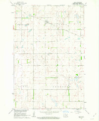 1961 Leal1963 Print · USGSNorth Dakota's prairie landscape comes into focus in the early sixties as the Soo Line cuts through Barnes County. Genealogists can locate the rural Townhall, the community Cem, and the small rail-side settlement of Leal.
 - 1961 Map of Wimbledon NE, 1963 Print
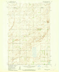 1961 Wimbledon NE1963 Print · USGSThe Griggs and Barnes County line in the early sixties showcases a classic North Dakota township system defined by isolated farmsteads and prairie wetlands. Local historians can trace early schoolhouse sites like Pierce Sch and Laketown Sch or industrial Gravel Pits.
 - 1961 Map of Rogers, 1963 Print
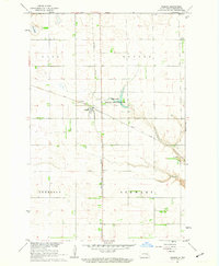 1961 Rogers1963 Print · USGSThe Barnes County prairie comes into focus in the early sixties at the intersection of two major rail lines. Genealogists and local historians can locate the Coleman Sch, the township of Stewart, and the Tomahawk National Wildlife Refuge.
 - 1961 Map of Dazey, 1963 Print
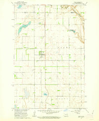 1961 Dazey1963 Print · USGSThe town of Dazey sits at a rail junction in eastern North Dakota during the early 1960s, surrounded by a landscape of prairie potholes and farmsteads. Researchers can trace the Northern Pacific rail line and locate landmarks like the Dazey Cemetery and Lake Benson.
 - 1971 Map of New Rockford, 1974 Print
 1971 New Rockford1974 Print · USGSCentral North Dakota was a landscape of wildlife refuges and rail-linked agricultural towns in the early seventies. Genealogists and local historians can trace the development of the Fort Totten Indian Reservation and locate old railway points like Maddock, Hamal, and Kloten.
 - 1985 Map of Cooperstown
 1985 Cooperstown1985 Print · USGSGriggs and Barnes Counties are seen here in the mid-eighties, a period where the prairie economy centered on rail lines and river reservoirs. Genealogists and local historians can trace family locations near Wimbledon, Hannaford, and Spiritwood Lake or locate the Fish Hatchery and Gaging Station along the Sheyenne River.2 unique versions available
End of results
Showing maps 1-8 of 8
Top cities near Edna Township
- Wimbledon historical maps
- Sanborn historical maps
- Hannaford historical maps
- Eckelson historical maps
- Dazey historical maps
- Rogers historical maps
See more
Frequently asked questions
- What are the different types of historical maps available for Edna Township?
- What is the oldest map of Edna Township?
- Where can I purchase historical maps of Edna Township for my home or office?
- Where can I download high-res historical maps of Edna Township?
- Are there historical topographic maps available for Edna Township?
- Is there historical aerial imagery available for Edna Township?
- Where are historical maps of Edna Township sourced from?