1960s Maps of Tower Township, North Dakota
Explore 2 historic maps of Tower Township from the 1960s. These maps offer a rare glimpse into what life looked like during the 1960s — showing old roads, neighborhoods, homes, and landmarks that have changed or disappeared over time.
Whether you're researching your family's past, planning a metal detecting trip, or studying how Tower Township's landscape evolved across the 1960s, these high-resolution maps are a powerful tool for exploring the history of this region.
- Focus on a specific era: All maps on this page are from the 1960s, giving you a focused view of this time period.
- See what’s changed: Compare century-old streets, trails, and buildings to today's modern landscape using overlays and satellite layers.
- Research with precision: Use these maps for genealogy, historical research, land use analysis, or educational projects.
- View, download, or print: Maps are fully viewable online in high resolution, and can be downloaded or printed for your own records.
Start exploring Tower Township's history through authentic maps from the 1960s. This is your window into the past.
Tower Township, ND maps
(2)- 1967 Map of Tower City, 1969 Print
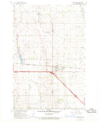 1967 Tower City1969 Print · USGSThe intersection of the Northern Pacific railroad and the modern interstate era defines this late-1960s North Dakota landscape. Researchers can trace the layout of Tower City and Koldok, or locate family sites near Greenwood Cem and several local Sandpit operations.
 - 1967 Map of Buffalo, 1969 Print
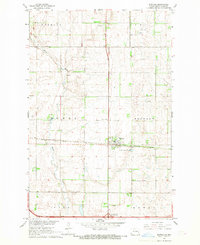 1967 Buffalo1969 Print · USGSThe prairie landscape of western Cass County is centered on the railroad town of Buffalo during the late sixties. Genealogists and historians can trace the Northern Pacific rail line, the meanders of the Maple River, and local landmarks like the Grieve Landing Strip.
End of results
Showing maps 1-2 of 2
Top cities near Tower Township
- Tower City historical maps
- Page historical maps
- Buffalo historical maps
- Fingal historical maps
- Erie historical maps
- Oriska historical maps
See more
Top neighborhoods of Tower Township
Frequently asked questions
- What are the different types of historical maps available for Tower Township?
- What is the oldest map of Tower Township?
- Where can I purchase historical maps of Tower Township for my home or office?
- Where can I download high-res historical maps of Tower Township?
- Are there historical topographic maps available for Tower Township?
- Is there historical aerial imagery available for Tower Township?
- Where are historical maps of Tower Township sourced from?