1970s Maps of Tell Township, North Dakota
Explore 5 historic maps of Tell Township from the 1970s. These maps offer a rare glimpse into what life looked like during the 1970s — showing old roads, neighborhoods, homes, and landmarks that have changed or disappeared over time.
Whether you're researching your family's past, planning a metal detecting trip, or studying how Tell Township's landscape evolved across the 1970s, these high-resolution maps are a powerful tool for exploring the history of this region.
- Focus on a specific era: All maps on this page are from the 1970s, giving you a focused view of this time period.
- See what’s changed: Compare century-old streets, trails, and buildings to today's modern landscape using overlays and satellite layers.
- Research with precision: Use these maps for genealogy, historical research, land use analysis, or educational projects.
- View, download, or print: Maps are fully viewable online in high resolution, and can be downloaded or printed for your own records.
Start exploring Tell Township's history through authentic maps from the 1970s. This is your window into the past.
Tell Township, ND maps
(5)- 1975 Map of Linton NE, 1978 Print
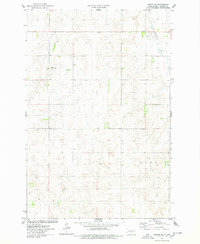 1975 Linton NE1978 Print · USGSThe rural prairie of Emmons County was surveyed in the mid-1970s, showing the agricultural character of Tell and Wood townships. Genealogists and researchers can locate the small settlement of Brad and a specific early Grave site north of the Long Lake Creek.
 - 1975 Map of Braddock, 1978 Print
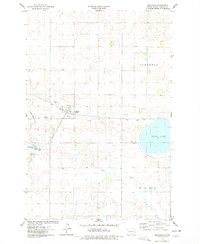 1975 Braddock1978 Print · USGSBraddock and the surrounding Emmons County plains are captured here in the mid-seventies as the rail-and-creek economy shaped the local township. Genealogists can locate Braddock Cem and Maria Cem, or trace the Soo Line past Goose Lake.
 - 1975 Map of Kintyre, 1978 Print
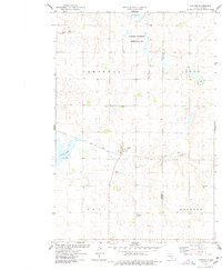 1975 Kintyre1978 Print · USGSThe rural prairie landscape surrounding Kintyre is captured here during the mid-seventies, showing the vital role of the railroad and land management. Researchers can trace the Soo Line tracks through town or locate the National Waterfowl Production Area and Stink Lake.
 - 1979 Map of Bismarck, 1980 Print
 1979 Bismarck1980 Print · USGSBismarck and Mandan sit at the heart of this late-century North Dakota survey, where the Missouri River flows past historic frontier outposts. Trace the old Soo Line rail corridors or locate family landmarks near St Anthony, Fort Rice, and Custer Flats.
 - 1979 Map of Schell Buttes NW, 1980 Print
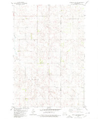 1979 Schell Buttes NW1980 Print · USGSEmmons and Logan counties are documented here in the late seventies, showing the township borders of Tell and Kroeber. Researchers can trace old family roots through sites like Tell Cem, St Boniface Cem, and the headwaters of Finnish Cr.
End of results
Showing maps 1-5 of 5
Top cities near Tell Township
Frequently asked questions
- What are the different types of historical maps available for Tell Township?
- What is the oldest map of Tell Township?
- Where can I purchase historical maps of Tell Township for my home or office?
- Where can I download high-res historical maps of Tell Township?
- Are there historical topographic maps available for Tell Township?
- Is there historical aerial imagery available for Tell Township?
- Where are historical maps of Tell Township sourced from?