Old Maps of Clifton, North Dakota for Genealogy
Trace your family roots with 10 historic maps of Clifton. These high-res maps reveal old neighborhoods, homesites, landmarks, and streets — helping you uncover where your ancestors lived and how the area evolved over time.
- Explore historic neighborhoods: Identify where your relatives may have lived in the 1800s or 1900s.
- Compare maps over time: Trace the changes in streets, buildings, and landmarks for multi-generational research.
- Perfect for genealogy & ancestry research: Used by family historians and researchers to map out lineage and migration.
These maps are an incredible resource for exploring your personal connection to Clifton's past.
Clifton, ND maps
(10)- 1940 Map of Aylmer
 1940 Aylmer1940 Print · USGSPierce and Sheridan Counties come into focus just before the war, showing the peak of the North Dakota rail-and-prairie economy. Genealogists can pinpoint exact locations for family landmarks like Hillsdale Ch, White Sch, and Martin Cem.3 unique versions available
 - 1954 Map of McClusky, 1968 Print
 1954 McClusky1968 Print · USGSCentral North Dakota was undergoing a profound transformation in the fifties as the newly formed Lake Sakakawea reshaped the Missouri River valley. Genealogists and historians can trace rail-town development along the Soo Line and locate historic markers like Garrison Dam or the Lewis and Clark Trail.3 unique versions available
 - 1958 Map of McClusky
 1958 McClusky1958 Print · USGSCentral North Dakota was undergoing a profound change in the late fifties as the Garrison Reservoir filled behind its massive new dam. Trace the early layout of Riverdale, the Lewis and Clark Trail, and the vanishing rail stops of the Northern Pacific.
 - 1958 Map of Clifton, 1959 Print
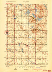
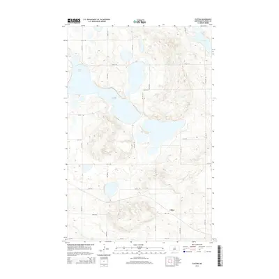
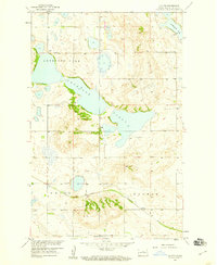 1958 Clifton1959 Print · USGSPierce County prairie life in the late fifties is centered on the railroad and the water. Track the Great Northern rail corridor through Clifton or scout the expansive shores of Antelope Lake and Lesmeister Lake.2 unique versions available
 - 1979 Map of Drake, 1980 Print
 1979 Drake1980 Print · USGSCentral North Dakota in the late seventies reveals a landscape of prairie potholes and developing water infrastructure. Trace the rail-fed growth of Drake and Anamoose or locate rural landmarks like the McClusky Canal and Lincoln Valley.
 - 2011 Map of Clifton, 2011 Print
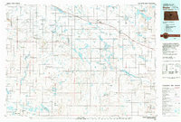
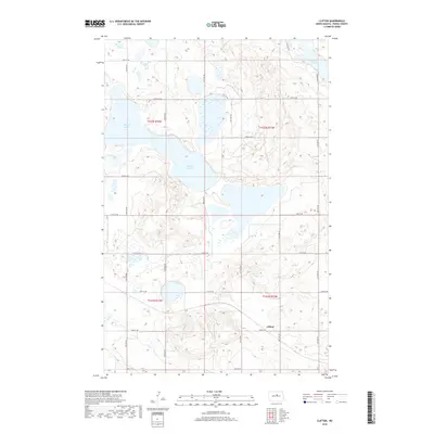
 2011 Clifton2011 Print · USGSCovers Clifton, including Pierce County, United States, and other nearby areas
 - 2014 Map of Clifton, 2014 Print
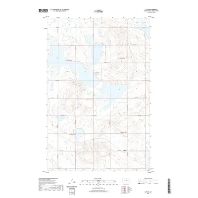
 2014 Clifton2014 Print · USGSCovers Clifton, including Pierce County, United States, and other nearby areas
 - 2018 Map of Clifton, 2018 Print
 2018 Clifton2018 Print · USGSCovers Clifton, including Pierce County, United States, and other nearby areas
 - 2020 Map of Clifton, 2020 Print
 2020 Clifton2020 Print · USGSCovers Clifton, including Pierce County, United States, and other nearby areas
 - 2024 Map of Clifton, 2024 Print
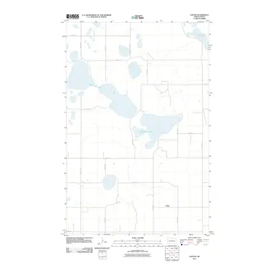
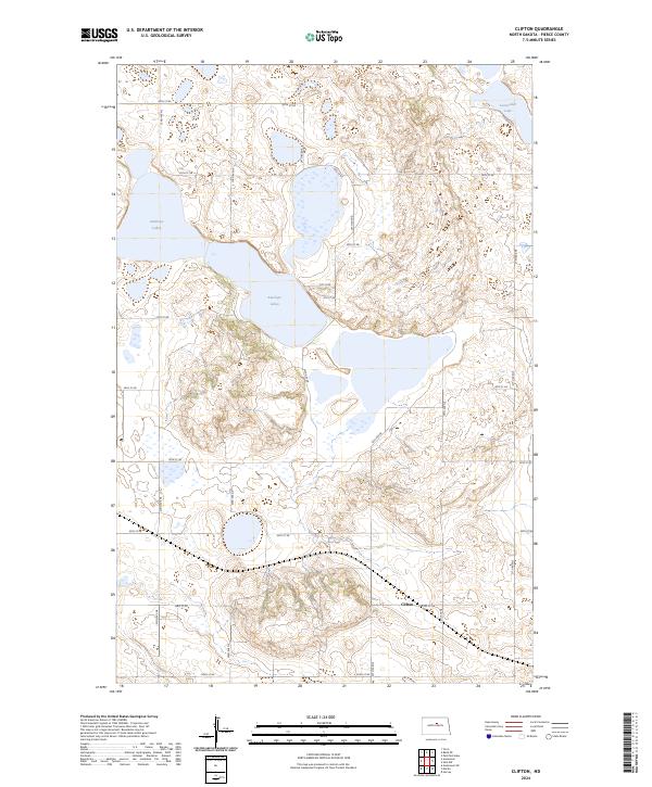 2024 Clifton2024 Print · USGSIn the central plains of Pierce County, this modern survey shows the enduring rural layout of the northern prairie. You can trace the proximity of Clifton to the protected wetlands of the Pierce County Waterfowl Production Area and the waters of Antelope Lakes.
End of results
Showing maps 1-10 of 10
Top cities near Clifton
Frequently asked questions
- What are the different types of historical maps available for Clifton?
- What is the oldest map of Clifton?
- Where can I purchase historical maps of Clifton for my home or office?
- Where can I download high-res historical maps of Clifton?
- Are there historical topographic maps available for Clifton?
- Is there historical aerial imagery available for Clifton?
- Where are historical maps of Clifton sourced from?