1900s (20th Century) Maps of Eagle Township, North Dakota
Explore 11 historic maps of Eagle Township from the 1900s (20th Century). These maps offer a rare glimpse into what life looked like during the 1900s — showing old roads, neighborhoods, homes, and landmarks that have changed or disappeared over time.
Whether you're researching your family's past, planning a metal detecting trip, or studying how Eagle Township's landscape evolved across the 1900s, these high-resolution maps are a powerful tool for exploring the history of this region.
- Focus on a specific era: All maps on this page are from the 1900s, giving you a focused view of this time period.
- See what’s changed: Compare century-old streets, trails, and buildings to today's modern landscape using overlays and satellite layers.
- Research with precision: Use these maps for genealogy, historical research, land use analysis, or educational projects.
- View, download, or print: Maps are fully viewable online in high resolution, and can be downloaded or printed for your own records.
Start exploring Eagle Township's history through authentic maps from the 1900s. This is your window into the past.
Eagle Township, ND maps
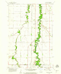
(11)- 1904 Map of Wahpeton
 1904 Wahpeton1904 Print · USGSThe Red River Valley at the start of the century was a landscape of burgeoning rail towns and river commerce along the Minnesota border. Genealogists can trace early homesteads and transport hubs between Wahpeton and Breckenridge, or follow the rail lines through Hankinson and Abercrombie.2 unique versions available
 - 1953 Map of Fargo, 1965 Print
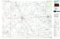
 1953 Fargo1965 Print · USGSThe Red River Valley in the mid-fifties was a bustling rail and agricultural corridor during a period of steady prairie growth. Genealogists and historians can trace the intricate rail networks of the Great Northern and Soo Line connecting local hubs like Casselton and Wahpeton.2 unique versions available
 - 1956 Map of Fargo
 1956 Fargo1956 Print · USGSThe Red River Valley's agricultural heartland is documented here in the mid-fifties as the rail-and-road network expanded across the plains. Genealogists can trace family roots through numerous small railroad towns and local landmarks like Casselton, Sheyenne Valley Church, and Sisseton Indian Res.
 - 1959 Map of Hickson, 1960 Print
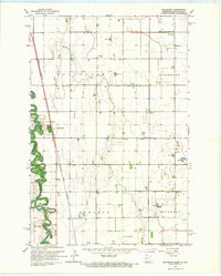
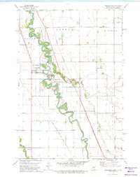
 1959 Hickson1960 Print · USGSThe Red River Valley's rich agricultural borderlands are captured here in the late fifties, showcasing the intricate meanders of the Red River of the North. Genealogists can locate rural landmarks like St Benedict, Hickson, and the North Pleasant Cem.3 unique versions available
 - 1959 Map of Christine, 1960 Print
 1959 Christine1960 Print · USGSThe Red River Valley landscape of the late fifties is captured here as a network of rail-side settlements and winding river loops. Genealogists can locate family landmarks like South Pleasant Cem, Richland Ch, and the small siding at Lithia.2 unique versions available
 - 1960 Map of Galchutt, 1961 Print
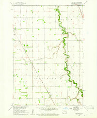 1960 Galchutt1961 Print · USGSRichland County, North Dakota, is captured here in the early sixties as a settled landscape of rail-side hamlets and meandering prairie rivers. Genealogists and historians can locate rural landmarks like Bethany Ch and trace the paths of the Great Northern and C M St P & P railroads.
 - 1966 Map of Wolverton, 1967 Print
 1966 Wolverton1967 Print · USGSThe Red River valley at the Minnesota-North Dakota border is captured here in the mid-sixties, showing a landscape defined by rail and river. Researchers can trace the Great Northern rail corridor through Wolverton or locate family sites near Schmitt Cem and Wolverton Cem.
 - 1973 Map of Abercrombie, 1975 Print
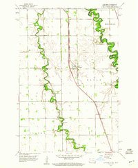
 1973 Abercrombie1975 Print · USGSThe Red River valley in the early 1970s shows a landscape defined by sharp river bends and competing rail lines. Genealogists can locate St Johns Ch and St Thomas Cem, or explore the grounds of Fort Abercrombie State Park.
 - 1985 Map of Fargo
 1985 Fargo1985 Print · USGSThe Red River Valley and the Minnesota lake country meet in this mid-1980s survey of the Fargo-Moorhead border region. Genealogists and researchers can trace the Burlington Northern rail corridors and find rural communities like Pelican Rapids, Sabin, and Dilworth.2 unique versions available
 - 1985 Map of Wahpeton, 1986 Print
 1985 Wahpeton1986 Print · USGSThe Red River Valley and Minnesota lake country meet in the mid-eighties at the border towns of Wahpeton and Breckenridge. Genealogists and historians can trace the rail lines of the Burlington Northern through settlements like Abercrombie and Hankinson, or locate legacy sites like Fort Abercrombie State Park.2 unique versions available
 - 1989 Map of Fargo, 1990 Print
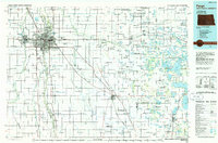
 1989 Fargo1990 Print · USGSThe Red River Valley at the end of the eighties shows a landscape of flourishing university towns and vital rail corridors. Researchers can trace family roots through Riverside Cem, find early campus layouts for North Dakota State University, or follow the Soo Line Railroad through West Fargo.
End of results
Showing maps 1-11 of 11
Top cities near Eagle Township
- Fargo historical maps
- Horace historical maps
- Abercrombie historical maps
- Oxbow historical maps
- Walcott historical maps
- Christine historical maps
See more
Top neighborhoods of Eagle Township
Frequently asked questions
- What are the different types of historical maps available for Eagle Township?
- What is the oldest map of Eagle Township?
- Where can I purchase historical maps of Eagle Township for my home or office?
- Where can I download high-res historical maps of Eagle Township?
- Are there historical topographic maps available for Eagle Township?
- Is there historical aerial imagery available for Eagle Township?
- Where are historical maps of Eagle Township sourced from?