2020s Maps of Luverne, North Dakota
Explore 4 historic maps of Luverne from the 2020s. These maps offer a rare glimpse into what life looked like during the 2020s — showing old roads, neighborhoods, homes, and landmarks that have changed or disappeared over time.
Whether you're researching your family's past, planning a metal detecting trip, or studying how Luverne's landscape evolved across the 2020s, these high-resolution maps are a powerful tool for exploring the history of this region.
- Focus on a specific era: All maps on this page are from the 2020s, giving you a focused view of this time period.
- See what’s changed: Compare century-old streets, trails, and buildings to today's modern landscape using overlays and satellite layers.
- Research with precision: Use these maps for genealogy, historical research, land use analysis, or educational projects.
- View, download, or print: Maps are fully viewable online in high resolution, and can be downloaded or printed for your own records.
Start exploring Luverne's history through authentic maps from the 2020s. This is your window into the past.
Luverne, ND maps
(4)- 2020 Map of Luverne, 2020 Print
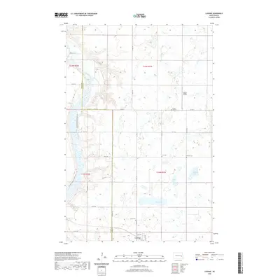 2020 Luverne2020 Print · USGSCovers Luverne, including Riverside Township, Willow Lake Township, and other nearby areas
 - 2020 Map of Sibley, 2020 Print
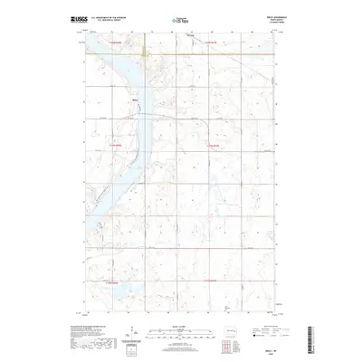 2020 Sibley2020 Print · USGSCovers Luverne, including Sibley, Grand Prairie Township, and other nearby areas
 - 2024 Map of Sibley, 2024 Print
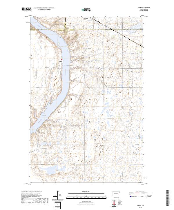 2024 Sibley2024 Print · USGSThe Sheyenne River valley and Lake Ashtabula define this Barnes County landscape in the modern era. Trace the path of the North Country National Scenic Trl or locate rural homesteads near Sibley and Luverne.
 - 2024 Map of Luverne, 2024 Print
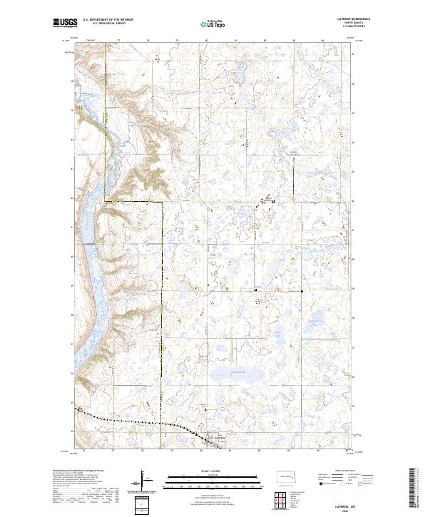 2024 Luverne2024 Print · USGSLuverne and the prairie pothole region of Steele County are shown in this modern survey. Genealogists can locate family burial plots at Original Lund Cem, Pederson Cem, and Luverne Cem while tracing the winding course of the Sheyenne River.
End of results
Showing maps 1-4 of 4
Top cities near Luverne
- Cooperstown historical maps
- Hope historical maps
- Sherbrooke Township historical maps
- Sibley historical maps
- Pillsbury historical maps
Frequently asked questions
- What are the different types of historical maps available for Luverne?
- What is the oldest map of Luverne?
- Where can I purchase historical maps of Luverne for my home or office?
- Where can I download high-res historical maps of Luverne?
- Are there historical topographic maps available for Luverne?
- Is there historical aerial imagery available for Luverne?
- Where are historical maps of Luverne sourced from?