Old Maps of Williamsfield Township, Ohio for Genealogy
Trace your family roots with 22 historic maps of Williamsfield Township. These high-res maps reveal old neighborhoods, homesites, landmarks, and streets — helping you uncover where your ancestors lived and how the area evolved over time.
- Explore historic neighborhoods: Identify where your relatives may have lived in the 1800s or 1900s.
- Compare maps over time: Trace the changes in streets, buildings, and landmarks for multi-generational research.
- Perfect for genealogy & ancestry research: Used by family historians and researchers to map out lineage and migration.
These maps are an incredible resource for exploring your personal connection to Williamsfield Township's past.
Williamsfield Township, OH maps
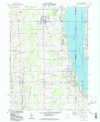
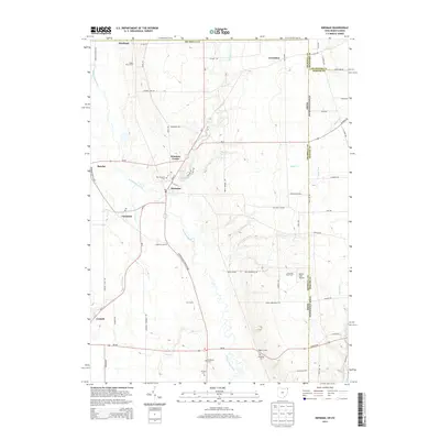
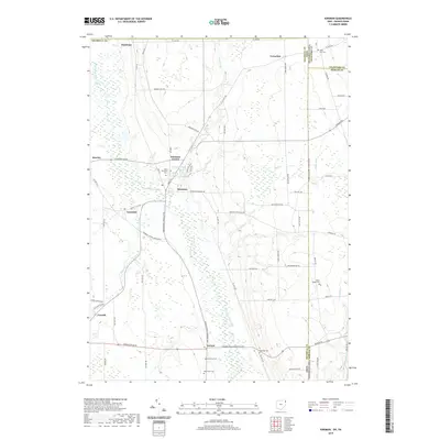
(22)- 1905 Map of Andover
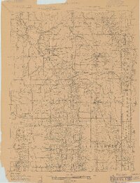 1905 Andover1905 Print · USGSAshtabula County and the Pennsylvania border are shown here at the height of the steam era, before modern highways transformed these rural townships. Genealogists and researchers can locate early congregations like South Denmark Church and trace the paths of the Cooperage Co RR or the Lake Shore and Michigan Southern Railroad.3 unique versions available
 - 1907 Map of Andover
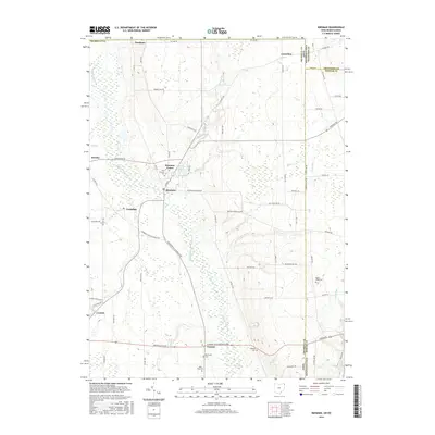
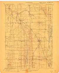 1907 Andover1907 Print · USGSThe Ohio-Pennsylvania borderlands near Andover are captured here during a period of significant railway expansion. Local historians can trace early mail routes and church sites like the Williamsfield P O, South Denmark Church, and the vanished crossroads of Padanaram.4 unique versions available
 - 1907 Map of Kinsman, 1940 Print
 1907 Kinsman1940 Print · USGSEastern Trumbull County thrived at the start of the century as a vital crossroads of Ohio and Pennsylvania rail lines. Local historians can trace the foundations of Kinsman, Orangeville, and the remote State Line Church during the height of the steam rail era.2 unique versions available
 - 1950 Map of Cleveland
 1950 Cleveland1950 Print · USGSCovers Williamsfield Township, including Cleveland, Akron, and other nearby areas
 - 1956 Map of Cleveland, 1967 Print
 1956 Cleveland1967 Print · USGSNortheast Ohio and Western Pennsylvania are shown at their industrial height during the mid-fifties, from the steel mills to the lakeshore. Researchers can trace the massive Ravenna Arsenal, the Ohio Turnpike, and vanished rail sidings of the B & O RR.3 unique versions available
 - 1959 Map of Andover, 1961 Print
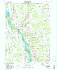
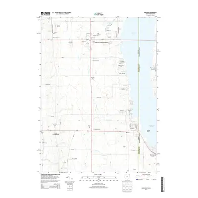
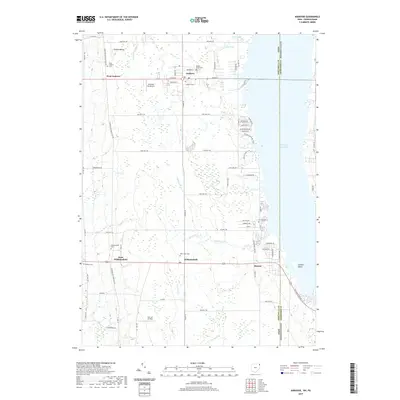
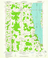 1959 Andover1961 Print · USGSAndover and Williamsfield sit at the edge of the Pymatuning Reservoir in the late fifties, where rural life meets a growing recreation industry. Researchers can trace family sites like Maple Grove Cem, the New York Central rail line, and the local Drive-in Theater.4 unique versions available
 - 1961 Map of Kinsman, 1963 Print
 1961 Kinsman1963 Print · USGSIn the early sixties, the Trumbull County borderlands were defined by the growing Shenango River Reservoir and a network of traditional farming crossroads. Genealogists can trace family names and local landmarks like Farmdale (Kinsman Sta), Badger High Sch, and Rocky Ridge Cem.3 unique versions available
 - 1962 Map of Cleveland
 1962 Cleveland1962 Print · USGSNortheast Ohio and the Pennsylvania borderlands appear here during the industrial peak of the early sixties. Genealogists and historians can trace the expansive rail lines of the Nickel Plate Road and the growth of suburbs from Parma to Lyndhurst.
 - 1986 Map of Ashtabula
 1986 Ashtabula1986 Print · USGSThe Lake Erie shoreline and the rural borderlands of Ohio and Pennsylvania are captured here as they appeared in the 1980s. You can trace industrial rail lines like the BESSEMER AND LAKE ERIE or locate family sites near Kelloggsville Cem and Pymatuning State Park.2 unique versions available
 - 1986 Map of Youngstown, 1988 Print
 1986 Youngstown1988 Print · USGSThe industrial corridor of the Mahoning Valley and the collegiate towns of Western Pennsylvania are captured here in the mid-eighties. Researchers can trace the rail lines of the Conrail network or locate historical sites like Churchill and Crown Hill Cem.2 unique versions available
 - 1994 Map of Andover, 1997 Print
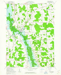
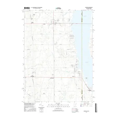
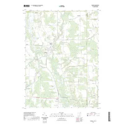
 1994 Andover1997 Print · USGSAshtabula County and the Pennsylvania borderlands appear here in the mid-nineties, centered on the village of Andover. Researchers can trace family history through the West Lawn and Simons cemeteries or locate recreational landmarks like the Drive-in Theater.
 - 1994 Map of Kinsman, 1997 Print
 1994 Kinsman1997 Print · USGSTrumbull County and the Pennsylvania border are captured in the late twentieth century, showing a landscape of fertile creek valleys and quiet crossroads. Trace family history at Gibson Cem, find the site of Farmdale (Kinsman Sta), or explore the Pymatuning State Wildlife Area.
 - 2010 Map of Andover, 2010 Print
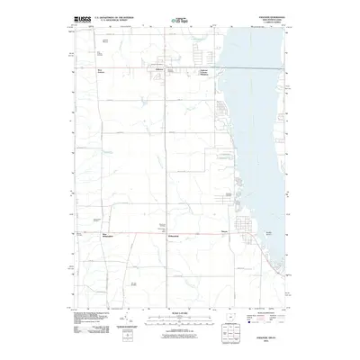 2010 Andover2010 Print · USGSCovers Williamsfield Township, including Williamsfield, Andover, and other nearby areas
 - 2010 Map of Kinsman, 2010 Print
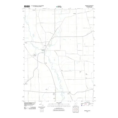 2010 Kinsman2010 Print · USGSCovers Williamsfield Township, including Kinsman Township, Kinsman, and other nearby areas
 - 2013 Map of Kinsman, 2013 Print
 2013 Kinsman2013 Print · USGSCovers Williamsfield Township, including Kinsman Township, Kinsman, and other nearby areas
 - 2013 Map of Andover, 2013 Print
 2013 Andover2013 Print · USGSCovers Williamsfield Township, including Williamsfield, Andover, and other nearby areas
 - 2016 Map of Andover, 2016 Print
 2016 Andover2016 Print · USGSCovers Williamsfield Township, including Williamsfield, Andover, and other nearby areas
 - 2016 Map of Kinsman, 2016 Print
 2016 Kinsman2016 Print · USGSCovers Williamsfield Township, including Kinsman Township, Kinsman, and other nearby areas
 - 2019 Map of Kinsman, 2019 Print
 2019 Kinsman2019 Print · USGSCovers Williamsfield Township, including Kinsman Township, Kinsman, and other nearby areas
 - 2019 Map of Andover, 2019 Print
 2019 Andover2019 Print · USGSCovers Williamsfield Township, including Williamsfield, Andover, and other nearby areas
 - 2023 Map of Kinsman, 2023 Print
 2023 Kinsman2023 Print · USGSTrumbull County, Ohio, sits at the Pennsylvania border in this recent survey of the Western Reserve. Genealogists can locate several historic burial grounds including Pioneer Cem, West View Cem, and State Line Cem near the village of Kinsman.
 - 2023 Map of Andover, 2023 Print
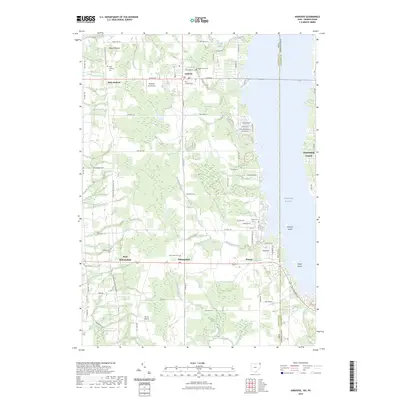 2023 Andover2023 Print · USGSThe Ohio-Pennsylvania state line is captured here as it bisects the Pymatuning Reservoir in the early twenty-first century. Genealogists and historians can trace numerous family burial grounds including Simons Cem and West Lawn Cem, or locate the ancient Owens Mound.
End of results
Showing maps 1-22 of 22
Top cities near Williamsfield Township
- Cortland historical maps
- Cortland historical maps
- Bazetta Township historical maps
- Greenville historical maps
- Shenango historical maps
- Jefferson Township historical maps
See more
Top neighborhoods of Williamsfield Township
Frequently asked questions
- What are the different types of historical maps available for Williamsfield Township?
- What is the oldest map of Williamsfield Township?
- Where can I purchase historical maps of Williamsfield Township for my home or office?
- Where can I download high-res historical maps of Williamsfield Township?
- Are there historical topographic maps available for Williamsfield Township?
- Is there historical aerial imagery available for Williamsfield Township?
- Where are historical maps of Williamsfield Township sourced from?