Old Maps of Guysville, Rome Township for Academic Research
Study the evolution of Guysville with 15 high-resolution historic maps. Whether you're teaching, researching, or modeling changes in land use, these maps provide essential visual documentation of urban, environmental, and geographic change.
- Analyze long-term change: Track patterns in development, transportation, and natural features.
- Ideal for environmental or urban studies: Support academic projects with primary historical map data.
- Use in the classroom or lab: Educators and researchers rely on these maps to bring historical context to life.
These maps are a powerful tool for teaching, research, and visualizing how Guysville has changed over the decades.
Guysville, Rome Township maps
(15)- 1904 Map of Chesterhill, 1957 Print
 1904 Chesterhill1957 Print · USGSSoutheast Ohio's rugged hill country is captured here during the peak of its rail-and-river economy in the early twentieth century. Researchers can locate vanished rural post offices and community landmarks like Calvary P O, Bethany Church, and Patten Mills.
 - 1906 Map of Chesterhill, 1943 Print
 1906 Chesterhill1943 Print · USGSSoutheastern Ohio at the start of the century reveals a landscape of coal-mining hamlets and river valley rail lines. Genealogists and researchers can trace family landmarks like Mills School, Patten Mills, and the scattered post offices of Calvary PO and Federal.
 - 1949 Map of Clarksburg
 1949 Clarksburg1949 Print · USGSThe upper Ohio River valley and the industrial heart of West Virginia come into focus during this post-war period. Genealogists and researchers can trace the rail corridors of the Baltimore and Ohio and locate centers like Fairmont, Grafton, and Waynesburg.
 - 1956 Map of Clarksburg, 1966 Print
 1956 Clarksburg1966 Print · USGSThe Ohio River valley and the industrial heart of West Virginia are seen here in the mid-1950s as rail and river commerce thrived. Researchers can trace historic transport lines like the Baltimore and Ohio RR and locate ancestral homes in Clarksburg, Moundsville, or Parkersburg.2 unique versions available
 - 1961 Map of Clarksburg
 1961 Clarksburg1961 Print · USGSThe mid-century industrial and river landscapes of West Virginia and Ohio are detailed here, centered on the Ohio River. Researchers can trace the Baltimore and Ohio rail lines connecting towns like Parkersburg, Clarksburg, and Monongah.
 - 1961 Map of Stewart, 1962 Print
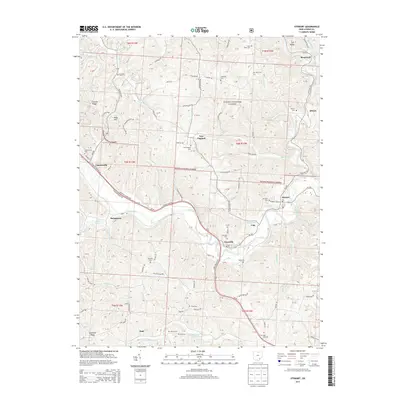
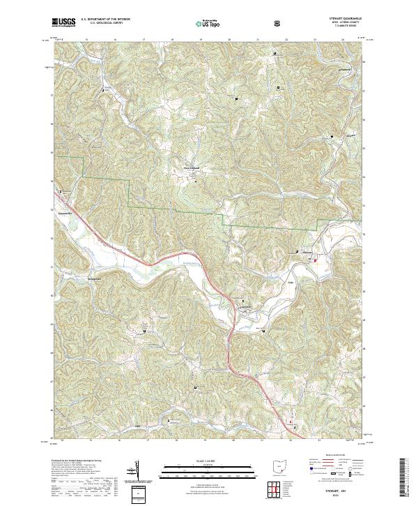
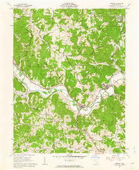 1961 Stewart1962 Print · USGSAthens County at the start of the sixties reveals a landscape of winding river valleys and ridge-top oil fields. Trace the old Baltimore and Ohio rail line through Guysville and Stewart, or find rural landmarks like Asbury Ch and Kilvert.4 unique versions available
 - 1981 Map of Parkersburg, 1984 Print
 1981 Parkersburg1984 Print · USGSThe Ohio River valley at the start of the 1980s reveals a landscape shaped by river commerce and the rail networks of the Baltimore and Ohio RR. Genealogists and historians can trace the development of riverfront communities like Parkersburg, Marietta, and Williamstown, alongside rural landmarks like Blennerhassett Island and Elizabeth.
 - 1988 Map of Clarksburg, 1989 Print
 1988 Clarksburg1989 Print · USGSThe central Appalachians are documented in detail during the late eighties, showing the industrial and river-based economies of West Virginia, Ohio, and Pennsylvania. Researchers can trace historic rail routes like the B & O RR and locate river towns from St Marys to Parkersburg.
 - 1994 Map of Stewart, 1998 Print
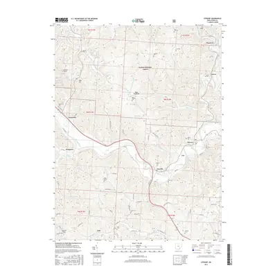
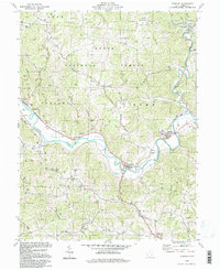 1994 Stewart1998 Print · USGSAthens County hill country comes into focus in the mid-nineties, where river-valley life meets the deep woods of the Wayne National Forest. Genealogists can trace family footprints at Copeland Cem or follow the Hocking River to the village of Stewart.
 - 2002 Map of Stewart, 2006 Print
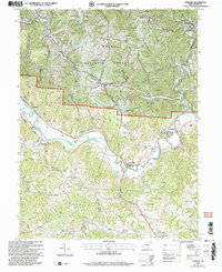 2002 Stewart2006 Print · USGSAthens County at the start of the millennium shows a landscape defined by the winding Hocking River and the expansion of the Wayne National Forest. Genealogists can trace family names at Sand Rock Cemetery and locate community hubs like Asbury Church and Broadwell.
 - 2011 Map of Stewart, 2011 Print
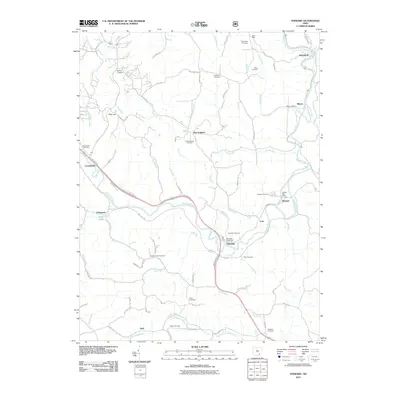 2011 Stewart2011 Print · USGSCovers Guysville, including Carthage Township, Bern Township, and other nearby areas
 - 2013 Map of Stewart, 2013 Print
 2013 Stewart2013 Print · USGSCovers Guysville, including Carthage Township, Bern Township, and other nearby areas
 - 2016 Map of Stewart, 2016 Print
 2016 Stewart2016 Print · USGSCovers Guysville, including Carthage Township, Bern Township, and other nearby areas
 - 2019 Map of Stewart, 2019 Print
 2019 Stewart2019 Print · USGSCovers Guysville, including Carthage Township, Bern Township, and other nearby areas
 - 2023 Map of Stewart, 2023 Print
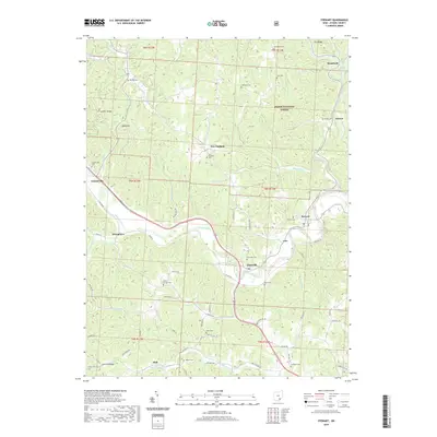
 2023 Stewart2023 Print · USGSAthens County's river valleys and forested ridges are documented here in the early twenty-first century. Genealogists can locate family burial sites at Guysville Cem and New England Cem along the winding Hocking River.
End of results
Showing maps 1-15 of 15
Top cities near Guysville
- Athens historical maps
- The Plains historical maps
- Chester historical maps
- Glouster historical maps
- Chauncey historical maps
- Jacksonville historical maps
See more
Frequently asked questions
- What are the different types of historical maps available for Guysville?
- What is the oldest map of Guysville?
- Where can I purchase historical maps of Guysville for my home or office?
- Where can I download high-res historical maps of Guysville?
- Are there historical topographic maps available for Guysville?
- Is there historical aerial imagery available for Guysville?
- Where are historical maps of Guysville sourced from?