2000-2009 Maps of Nelsonville, Trimble Township
Explore 2 historic maps of Nelsonville from 2000-2009. These maps offer a rare glimpse into what life looked like during the 2000s — showing old roads, neighborhoods, homes, and landmarks that have changed or disappeared over time.
Whether you're researching your family's past, planning a metal detecting trip, or studying how Nelsonville's landscape evolved across the 2000s, these high-resolution maps are a powerful tool for exploring the history of this region.
- Focus on a specific era: All maps on this page are from the 2000s, giving you a focused view of this time period.
- See what’s changed: Compare century-old streets, trails, and buildings to today's modern landscape using overlays and satellite layers.
- Research with precision: Use these maps for genealogy, historical research, land use analysis, or educational projects.
- View, download, or print: Maps are fully viewable online in high resolution, and can be downloaded or printed for your own records.
Start exploring Nelsonville's history through authentic maps from the 2000s. This is your window into the past.
Nelsonville, Trimble Township maps
(2)- 2002 Map of Nelsonville, 2006 Print
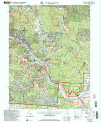 2002 Nelsonville2006 Print · USGSThe Hocking River valley at the start of the twenty-first century reveals a landscape of industrial history and forest conservation. Researchers can trace the legacy of coal mining and the Chesapeake and Ohio railroad near Buchtel and Strip Mine sites.
 - 2002 Map of Union Furnace, 2006 Print
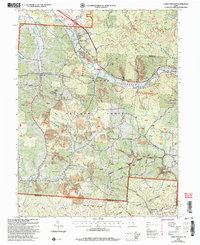 2002 Union Furnace2006 Print · USGSThe southeastern Ohio hill country is documented here at the turn of the twenty-first century, showcasing a landscape defined by coal extraction and conservation. Researchers can trace family history at Haydenville Cem or locate the old Green Sch and the community of Union Furnace.
End of results
Showing maps 1-2 of 2
Top cities near Nelsonville
- Athens historical maps
- The Plains historical maps
- Glouster historical maps
- Starr historical maps
- Chauncey historical maps
- Albany historical maps
See more
Frequently asked questions
- What are the different types of historical maps available for Nelsonville?
- What is the oldest map of Nelsonville?
- Where can I purchase historical maps of Nelsonville for my home or office?
- Where can I download high-res historical maps of Nelsonville?
- Are there historical topographic maps available for Nelsonville?
- Is there historical aerial imagery available for Nelsonville?
- Where are historical maps of Nelsonville sourced from?