Old Maps of Champaign County, Ohio for Hiking & Exploration
Hike through history with 107 historic maps of Champaign County. Explore old trails, ghost towns, and forgotten backroads — perfect for outdoor adventurers and local explorers.
- Rediscover forgotten places: Map out old mining camps, roads, and footpaths that no longer exist on modern maps.
- Layer with modern tools: Combine with LiDAR or satellite views to plan hikes through historical terrain.
- Made for exploration: Popular among hikers, overlanders, and local history lovers.
Use these maps to find adventure and explore the hidden past of Champaign County.
Champaign County, OH maps
(107)- 1913 Map of Bellefontaine
 1913 Bellefontaine1913 Print · USGSLogan County in the decade before the First World War shows a landscape connected by steam and electric rail. Genealogists can locate family landmarks from Santa Fe to Quincy, including the County Infirmary and old sites like Muchinippi Church.2 unique versions available
 - 1913 Map of Sidney, 1934 Print
 1913 Sidney1934 Print · USGSShelby County at the height of the steam and electric rail era features a landscape defined by the Miami and Erie Canal and the historic Greenville Treaty Line. Genealogists and historians can trace dozens of rural schoolhouses, including Poplar Knob School and Walnut Grove School, alongside the early streetcar route of the Western Ohio RR.2 unique versions available
 - 1914 Map of Troy, 1931 Print
 1914 Troy1931 Print · USGSMiami County at the height of the interurban era shows a landscape defined by the Miami River and competing rail lines. Genealogists can locate family landmarks like the County Infirmary or schools such as Sheepskin School and Frogpond School.2 unique versions available
 - 1914 Map of St. Paris, 1954 Print
 1914 St. Paris1954 Print · USGSChampaign County at the height of the steam and electric rail era shows a landscape of thriving rural school districts and busy market towns. Trace the footprints of early education at Mt Jesse School or locate family roots near Millerstown and the County Infirmary.2 unique versions available
 - 1914 Map of Mechanicsburg, 1954 Print
 1914 Mechanicsburg1954 Print · USGSChampaign County at the start of the Great War was a thriving landscape of rail-connected villages and one-room schoolhouses. Genealogists can trace family footprints at Pretty Prairie School, the ancient Indian Mound, or along the busy tracks of the Erie RR in North Lewisburg.
 - 1915 Map of Bellefontaine
 1915 Bellefontaine1915 Print · USGSLogan County at the start of the twentieth century shows a bustling landscape of rail hubs and lakeside settlements. Genealogists can trace family footprints at Richland New Richland PO or locate landmarks like the County Infirmary and Black Lake School.3 unique versions available
 - 1916 Map of Mechanicsburg, 1936 Print
 1916 Mechanicsburg1936 Print · USGSChampaign County at the height of the rail era shows a landscape where small villages and rural schoolhouses thrived alongside major transit corridors. Genealogists and historians can trace family locations near landmarks like Indian Mound, Catawba Station, and Five Points School.
 - 1916 Map of St. Paris, 1936 Print
 1916 St. Paris1936 Print · USGSChampaign and Clark counties are shown here just before the first World War, revealing a landscape of rural schoolhouses and bustling rail junctions. Researchers can locate family landmarks like the Speece School or trace the path of the Ohio Electric Ry through Tremont City.
 - 1916 Map of Milford Center, 1948 Print
 1916 Milford Center1948 Print · USGSThe rural expanse of central Ohio is captured here in the mid-nineteen-tens, centered on the rail junctions of Marysville and Milford Center. Genealogists and local historians can trace family roots through numerous country schools like Minoque School and the Industrial Home for Women.
 - 1944 Map of Sidney
 1944 Sidney1944 Print · USGSShelby County thrived as a rail and river hub in the mid-1940s, centered on the growing industrial town of Sidney. Researchers can trace old rural school districts and family-named landmarks such as Walnut Grove Sch, Poplar Knob, and the Childrens Home.
 - 1944 Map of Mechanicsburg
 1944 Mechanicsburg1944 Print · USGSChampaign County and its borders with Logan, Union, and Clark counties are shown here during the peak of the rail era in the 1940s. Genealogists and historians can locate numerous rural schools like Pretty Prairie Sch and landmarks such as the Indian Mound and White Cem.
 - 1944 Map of St. Paris
 1944 St. Paris1944 Print · USGSChampaign County at the height of the war years reveals a landscape of thriving rural schoolhouses and bustling rail junctions. Genealogists can trace family footprints through sites like Mt Zion Ch, Carysville, and the County Infirmary.
 - 1944 Map of Troy
 1944 Troy1944 Print · USGSMiami County during the mid-forties reveals a landscape of industrial river towns and an incredibly dense network of rural schools. Researchers can trace the path of the Miami and Erie Canal and locate family-named landmarks like Rhodhammel Sch and Staunton.
 - 1944 Map of Milford Center
 1944 Milford Center1944 Print · USGSCentral Ohio during the war years shows a landscape of busy rail junctions and fertile creek valleys. Genealogists and local historians can locate old rural schoolhouses like Lombard Sch and trace the paths of the Pennsylvania railroad through Milford Center.
 - 1944 Map of Bellefontaine
 1944 Bellefontaine1944 Print · USGSLogan County in the 1940s centers on the bustling rail junction of Bellefontaine and the recreational shores of Indian Lake. Genealogists and local historians can locate early landmarks like the County Infirmary and dozens of rural schoolhouses, including McKee Creek Sch and Miller Sch.
 - 1950 Map of Marion
 1950 Marion1950 Print · USGSCentral Ohio was a powerhouse of rail and river industry at the mid-century point, serving as a vital corridor between the Great Lakes and the Ohio River valley. Genealogists and rail historians can trace the paths of the Erie RR and Nickel Plate Road through towns like Bucyrus, Galion, and Upper Sandusky.
 - 1953 Map of Muncie, 1966 Print
 1953 Muncie1966 Print · USGSIndiana and Ohio borderlands thrive in the early fifties, showing a landscape defined by manufacturing cities and an intensive railroad network. Genealogists can trace family roots across the Indiana-Ohio line through Muncie, Celina, and Portland via the Pennsylvania railroad.5 unique versions available
 - 1956 Map of Muncie
 1956 Muncie1956 Print · USGSEastern Indiana and western Ohio are shown at a peak of rail-driven industry in the mid-fifties. Genealogists and rail historians can trace the paths of the Pennsylvania RR through Muncie or locate landmarks like Lake Saint Marys (Grand Lake Reservoir) and Frances Slocum State Forest.
 - 1960 Map of Bellefontaine, 1962 Print
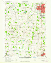 1960 Bellefontaine1962 Print · USGSCentral Ohio during the early sixties shows a landscape of growing towns and deep-rooted rural townships. Trace family history through Alexander Cem, visit the original Rutan Hospital, or follow the New York Central lines near Gretna.4 unique versions available
 - 1961 Map of Thackery, 1962 Print
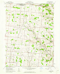 1961 Thackery1962 Print · USGSChampaign County at the start of the sixties reveals a landscape of deeply rooted farm communities and active rail corridors. Local historians can trace family ties at Evergreen Cem, Grafton Ch, and the many rural hamlets like Thackery and Terre Haute.
 - 1961 Map of North Lewisburg, 1962 Print
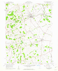 1961 North Lewisburg1962 Print · USGSChampaign and Union Counties appear here in the early sixties, showing a landscape defined by traditional family farming and crossing rail lines. Researchers can trace ancestral sites at Jenkins Chapel, Immaculate Conception Ch, and numerous family burial grounds like Graham Cem.3 unique versions available
 - 1961 Map of Saint Paris, 1962 Print
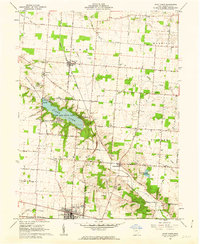 1961 Saint Paris1962 Print · USGSChampaign County agricultural life and lakeside recreation are captured here in the early sixties. Researchers can locate numerous family burial grounds like Halterman Cem and trace the path of the Detroit Toledo and Ironton RR through Rosewood.2 unique versions available
 - 1961 Map of Mechanicsburg, 1962 Print
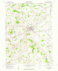 1961 Mechanicsburg1962 Print · USGSMechanicsburg was a vital rail and road junction in the early 1960s, surrounded by a landscape of family farms and rural hamlets. Researchers can trace ancestral roots through numerous local landmarks like Maple Grove Cemetery, Treacle Ch, and the small settlement of Catawba.2 unique versions available
 - 1961 Map of Kingscreek, 1962 Print
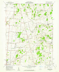 1961 Kingscreek1962 Print · USGSChampaign and Logan counties are documented here in the early sixties, showing a rural landscape of family farms and rail-stop villages. Trace local genealogy and industry through Ohio Caverns, the Township High Sch, and the Erie Lackawanna rail corridor.3 unique versions available
 - 1961 Map of Urbana West, 1962 Print
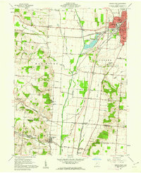 1961 Urbana West1962 Print · USGSUrbana and the Mad River valley are captured in the early sixties as a bustling hub of rail transport and rural industry. Genealogists can trace family sites at Nettle Creek Cem and Cook Cem or locate the old Urbana Jr College.4 unique versions available
Showing maps 1-25 of 107
Top cities of Champaign County
- Urbana historical maps
- Mechanicsburg historical maps
- North Lewisburg historical maps
- Christiansburg historical maps
- Woodstock historical maps
- Mutual historical maps
Frequently asked questions
- What are the different types of historical maps available for Champaign County?
- What is the oldest map of Champaign County?
- Where can I purchase historical maps of Champaign County for my home or office?
- Where can I download high-res historical maps of Champaign County?
- Are there historical topographic maps available for Champaign County?
- Is there historical aerial imagery available for Champaign County?
- Where are historical maps of Champaign County sourced from?