1960s Maps of Champaign County, Ohio
Explore 16 historic maps of Champaign County from the 1960s. These maps offer a rare glimpse into what life looked like during the 1960s — showing old roads, neighborhoods, homes, and landmarks that have changed or disappeared over time.
Whether you're researching your family's past, planning a metal detecting trip, or studying how Champaign County's landscape evolved across the 1960s, these high-resolution maps are a powerful tool for exploring the history of this region.
- Focus on a specific era: All maps on this page are from the 1960s, giving you a focused view of this time period.
- See what’s changed: Compare century-old streets, trails, and buildings to today's modern landscape using overlays and satellite layers.
- Research with precision: Use these maps for genealogy, historical research, land use analysis, or educational projects.
- View, download, or print: Maps are fully viewable online in high resolution, and can be downloaded or printed for your own records.
Start exploring Champaign County's history through authentic maps from the 1960s. This is your window into the past.
Champaign County, OH maps
(16)- 1960 Map of Bellefontaine, 1962 Print
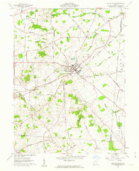
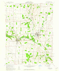
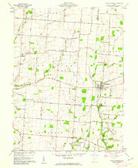
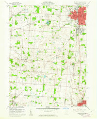 1960 Bellefontaine1962 Print · USGSCentral Ohio during the early sixties shows a landscape of growing towns and deep-rooted rural townships. Trace family history through Alexander Cem, visit the original Rutan Hospital, or follow the New York Central lines near Gretna.4 unique versions available
 - 1961 Map of Thackery, 1962 Print
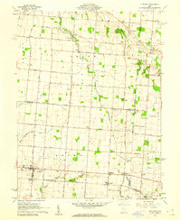
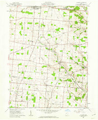 1961 Thackery1962 Print · USGSChampaign County at the start of the sixties reveals a landscape of deeply rooted farm communities and active rail corridors. Local historians can trace family ties at Evergreen Cem, Grafton Ch, and the many rural hamlets like Thackery and Terre Haute.
 - 1961 Map of North Lewisburg, 1962 Print
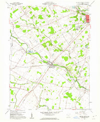
 1961 North Lewisburg1962 Print · USGSChampaign and Union Counties appear here in the early sixties, showing a landscape defined by traditional family farming and crossing rail lines. Researchers can trace ancestral sites at Jenkins Chapel, Immaculate Conception Ch, and numerous family burial grounds like Graham Cem.3 unique versions available
 - 1961 Map of Saint Paris, 1962 Print
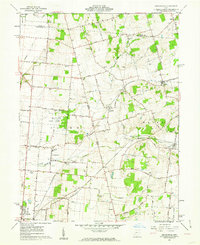
 1961 Saint Paris1962 Print · USGSChampaign County agricultural life and lakeside recreation are captured here in the early sixties. Researchers can locate numerous family burial grounds like Halterman Cem and trace the path of the Detroit Toledo and Ironton RR through Rosewood.2 unique versions available
 - 1961 Map of Mechanicsburg, 1962 Print
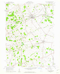
 1961 Mechanicsburg1962 Print · USGSMechanicsburg was a vital rail and road junction in the early 1960s, surrounded by a landscape of family farms and rural hamlets. Researchers can trace ancestral roots through numerous local landmarks like Maple Grove Cemetery, Treacle Ch, and the small settlement of Catawba.2 unique versions available
 - 1961 Map of Kingscreek, 1962 Print
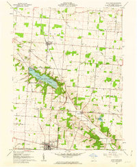
 1961 Kingscreek1962 Print · USGSChampaign and Logan counties are documented here in the early sixties, showing a rural landscape of family farms and rail-stop villages. Trace local genealogy and industry through Ohio Caverns, the Township High Sch, and the Erie Lackawanna rail corridor.3 unique versions available
 - 1961 Map of Urbana West, 1962 Print
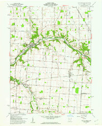
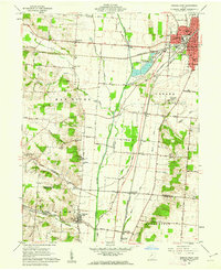 1961 Urbana West1962 Print · USGSUrbana and the Mad River valley are captured in the early sixties as a bustling hub of rail transport and rural industry. Genealogists can trace family sites at Nettle Creek Cem and Cook Cem or locate the old Urbana Jr College.4 unique versions available
 - 1961 Map of Northville, 1962 Print
 1961 Northville1962 Print · USGSChampaign County in the early 1960s is a landscape of established family farms and thriving rural hamlets like Northville and Millerstown. Researchers can trace ancestral sites through numerous family cemeteries including Scott and Pullins Cem and Idle and Stevens Cem.2 unique versions available
 - 1961 Map of De Graff, 1962 Print
 1961 De Graff1962 Print · USGSLogan County during the early 1960s reveals a landscape defined by the intersection of the New York Central Railroad and the Miami River. Researchers can trace old family lineages at Olive Chapel Cem or locate community landmarks like Riverside High Sch and the Shady Bowl Speedway.3 unique versions available
 - 1961 Map of Urbana East, 1962 Print
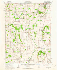
 1961 Urbana East1962 Print · USGSThe eastern edges of Urbana and the surrounding Champaign County farmlands are captured in the early sixties as the regional rail network still connected small rural hubs. Researchers can trace ancestral sites at Oakdale Cemetery, identify the location of Lawn View Sch, or find the small hamlet of Mutual.4 unique versions available
 - 1961 Map of Fletcher, 1962 Print
 1961 Fletcher1962 Print · USGSIn the early 1960s, these western Ohio farm communities remained centered on their rail stops and rural churches. Genealogists can trace family footprints near Fletcher, Conover, and Plattsville, or find local burial grounds like Pioneer Cem and Sturm Cem.3 unique versions available
 - 1961 Map of Milford Center, 1962 Print
 1961 Milford Center1962 Print · USGSUnion County enters the 1960s with a landscape defined by crossing railroads and historic creek-side settlements. Researchers can locate the State Reformatory for Women, several family cemeteries like Connor Cem, and a traditional Covered Bridge.3 unique versions available
 - 1961 Map of Christiansburg, 1962 Print
 1961 Christiansburg1962 Print · USGSChristiansburg and the surrounding Miami County farmland are captured here in the early sixties, showing a landscape of family farms and country schools. Genealogists can trace deep local roots through numerous small burial sites like Sodom Cem and Huddleston-Sills Cem.3 unique versions available
 - 1961 Map of Port Jefferson, 1962 Print
 1961 Port Jefferson1962 Print · USGSShelby County farmland and the Miami River valley appear here in the early sixties, as the local economy balanced rail transport with new pipeline infrastructure. Genealogists and local historians can locate early burial sites like Old Dunkard Cem and trace the path of the old Miami Canal.3 unique versions available
 - 1962 Map of Marion
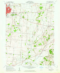
 1962 Marion1962 Print · USGSCentral Ohio during the post-war era showcases a dense network of railroad towns and emerging interstate highways. Genealogists can trace family roots in smaller settlements like Houcktown and Marseilles or locate landmarks near Indian Lake.
 - 1966 Map of Marion, 1968 Print
 1966 Marion1968 Print · USGSCentral Ohio in the mid-sixties is captured during a period of rapid highway expansion and industrial connectivity. Genealogists and historians can trace rail-and-river networks through towns like Marion, Urbana, and Mount Vernon, or locate landmarks such as Malabar Farm and Black Hand Rock.3 unique versions available
End of results
Showing maps 1-16 of 16
Top cities of Champaign County
- Urbana historical maps
- Mechanicsburg historical maps
- North Lewisburg historical maps
- Christiansburg historical maps
- Woodstock historical maps
- Mutual historical maps
Frequently asked questions
- What are the different types of historical maps available for Champaign County?
- What is the oldest map of Champaign County?
- Where can I purchase historical maps of Champaign County for my home or office?
- Where can I download high-res historical maps of Champaign County?
- Are there historical topographic maps available for Champaign County?
- Is there historical aerial imagery available for Champaign County?
- Where are historical maps of Champaign County sourced from?