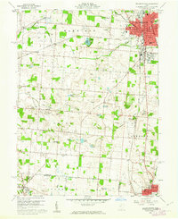
1960 Map of Bellefontaine
USGS Topo · Published 1962About this map
Bellefontaine serves as the focal point of this 1960s study, revealing a developed landscape where the New York Central railroad and Central Avenue anchor the regional economy. Beyond the urban grid of the county seat, the map reveals a rural expanse defined by an intricate network of family-named cemeteries and small community hubs like Gretna and Philadelphia. The transition into northern Champaign County is marked by the Mad River and the settlement of West Liberty, where Runkle Street and the Hanger Cem sit near the water. Genealogists will find significant value in the distribution of smaller burial grounds such as Alexander Cem and Sagers Cem, which remain as markers of early settlement patterns. From Tangers Airport to the Bellefontaine Country Club, the sheet documents the mid-century infrastructure supporting this corner of Ohio.
Find a feature on this map
66 named features on this map. Tap any name to fly to it.
Don’t see what you’re looking for? This feature index may not catch every label — zoom into the map to look around manually.
Map Details
Editions of this 1960 Bellefontaine Map
4 editions found
Other maps of this area

1913 · Bellefontaine
USGS Topo · 1:48,000

1913 · East Liberty
USGS Topo · 1:62,500

1914 · St. Paris
USGS Topo · 1:62,500

1914 · Mechanicsburg
USGS Topo · 1:62,500

1915 · Bellefontaine
USGS Topo · 1:62,500

1915 · East Liberty
USGS Topo · 1:62,500

1916 · Mechanicsburg
USGS Topo · 1:62,500

1916 · St. Paris
USGS Topo · 1:62,500

1944 · East Liberty
USGS Topo · 1:62,500

1944 · Mechanicsburg
USGS Topo · 1:62,500