Old Maps of Catawba, Ohio
Explore 38 old maps of Catawba, spanning from 1907 to today. These high-resolution historic maps reveal how streets, neighborhoods, landmarks, and natural features evolved over time — perfect for genealogy, metal detecting, research, and local history exploration.
What you can do with these maps:
- See how Catawba changed over time: Compare historical maps to modern-day views to trace roads, homesites, rail lines & more.
- View detailed metadata: Each map includes creators, publishers, year, scale, and archive source.
- Overlay maps with satellite & LiDAR: Visualize the past alongside modern tools to explore terrain & human change.
- Trusted historical sources: Maps sourced from the USGS, Library of Congress, and other archives.
- Access maps your way: View online, download high-res files, or order prints for personal or research use.
Start exploring old maps of Catawba to uncover forgotten places, hidden landmarks, and the deep history beneath your feet.
Catawba, OH maps
(38)- 1907 Map of South Charleston, 1943 Print
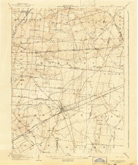 1907 South Charleston1943 Print · USGSThe Clark County countryside at the turn of the century shows a landscape dominated by rail travel and local school districts. Genealogists can locate family-named landmarks such as Yeazel School, Pancake Chapel, and the settlement of Dolly Varden.2 unique versions available
 - 1914 Map of Mechanicsburg, 1954 Print
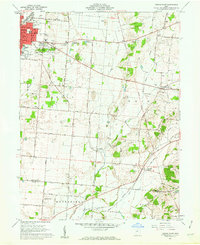
 1914 Mechanicsburg1954 Print · USGSChampaign County at the start of the Great War was a thriving landscape of rail-connected villages and one-room schoolhouses. Genealogists can trace family footprints at Pretty Prairie School, the ancient Indian Mound, or along the busy tracks of the Erie RR in North Lewisburg.
 - 1916 Map of Mechanicsburg, 1936 Print
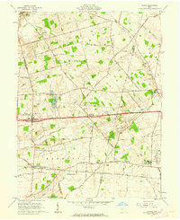
 1916 Mechanicsburg1936 Print · USGSChampaign County at the height of the rail era shows a landscape where small villages and rural schoolhouses thrived alongside major transit corridors. Genealogists and historians can trace family locations near landmarks like Indian Mound, Catawba Station, and Five Points School.
 - 1944 Map of Mechanicsburg
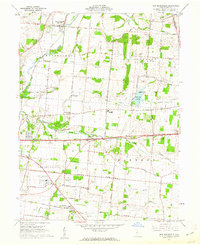
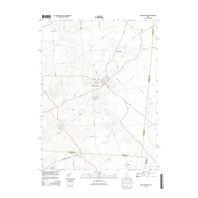
 1944 Mechanicsburg1944 Print · USGSChampaign County and its borders with Logan, Union, and Clark counties are shown here during the peak of the rail era in the 1940s. Genealogists and historians can locate numerous rural schools like Pretty Prairie Sch and landmarks such as the Indian Mound and White Cem.
 - 1947 Map of Columbus, 1948 Print
 1947 Columbus1948 Print · USGSCentral Ohio in the late 1940s is captured in this survey, showing the post-war transition of its rail hubs and military airfield expansions. Genealogists and historians can trace the paths of the Ohio Canal, the Pennsylvania RR lines, and the Camp Sherman Military Reservation.
 - 1950 Map of Marion
 1950 Marion1950 Print · USGSCentral Ohio was a powerhouse of rail and river industry at the mid-century point, serving as a vital corridor between the Great Lakes and the Ohio River valley. Genealogists and rail historians can trace the paths of the Erie RR and Nickel Plate Road through towns like Bucyrus, Galion, and Upper Sandusky.
 - 1961 Map of Columbus
 1961 Columbus1961 Print · USGSCentral and Southern Ohio are captured here in the early sixties, as the region's industrial rail hubs and military bases reached their peak. Genealogists and historians can trace the transition from urban Columbus to rural townships along the Scioto River, locating Lockbourne USAF and old junctions like Washington Court House.
 - 1961 Map of Vienna, 1962 Print
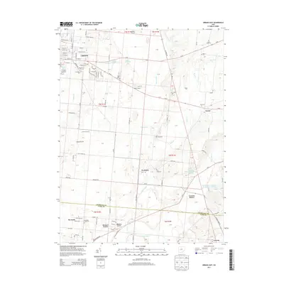
 1961 Vienna1962 Print · USGSThe Clark and Madison County line reveals a productive Ohio landscape in the early sixties, centered on the historic National Road. Researchers can trace the New York Central Railroad corridor and locate landmarks like the State Fish Hatchery and Wilson Chapel.3 unique versions available
 - 1961 Map of New Moorefield, 1962 Print
 1961 New Moorefield1962 Print · USGSClark County is captured in the early sixties as the suburban and agricultural landscapes of New Moorefield and Harmony evolved alongside major transit corridors. Researchers can locate numerous pioneer and church burial sites like Foley Cem and Asbury Cem Ch or trace the New York Central rail lines.5 unique versions available
 - 1961 Map of Mechanicsburg, 1962 Print
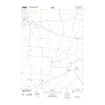
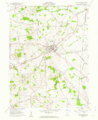 1961 Mechanicsburg1962 Print · USGSMechanicsburg was a vital rail and road junction in the early 1960s, surrounded by a landscape of family farms and rural hamlets. Researchers can trace ancestral roots through numerous local landmarks like Maple Grove Cemetery, Treacle Ch, and the small settlement of Catawba.2 unique versions available
 - 1961 Map of Urbana East, 1962 Print
 1961 Urbana East1962 Print · USGSThe eastern edges of Urbana and the surrounding Champaign County farmlands are captured in the early sixties as the regional rail network still connected small rural hubs. Researchers can trace ancestral sites at Oakdale Cemetery, identify the location of Lawn View Sch, or find the small hamlet of Mutual.4 unique versions available
 - 1962 Map of Columbus
 1962 Columbus1962 Print · USGSCentral Ohio during the early sixties reveals a transition from the industrial corridors of Columbus to the forested ridges of the south. Genealogists and historians can trace the rail networks of the Baltimore & Ohio RR and find local landmarks like Washington Court House and Camp Sherman Military Reservation.
 - 1962 Map of Marion
 1962 Marion1962 Print · USGSCentral Ohio during the post-war era showcases a dense network of railroad towns and emerging interstate highways. Genealogists can trace family roots in smaller settlements like Houcktown and Marseilles or locate landmarks near Indian Lake.
 - 1966 Map of Marion, 1968 Print
 1966 Marion1968 Print · USGSCentral Ohio in the mid-sixties is captured during a period of rapid highway expansion and industrial connectivity. Genealogists and historians can trace rail-and-river networks through towns like Marion, Urbana, and Mount Vernon, or locate landmarks such as Malabar Farm and Black Hand Rock.3 unique versions available
 - 1967 Map of Columbus, 1969 Print
 1967 Columbus1969 Print · USGSCentral Ohio during the late sixties serves as a vital corridor of rail and aviation, from the industrial streets of Springfield to the hangar lines of Lockbourne Air Force Base. Genealogists and researchers can trace the growth of towns like Circleville and London or locate rural landmarks such as St Paul church and the London Correctional Institution.2 unique versions available
 - 1986 Map of Bellefontaine
 1986 Bellefontaine1986 Print · USGSWest Central Ohio in the mid-1980s reveals a landscape of growing metropolitan fringes and established rural centers. Researchers can trace historic cemeteries and civic institutions from Oak Grove Cem to the State Reformatory For Women and Cedar Bog State Nature Preserve.
 - 1986 Map of Springfield
 1986 Springfield1986 Print · USGSCentral Ohio in the mid-1980s shows the bustling rail-and-road network connecting Springfield and Xenia to the western outskirts of Columbus. Researchers can trace old family sites and transit routes through Glen Haven Mem Cem, Madison Lake State Park, and the CONRAIL line.2 unique versions available
 - 1992 Map of Bellefontaine
 1992 Bellefontaine1992 Print · USGSWest-central Ohio in the early nineties reveals a blend of high-plateau geography and growing suburban corridors near the state capital. Genealogists can trace family connections to landmarks like Mount Tabor Church, Oak Grove Cemetery, and the high ground of Campbell Hill.
 - 2010 Map of New Moorefield, 2010 Print
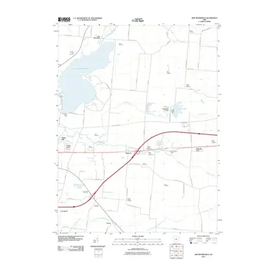 2010 New Moorefield2010 Print · USGSCovers Catawba, including Springfield, Harmony, and other nearby areas
 - 2010 Map of South Vienna, 2010 Print
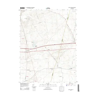
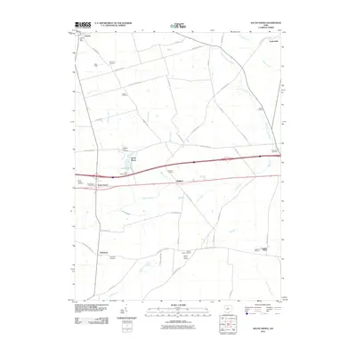 2010 South Vienna2010 Print · USGSCovers Catawba, including South Vienna, Brighton, and other nearby areas
 - 2010 Map of Mechanicsburg, 2010 Print
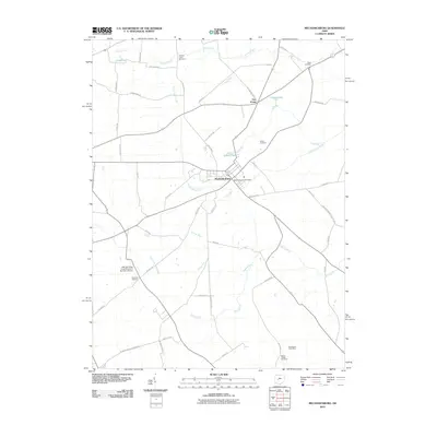 2010 Mechanicsburg2010 Print · USGSCovers Catawba, including Mechanicsburg, Pike Township, and other nearby areas
 - 2010 Map of Urbana East, 2010 Print
 2010 Urbana East2010 Print · USGSCovers Catawba, including Urbana, Mutual, and other nearby areas
 - 2013 Map of Urbana East, 2013 Print
 2013 Urbana East2013 Print · USGSCovers Catawba, including Urbana, Mutual, and other nearby areas
 - 2013 Map of Mechanicsburg, 2013 Print
 2013 Mechanicsburg2013 Print · USGSCovers Catawba, including Mechanicsburg, Pike Township, and other nearby areas
 - 2013 Map of South Vienna, 2013 Print
 2013 South Vienna2013 Print · USGSCovers Catawba, including South Vienna, Brighton, and other nearby areas
Showing maps 1-25 of 38
Top cities near Catawba
- Springfield historical maps
- Marysville historical maps
- Urbana historical maps
- London historical maps
- Harmony historical maps
- South Charleston historical maps
See more
Frequently asked questions
- What are the different types of historical maps available for Catawba?
- What is the oldest map of Catawba?
- Where can I purchase historical maps of Catawba for my home or office?
- Where can I download high-res historical maps of Catawba?
- Are there historical topographic maps available for Catawba?
- Is there historical aerial imagery available for Catawba?
- Where are historical maps of Catawba sourced from?