1900-1909 Maps of Hanoverton, Ohio
Explore 2 historic maps of Hanoverton from 1900-1909. These maps offer a rare glimpse into what life looked like during the 1900s — showing old roads, neighborhoods, homes, and landmarks that have changed or disappeared over time.
Whether you're researching your family's past, planning a metal detecting trip, or studying how Hanoverton's landscape evolved across the 1900s, these high-resolution maps are a powerful tool for exploring the history of this region.
- Focus on a specific era: All maps on this page are from the 1900s, giving you a focused view of this time period.
- See what’s changed: Compare century-old streets, trails, and buildings to today's modern landscape using overlays and satellite layers.
- Research with precision: Use these maps for genealogy, historical research, land use analysis, or educational projects.
- View, download, or print: Maps are fully viewable online in high resolution, and can be downloaded or printed for your own records.
Start exploring Hanoverton's history through authentic maps from the 1900s. This is your window into the past.
Hanoverton, OH maps
(2)- 1905 Map of Salineville, 1948 Print
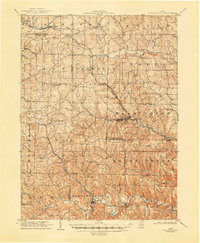 1905 Salineville1948 Print · USGSEastern Ohio at the turn of the century shows a landscape transitioning between agrarian roots and new industrial rail lines. Genealogists and researchers can trace family lands near Salineville and Bergholz, or locate rural hamlets like Summitville and Wattsville.
 - 1909 Map of Lisbon, 1937 Print
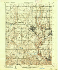 1909 Lisbon1937 Print · USGSColumbiana and Mahoning Counties flourished at the intersection of rail and agriculture in the early 1900s. Genealogists can trace family roots through numerous small hamlets and local landmarks like Franklin Square, St Jacobs Church, and New Garden.2 unique versions available
End of results
Showing maps 1-2 of 2
Top cities near Hanoverton
- Alliance historical maps
- Salem historical maps
- Columbiana historical maps
- Lexington historical maps
- Sebring historical maps
- Minerva historical maps
See more
Top neighborhoods of Hanoverton
Frequently asked questions
- What are the different types of historical maps available for Hanoverton?
- What is the oldest map of Hanoverton?
- Where can I purchase historical maps of Hanoverton for my home or office?
- Where can I download high-res historical maps of Hanoverton?
- Are there historical topographic maps available for Hanoverton?
- Is there historical aerial imagery available for Hanoverton?
- Where are historical maps of Hanoverton sourced from?