Old Maps of Tyndall, Franklin Township
Explore 13 old maps of Tyndall, spanning from 1908 to today. These high-resolution historic maps reveal how streets, neighborhoods, landmarks, and natural features evolved over time — perfect for genealogy, metal detecting, research, and local history exploration.
What you can do with these maps:
- See how Tyndall changed over time: Compare historical maps to modern-day views to trace roads, homesites, rail lines & more.
- View detailed metadata: Each map includes creators, publishers, year, scale, and archive source.
- Overlay maps with satellite & LiDAR: Visualize the past alongside modern tools to explore terrain & human change.
- Trusted historical sources: Maps sourced from the USGS, Library of Congress, and other archives.
- Access maps your way: View online, download high-res files, or order prints for personal or research use.
Start exploring old maps of Tyndall to uncover forgotten places, hidden landmarks, and the deep history beneath your feet.
Tyndall, Franklin Township maps
(13)- 1908 Map of Conesville, 1961 Print
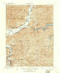 1908 Conesville1961 Print · USGSEastern Ohio at the dawn of the twentieth century was a landscape of river-valley commerce and tight-knit rural school districts. Researchers can trace the legacy of family farms and early industry through sites like Morgan Mill, Conesville, and the Science Hill School.
 - 1910 Map of Conesville, 1948 Print
 1910 Conesville1948 Print · USGSThe Muskingum River valley and the Ohio Canal are captured here in the decade before the Great War. Genealogists can trace family homesteads near dozens of rural landmarks like Young America School, Otsego, and Munroe Basin.
 - 1951 Map of Canton
 1951 Canton1951 Print · USGSThe industrial heartland of Ohio and Pennsylvania reached its mid-century peak during this era of heavy rail and river transit. Genealogists and historians can trace the development of steel towns like Aliquippa and Weirton alongside the Ohio River and major lines of the Pennsylvania RR.
 - 1953 Map of Canton
 1953 Canton1953 Print · USGSThe industrial heartland of Ohio and Pennsylvania is captured at its mid-century peak in this detailed regional survey. Genealogists and historians can trace the vast rail networks of the Pennsylvania RR and find local landmarks like Nimisila Reservoir and Tappan Reservoir.
 - 1957 Map of Canton, 1971 Print
 1957 Canton1971 Print · USGSThe industrial heartland of eastern Ohio and western Pennsylvania comes alive in this mid-century survey of the Ohio River Valley. Trace the heritage of rail and river commerce through Pittsburgh, the massive steel towns along the Ohio River, and major junctions on the Pennsylvania RR.3 unique versions available
 - 1962 Map of Canton
 1962 Canton1962 Print · USGSThe industrial heartland of Eastern Ohio and Western Pennsylvania thrives in the early sixties as steel mills and rail lines dominate the river valleys. Genealogists and historians can trace local landmarks like McKinley National Memorial, Malone College, and industrial sites such as Republic Steel Corp.2 unique versions available
 - 1962 Map of Conesville, 1963 Print
 1962 Conesville1963 Print · USGSThe Muskingum River valley comes to life in this early 1960s survey, showing the intensive coal mining and rail activity of central Ohio. Genealogists can locate family landmarks like McGee Cem, Titus Cem, and the rural community at New Moscow.4 unique versions available
 - 1994 Map of Conesville, 1998 Print
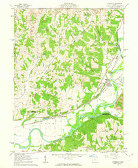
 1994 Conesville1998 Print · USGSThe Muskingum River valley during the late twentieth century reveals a landscape shaped by coal extraction and river commerce. Researchers can locate numerous family burial grounds like Warner Ch Cem and rural settlements such as New Moscow or Adams Mills.
 - 2010 Map of Conesville, 2010 Print
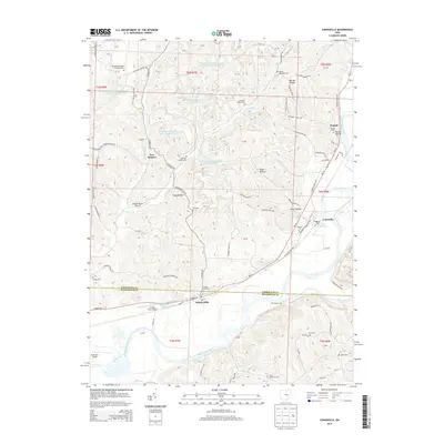
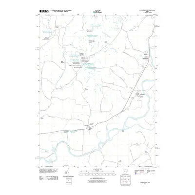 2010 Conesville2010 Print · USGSCovers Tyndall, including Franklin, Conesville, and other nearby areas
 - 2013 Map of Conesville, 2013 Print
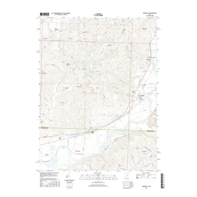
 2013 Conesville2013 Print · USGSCovers Tyndall, including Franklin, Conesville, and other nearby areas
 - 2016 Map of Conesville, 2016 Print
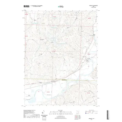
 2016 Conesville2016 Print · USGSCovers Tyndall, including Franklin, Conesville, and other nearby areas
 - 2019 Map of Conesville, 2019 Print
 2019 Conesville2019 Print · USGSCovers Tyndall, including Franklin, Conesville, and other nearby areas
 - 2023 Map of Conesville, 2023 Print
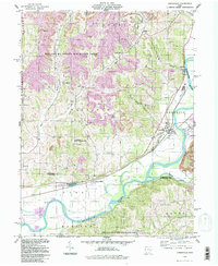
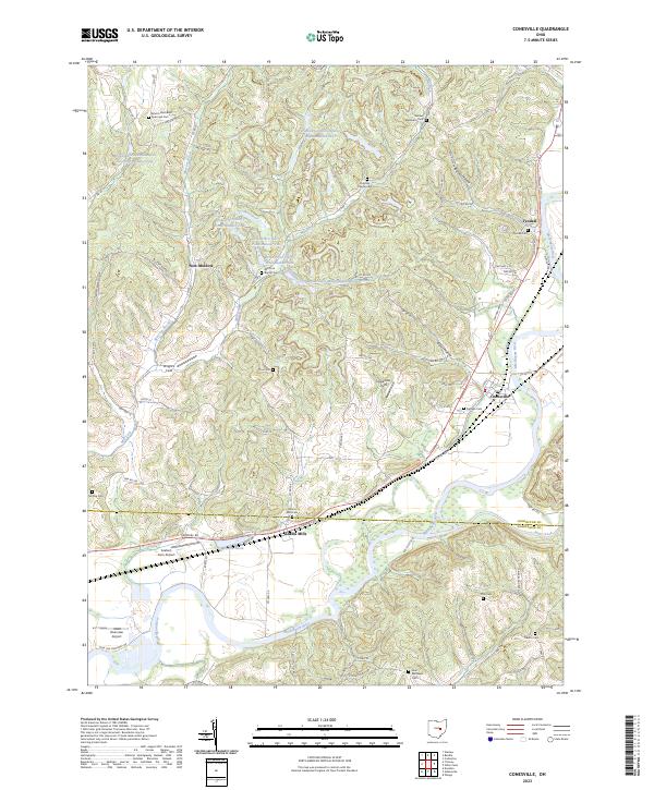 2023 Conesville2023 Print · USGSSettled along the Muskingum River in the 2020s, this area reflects a mix of coal industry impacts and deep-rooted farmsteads. Genealogists can trace family burial sites like Franklin Cem, Cox Cem, and Saint Matthews Cem across the hills.
End of results
Showing maps 1-13 of 13
Top cities near Tyndall
- Zanesville historical maps
- Coshocton historical maps
- New Concord historical maps
- West Lafayette historical maps
- Keene historical maps
- Dresden historical maps
See more
Frequently asked questions
- What are the different types of historical maps available for Tyndall?
- What is the oldest map of Tyndall?
- Where can I purchase historical maps of Tyndall for my home or office?
- Where can I download high-res historical maps of Tyndall?
- Are there historical topographic maps available for Tyndall?
- Is there historical aerial imagery available for Tyndall?
- Where are historical maps of Tyndall sourced from?