Old Maps of The Quarry, Kelleys Island for Academic Research
Study the evolution of The Quarry with 12 high-resolution historic maps. Whether you're teaching, researching, or modeling changes in land use, these maps provide essential visual documentation of urban, environmental, and geographic change.
- Analyze long-term change: Track patterns in development, transportation, and natural features.
- Ideal for environmental or urban studies: Support academic projects with primary historical map data.
- Use in the classroom or lab: Educators and researchers rely on these maps to bring historical context to life.
These maps are a powerful tool for teaching, research, and visualizing how The Quarry has changed over the decades.
The Quarry, Kelleys Island maps
(12)- 1916 Map of Kelleys Island, 1958 Print
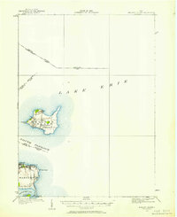 1916 Kelleys Island1958 Print · USGSLake Erie's western islands and the Marblehead peninsula are shown here as they appeared during the early twentieth century. Genealogists and local historians can trace the foundations of the island community through sites like Estes School or follow the path of the Northwestern Electric line.
 - 1919 Map of Kelleys Island, 1936 Print
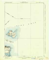 1919 Kelleys Island1936 Print · USGSLake Erie's coastal communities and islands are captured in the late nineteen-teens, during the height of the region's quarrying and port activity. Genealogists and local historians can trace school sites like St Michael School or explore the early layouts of Lakeside and Marblehead.
 - 1956 Map of Toledo, 1968 Print
 1956 Toledo1968 Print · USGSNorthwest Ohio and the Lake Erie shoreline are shown in detail during the late fifties, showcasing a landscape of heavy industry, railroads, and island communities. Genealogists and historians can trace rail networks like the Chesapeake & Ohio RR or locate landmarks such as the Erie Proving Ground and Kelleys Island.4 unique versions available
 - 1959 Map of Kelleys Island, 1961 Print
 1959 Kelleys Island1961 Print · USGSThe Lake Erie islands and Marblehead peninsula are shown here in the late fifties, featuring a mix of resort life and heavy industry. Genealogists and historians can locate the Confederate Cem on Johnson Island, the iconic Marblehead Lighthouse, and the Glacial Grooves State Memorial.2 unique versions available
 - 1961 Map of Toledo
 1961 Toledo1961 Print · USGSThe western basin of Lake Erie and the industrial heart of Northern Ohio are captured here during the post-war era. Researchers can trace historical rail lines like the New York Central or locate landmarks like the Erie Ordnance Depot and Pelee Island.
 - 1969 Map of Kelleys Island, 1971 Print
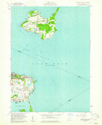
 1969 Kelleys Island1971 Print · USGSKelleys Island and the Marblehead peninsula were centers of industry and Great Lakes heritage during the late sixties. Genealogists and historians can trace cemetery locations like the Russian Cem, locate the Marblehead Lighthouse, and study the massive quarries that shaped the local landscape.2 unique versions available
 - 1986 Map of Put-In-Bay
 1986 Put-In-Bay1986 Print · USGSThe Lake Erie archipelago and Ohio shoreline are documented here in the mid-eighties, showing the region's unique maritime and rail connectivity. Trace island life and landmarks like the Marblehead Lighthouse, Put-in-Bay, and Kelleys Island.2 unique versions available
 - 2010 Map of Kelleys Island, 2010 Print
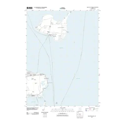 2010 Kelleys Island2010 Print · USGSCovers The Quarry, including Marblehead, Kelleys Island, and other nearby areas
 - 2013 Map of Kelleys Island, 2013 Print
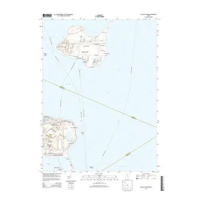 2013 Kelleys Island2013 Print · USGSCovers The Quarry, including Marblehead, Kelleys Island, and other nearby areas
 - 2016 Map of Kelleys Island, 2016 Print
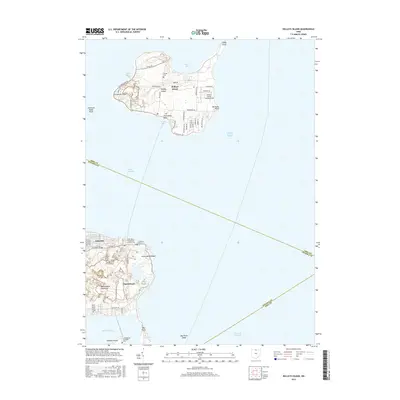 2016 Kelleys Island2016 Print · USGSCovers The Quarry, including Marblehead, Kelleys Island, and other nearby areas
 - 2019 Map of Kelleys Island, 2019 Print
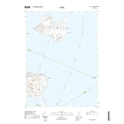 2019 Kelleys Island2019 Print · USGSCovers The Quarry, including Marblehead, Kelleys Island, and other nearby areas
 - 2023 Map of Kelleys Island, 2023 Print
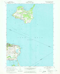
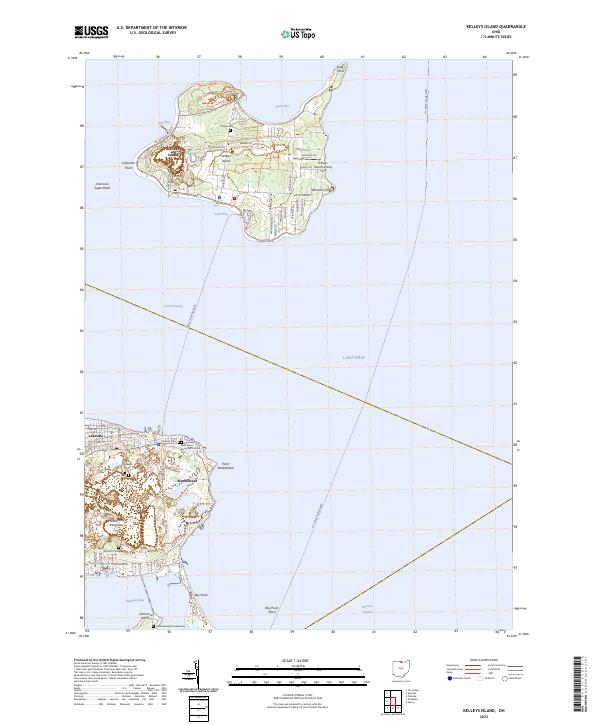 2023 Kelleys Island2023 Print · USGSKelleys Island and the Marblehead Peninsula appear here in the early twenty-first century, showing the enduring maritime character of Erie County. Researchers can locate numerous burial grounds like Confederate Stockade Cem and trace paths like the Kelleys Island East Quarry Trl.
End of results
Showing maps 1-12 of 12
Frequently asked questions
- What are the different types of historical maps available for The Quarry?
- What is the oldest map of The Quarry?
- Where can I purchase historical maps of The Quarry for my home or office?
- Where can I download high-res historical maps of The Quarry?
- Are there historical topographic maps available for The Quarry?
- Is there historical aerial imagery available for The Quarry?
- Where are historical maps of The Quarry sourced from?