Old Maps of Sandusky, Ohio
Explore 12 old maps of Sandusky, spanning from 1901 to today. These high-resolution historic maps reveal how streets, neighborhoods, landmarks, and natural features evolved over time — perfect for genealogy, metal detecting, research, and local history exploration.
What you can do with these maps:
- See how Sandusky changed over time: Compare historical maps to modern-day views to trace roads, homesites, rail lines & more.
- View detailed metadata: Each map includes creators, publishers, year, scale, and archive source.
- Overlay maps with satellite & LiDAR: Visualize the past alongside modern tools to explore terrain & human change.
- Trusted historical sources: Maps sourced from the USGS, Library of Congress, and other archives.
- Access maps your way: View online, download high-res files, or order prints for personal or research use.
Start exploring old maps of Sandusky to uncover forgotten places, hidden landmarks, and the deep history beneath your feet.
Sandusky, OH maps
(12)- 1901 Map of Bellevue, 1958 Print
 1901 Bellevue1958 Print · USGSCovers Sandusky, including Clyde, Port Clinton, and other nearby areas
 - 1903 Map of Bellevue, 1942 Print
 1903 Bellevue1942 Print · USGSCovers Sandusky, including Clyde, Port Clinton, and other nearby areas
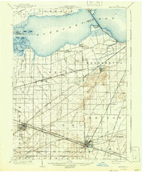
 - 1904 Map of Sandusky, 1941 Print
 1904 Sandusky1941 Print · USGSCovers Sandusky, including Norwalk, Milan, and other nearby areas3 unique versions available
 - 1956 Map of Toledo, 1968 Print
 1956 Toledo1968 Print · USGSCovers Sandusky, including Toledo, Lorain, and other nearby areas4 unique versions available
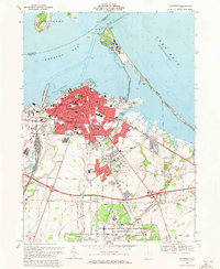
 - 1959 Map of Sandusky, 1960 Print
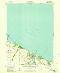
 1959 Sandusky1960 Print · USGSCovers Sandusky, including Marblehead, Margaretta Township, and other nearby areas
 - 1959 Map of Huron, 1961 Print
 1959 Huron1961 Print · USGSCovers Sandusky, including Rye beach, Grand Forest Beach, and other nearby areas
 - 1959 Map of Castalia, 1965 Print
 1959 Castalia1965 Print · USGSCovers Sandusky, including Danbury, Castalia, and other nearby areas
 - 1961 Map of Toledo
 1961 Toledo1961 Print · USGSCovers Sandusky, including Toledo, Lorain, and other nearby areas
 - 1969 Map of Huron, 1971 Print
 1969 Huron1971 Print · USGSCovers Sandusky, including Rye beach, Grand Forest Beach, and other nearby areas3 unique versions available
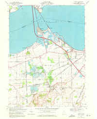
 - 1969 Map of Sandusky, 1971 Print
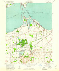
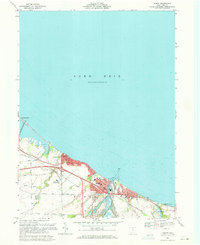
 1969 Sandusky1971 Print · USGSCovers Sandusky, including Marblehead, Margaretta Township, and other nearby areas5 unique versions available
 - 1969 Map of Castalia, 1971 Print
 1969 Castalia1971 Print · USGSCovers Sandusky, including Danbury, Castalia, and other nearby areas2 unique versions available
 - 1986 Map of Lorain
 1986 Lorain1986 Print · USGSCovers Sandusky, including Lorain, Elyria, and other nearby areas2 unique versions available
End of results
Showing maps 1-12 of 12
Top cities near Sandusky
- Norwalk historical maps
- Port Clinton historical maps
- Danbury historical maps
- Bellevue historical maps
- Milan historical maps
- Catawba Island historical maps
See more
Top neighborhoods of Sandusky
- MacArthur Park historical maps
- Venice historical maps
- Schade-Mylander Plaza historical maps
- Cedar Cove historical maps
- Kilbourne Plat historical maps
- McKelvey Plat historical maps
See more
Frequently asked questions
- What are the different types of historical maps available for Sandusky?
- What is the oldest map of Sandusky?
- Where can I purchase historical maps of Sandusky for my home or office?
- Where can I download high-res historical maps of Sandusky?
- Are there historical topographic maps available for Sandusky?
- Is there historical aerial imagery available for Sandusky?
- Where are historical maps of Sandusky sourced from?