2020s Maps of Fayette County, Ohio
Explore 11 historic maps of Fayette County from the 2020s. These maps offer a rare glimpse into what life looked like during the 2020s — showing old roads, neighborhoods, homes, and landmarks that have changed or disappeared over time.
Whether you're researching your family's past, planning a metal detecting trip, or studying how Fayette County's landscape evolved across the 2020s, these high-resolution maps are a powerful tool for exploring the history of this region.
- Focus on a specific era: All maps on this page are from the 2020s, giving you a focused view of this time period.
- See what’s changed: Compare century-old streets, trails, and buildings to today's modern landscape using overlays and satellite layers.
- Research with precision: Use these maps for genealogy, historical research, land use analysis, or educational projects.
- View, download, or print: Maps are fully viewable online in high resolution, and can be downloaded or printed for your own records.
Start exploring Fayette County's history through authentic maps from the 2020s. This is your window into the past.
Fayette County, OH maps
(11)- 2023 Map of Good Hope, 2023 Print
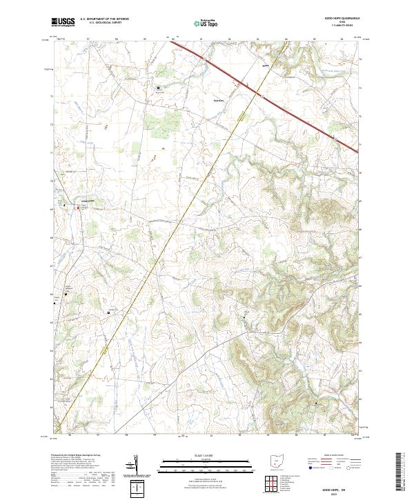 2023 Good Hope2023 Print · USGSThe Fayette and Ross county line comes to life in the 2020s, showing a landscape defined by farming and rural hamlets. Researchers can trace family roots through several small burial grounds like Good Hope Cem, Waugh Cem, and Stuckey Cem.
 - 2023 Map of New Holland, 2023 Print
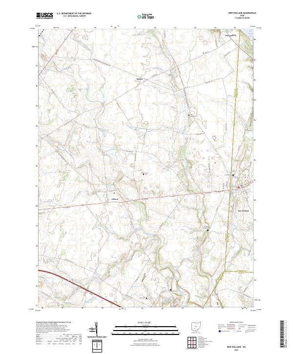 2023 New Holland2023 Print · USGSThe rural crossing of Fayette and Pickaway counties comes to life in this recent survey of New Holland and its surrounding hamlets. Researchers can trace ancestral locations at several small burial grounds, including Johnson Cem, Rowe Cem, and Compton Cem.
 - 2023 Map of New Martinsburg, 2023 Print
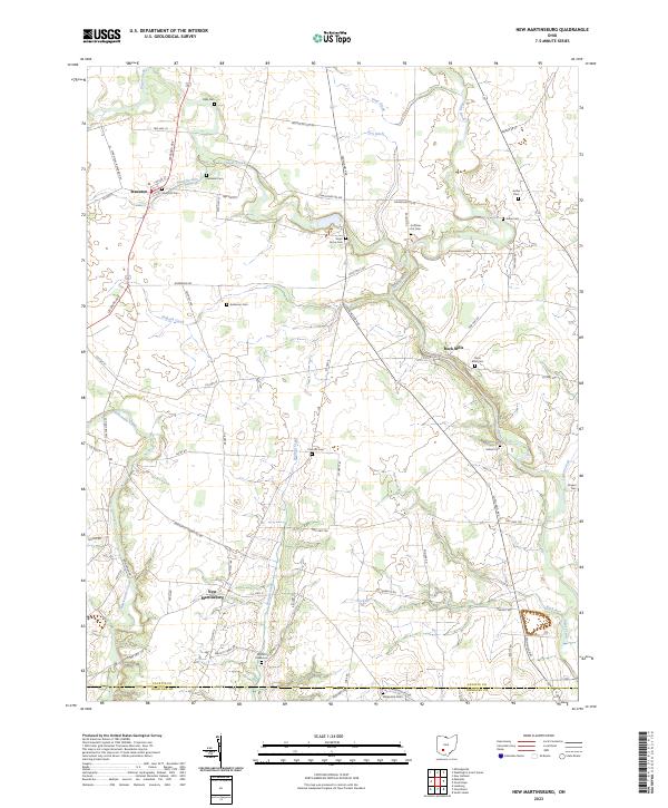 2023 New Martinsburg2023 Print · USGSFayette and Highland counties appear here in the early twenty-first century, showing a landscape defined by traditional farming and rural intersections. Genealogists can locate numerous burial sites such as Staunton Cem, Walnut Creek Cem, and Rock Mills Cem.
 - 2023 Map of Jeffersonville, 2023 Print
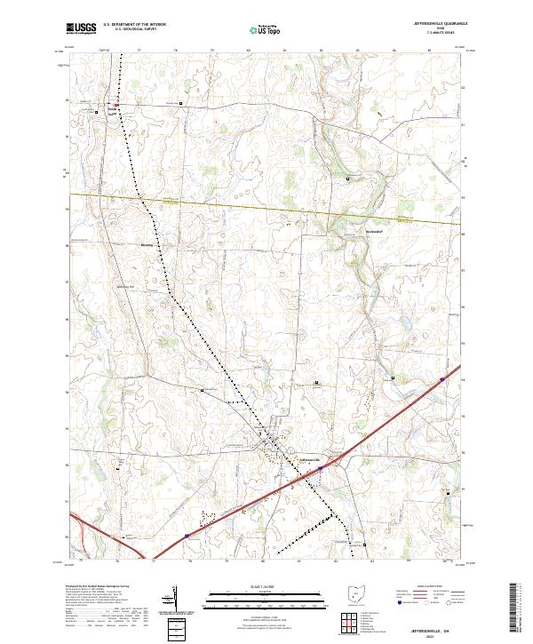 2023 Jeffersonville2023 Print · USGSThe rural border of Fayette and Madison counties is captured here in the early twenty-first century, showing a landscape defined by agriculture and deep family roots. Genealogists can trace local lineages through a dense network of burial sites, including Whiteman Cem, Hidy Cem, and McKillip Kirk Cem.
 - 2023 Map of Mount Sterling, 2023 Print
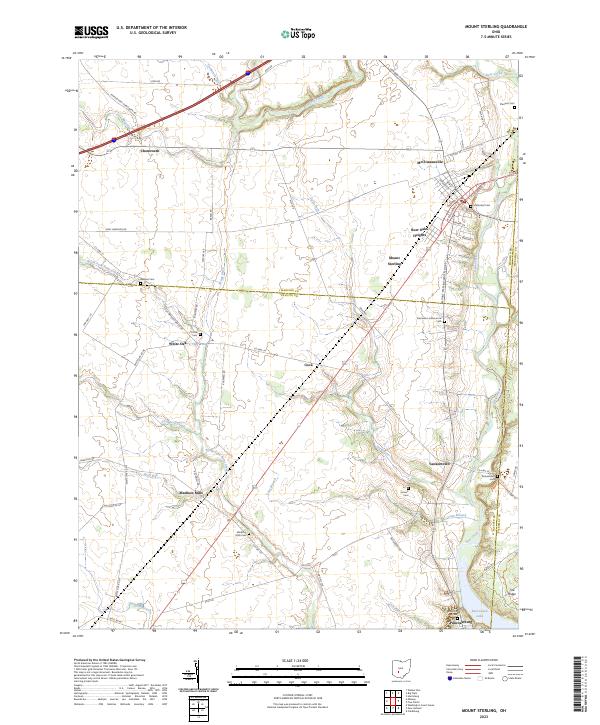 2023 Mount Sterling2023 Print · USGSThe tri-county border lands of Madison, Fayette, and Pickaway counties are documented here in the early twenty-first century. Genealogists and local historians can trace family roots at the Madison Mills Cem, Leavell Cem, and in small settlements like Yankeetown and Cook.
 - 2023 Map of Washington Court House, 2023 Print
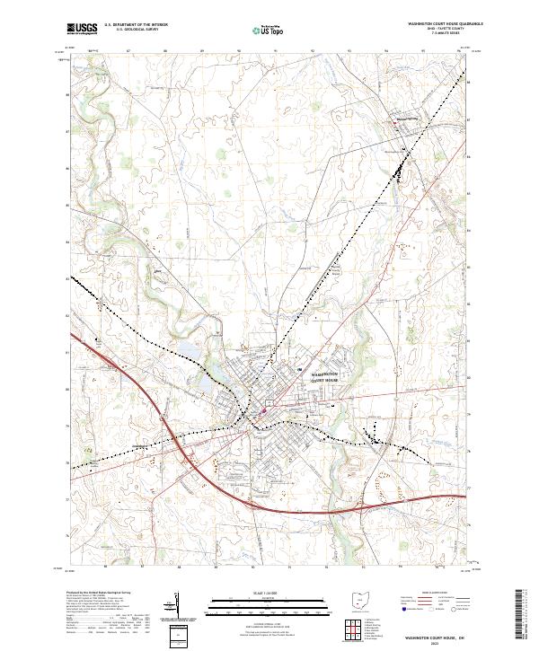 2023 Washington Court House2023 Print · USGSFayette County in the early twenty-first century centers on the hub of Washington Court House. Genealogists and historians can trace the town's growth and find local landmarks like Bloomingburg, the Fayette County Courthouse, and the Old Washington Cem.
 - 2023 Map of Midway, 2023 Print
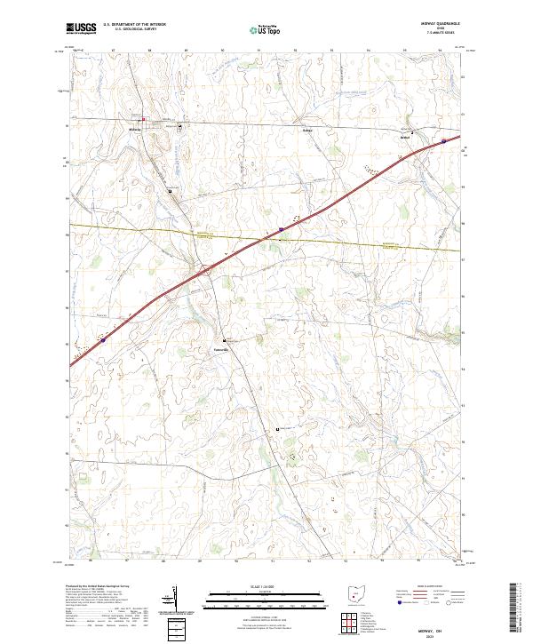 2023 Midway2023 Print · USGSAgricultural life in Madison and Fayette counties is captured here in the early twenty-first century. Researchers can trace family history through several small rural burial sites like Union Chapel Cem, Counts Cem, and Vesey Cem.
 - 2023 Map of Jamestown, 2023 Print
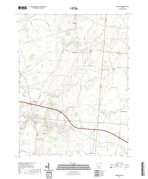 2023 Jamestown2023 Print · USGSSouthwestern Ohio farmland and rural crossroads are captured here in the early twenty-first century. Researchers can locate several burial sites like Quaker Cem and Grape Grove Cem, or trace the winding path of South Fork Massies Creek.
 - 2023 Map of Milledgeville, 2023 Print
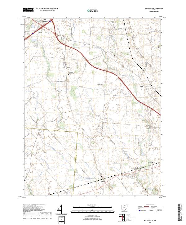 2023 Milledgeville2023 Print · USGSFayette County agricultural life is captured here in the modern era, showing the enduring footprint of rural hamlets and family cemeteries. Researchers can trace ancestral locations at Jefferson Township Cem or the namesake Milledgeville and Jasper Mills.
 - 2023 Map of Memphis, 2023 Print
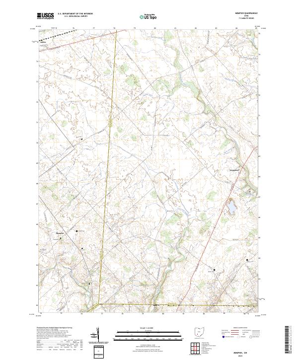 2023 Memphis2023 Print · USGSThe tri-county borderlands of Clinton, Fayette, and Highland counties are shown here in the 2020s. Genealogists can trace family footprints across numerous sites like Richland Cem, White Oak Grove Cem, and Memphis.
 - 2023 Map of Bowersville, 2023 Print
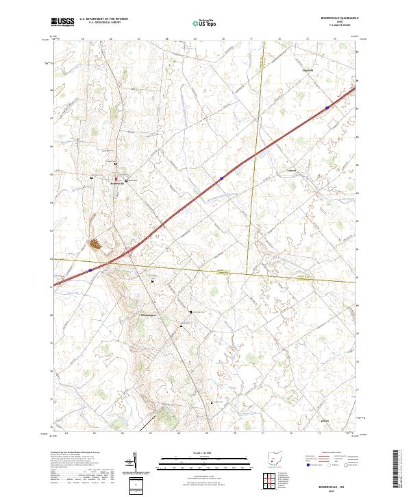 2023 Bowersville2023 Print · USGSThe rural landscape where Greene, Fayette, and Clinton Counties meet is captured here in the early twenty-first century. Researchers can locate numerous family burial grounds including Hussey Cem and Coulter Cem near the village of Bowersville.
End of results
Showing maps 1-11 of 11
Top cities of Fayette County
- Washington Court House historical maps
- Jeffersonville historical maps
- Bloomingburg historical maps
- Milledgeville historical maps
- Octa historical maps
Frequently asked questions
- What are the different types of historical maps available for Fayette County?
- What is the oldest map of Fayette County?
- Where can I purchase historical maps of Fayette County for my home or office?
- Where can I download high-res historical maps of Fayette County?
- Are there historical topographic maps available for Fayette County?
- Is there historical aerial imagery available for Fayette County?
- Where are historical maps of Fayette County sourced from?