1960s Maps of Brown Township, Ohio
Explore 9 historic maps of Brown Township from the 1960s. These maps offer a rare glimpse into what life looked like during the 1960s — showing old roads, neighborhoods, homes, and landmarks that have changed or disappeared over time.
Whether you're researching your family's past, planning a metal detecting trip, or studying how Brown Township's landscape evolved across the 1960s, these high-resolution maps are a powerful tool for exploring the history of this region.
- Focus on a specific era: All maps on this page are from the 1960s, giving you a focused view of this time period.
- See what’s changed: Compare century-old streets, trails, and buildings to today's modern landscape using overlays and satellite layers.
- Research with precision: Use these maps for genealogy, historical research, land use analysis, or educational projects.
- View, download, or print: Maps are fully viewable online in high resolution, and can be downloaded or printed for your own records.
Start exploring Brown Township's history through authentic maps from the 1960s. This is your window into the past.
Brown Township, OH maps
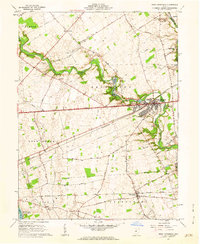
(9)- 1961 Map of Columbus
 1961 Columbus1961 Print · USGSCentral and Southern Ohio are captured here in the early sixties, as the region's industrial rail hubs and military bases reached their peak. Genealogists and historians can trace the transition from urban Columbus to rural townships along the Scioto River, locating Lockbourne USAF and old junctions like Washington Court House.
 - 1961 Map of West Jefferson, 1962 Print
 1961 West Jefferson1962 Print · USGSMadison County's agricultural heartland is documented here in the early sixties, centered on the rail-and-river hub of West Jefferson. Researchers can trace family roots through sites like Hampton Cem and the rural community at Lilly Chapel.4 unique versions available
 - 1961 Map of Plain City, 1962 Print
 1961 Plain City1962 Print · USGSThe border of Madison and Union counties comes alive in the early sixties, centered on the growing village of Plain City. Researchers can trace ancestral farmsteads near Sweeney Cem, local schools like Canaan Sch, and the winding path of Big Darby Creek.3 unique versions available
 - 1962 Map of Columbus
 1962 Columbus1962 Print · USGSCentral Ohio during the early sixties reveals a transition from the industrial corridors of Columbus to the forested ridges of the south. Genealogists and historians can trace the rail networks of the Baltimore & Ohio RR and find local landmarks like Washington Court House and Camp Sherman Military Reservation.
 - 1962 Map of Marion
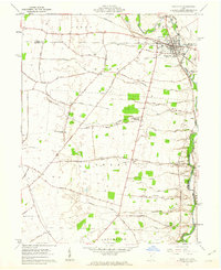
 1962 Marion1962 Print · USGSCentral Ohio during the post-war era showcases a dense network of railroad towns and emerging interstate highways. Genealogists can trace family roots in smaller settlements like Houcktown and Marseilles or locate landmarks near Indian Lake.
 - 1966 Map of Marion, 1968 Print
 1966 Marion1968 Print · USGSCentral Ohio in the mid-sixties is captured during a period of rapid highway expansion and industrial connectivity. Genealogists and historians can trace rail-and-river networks through towns like Marion, Urbana, and Mount Vernon, or locate landmarks such as Malabar Farm and Black Hand Rock.3 unique versions available
 - 1966 Map of Galloway, 1968 Print
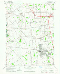
 1966 Galloway1968 Print · USGSWestern Franklin County was a landscape of transitioning farmsteads and new suburban tracts in the mid-sixties. Genealogists and local historians can trace old family cemetery plots like Clover Cem and Galloway Cem alongside vanished landmarks like Columbus Airpark.4 unique versions available
 - 1966 Map of Hilliard, 1968 Print
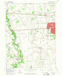
 1966 Hilliard1968 Print · USGSMid-century Franklin County comes to life as the railroad town of Hilliard begins to expand into its surrounding agricultural townships. Researchers can trace the layout of small vanished junctions and local landmarks like Mudsock, the County Fairground, and the St Johns Ch Cem.5 unique versions available
 - 1967 Map of Columbus, 1969 Print
 1967 Columbus1969 Print · USGSCentral Ohio during the late sixties serves as a vital corridor of rail and aviation, from the industrial streets of Springfield to the hangar lines of Lockbourne Air Force Base. Genealogists and researchers can trace the growth of towns like Circleville and London or locate rural landmarks such as St Paul church and the London Correctional Institution.2 unique versions available
End of results
Showing maps 1-9 of 9
Top cities near Brown Township
- Columbus historical maps
- Dublin historical maps
- Delaware historical maps
- Hilliard historical maps
- Upper Arlington historical maps
- Grove City historical maps
See more
Top neighborhoods of Brown Township
Frequently asked questions
- What are the different types of historical maps available for Brown Township?
- What is the oldest map of Brown Township?
- Where can I purchase historical maps of Brown Township for my home or office?
- Where can I download high-res historical maps of Brown Township?
- Are there historical topographic maps available for Brown Township?
- Is there historical aerial imagery available for Brown Township?
- Where are historical maps of Brown Township sourced from?