1950s Maps of Norwich Township, Ohio
Explore 5 historic maps of Norwich Township from the 1950s. These maps offer a rare glimpse into what life looked like during the 1950s — showing old roads, neighborhoods, homes, and landmarks that have changed or disappeared over time.
Whether you're researching your family's past, planning a metal detecting trip, or studying how Norwich Township's landscape evolved across the 1950s, these high-resolution maps are a powerful tool for exploring the history of this region.
- Focus on a specific era: All maps on this page are from the 1950s, giving you a focused view of this time period.
- See what’s changed: Compare century-old streets, trails, and buildings to today's modern landscape using overlays and satellite layers.
- Research with precision: Use these maps for genealogy, historical research, land use analysis, or educational projects.
- View, download, or print: Maps are fully viewable online in high resolution, and can be downloaded or printed for your own records.
Start exploring Norwich Township's history through authentic maps from the 1950s. This is your window into the past.
Norwich Township, OH maps
(5)- 1950 Map of Marion
 1950 Marion1950 Print · USGSCentral Ohio was a powerhouse of rail and river industry at the mid-century point, serving as a vital corridor between the Great Lakes and the Ohio River valley. Genealogists and rail historians can trace the paths of the Erie RR and Nickel Plate Road through towns like Bucyrus, Galion, and Upper Sandusky.
 - 1954 Map of Hilliard, 1956 Print
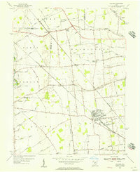 1954 Hilliard1956 Print · USGSCentral Ohio farm country and railway junctions are captured here in the mid-fifties, centered on the growing village of Hilliard. Genealogists can locate old rural landmarks like Mudsock, St John Ch, and the Hilliard Cemetery as they appeared before suburbanization.
 - 1955 Map of Northwest Columbus, 1956 Print
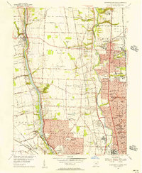 1955 Northwest Columbus1956 Print · USGSMid-century Columbus and its northern reaches reveal a landscape of rapid suburban growth and established institutions. Researchers can trace the development of Upper Arlington and Worthington alongside landmarks like Don Scott Field and the Griggs Reservoir.2 unique versions available
 - 1955 Map of Galloway, 1956 Print
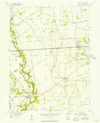 1955 Galloway1956 Print · USGSThe rural fringes of western Columbus during the mid-fifties reveal a landscape of creek-side camps and rail-stop villages. Genealogists can trace family names through sites like Oak Grove Cem and Gundy Cem, or locate the historic Alton Station along the Pennsylvania Railroad.
 - 1955 Map of Southwest Columbus, 1956 Print
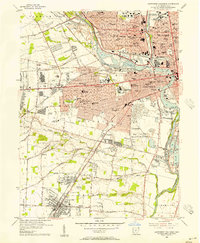 1955 Southwest Columbus1956 Print · USGSMid-century Franklin County is captured here during a period of significant urban growth and industrial activity. Researchers can trace the development of neighborhoods like Grove City and Urbancrest, or locate family landmarks at Greenlawn Cemetery and Salem Ch.
End of results
Showing maps 1-5 of 5
Top cities near Norwich Township
- Columbus historical maps
- Dublin historical maps
- Delaware historical maps
- Westerville historical maps
- Hilliard historical maps
- Upper Arlington historical maps
See more
Top neighborhoods of Norwich Township
Frequently asked questions
- What are the different types of historical maps available for Norwich Township?
- What is the oldest map of Norwich Township?
- Where can I purchase historical maps of Norwich Township for my home or office?
- Where can I download high-res historical maps of Norwich Township?
- Are there historical topographic maps available for Norwich Township?
- Is there historical aerial imagery available for Norwich Township?
- Where are historical maps of Norwich Township sourced from?