1990s Maps of Troy Township, Ohio
Explore 5 historic maps of Troy Township from the 1990s. These maps offer a rare glimpse into what life looked like during the 1990s — showing old roads, neighborhoods, homes, and landmarks that have changed or disappeared over time.
Whether you're researching your family's past, planning a metal detecting trip, or studying how Troy Township's landscape evolved across the 1990s, these high-resolution maps are a powerful tool for exploring the history of this region.
- Focus on a specific era: All maps on this page are from the 1990s, giving you a focused view of this time period.
- See what’s changed: Compare century-old streets, trails, and buildings to today's modern landscape using overlays and satellite layers.
- Research with precision: Use these maps for genealogy, historical research, land use analysis, or educational projects.
- View, download, or print: Maps are fully viewable online in high resolution, and can be downloaded or printed for your own records.
Start exploring Troy Township's history through authentic maps from the 1990s. This is your window into the past.
Troy Township, OH maps
(5)- 1994 Map of Cleveland South
 1994 Cleveland South1994 Print · USGSThe metropolitan corridor between Akron and Cleveland is shown here in the mid-nineties during a period of significant suburban growth. Researchers can trace the path of the Ohio Turnpike or explore expansive recreation lands like West Branch State Park.
 - 1994 Map of Mantua, 1997 Print
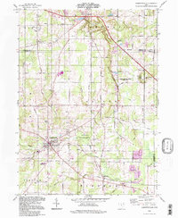
 1994 Mantua1997 Print · USGSPortage County in the mid-nineties remains a landscape of historic academic centers and preserved river corridors. Researchers can trace family roots at Westlawn Cem, explore the grounds of Hiram College, or locate the old Hiram Rapids settlement.
 - 1994 Map of Garrettsville, 1997 Print
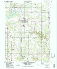
 1994 Garrettsville1997 Print · USGSGarrettsville and the surrounding townships of Portage and Geauga counties are captured here in the late twentieth century. Genealogists and local historians can trace family-named sites like Abbot Cem and Harrington Cem or explore the distinct geology of Nelson Ledge.
 - 1994 Map of Middlefield, 1997 Print
 1994 Middlefield1997 Print · USGSGeauga County’s rural townships are captured here in the mid-1990s, showing a landscape defined by headwater streams and scattered crossroads. Researchers can trace family history through sites like Burroughs Cem, the Shrine of Maria-Poch, and the old rail corridor at Burton Station.
 - 1994 Map of Burton, 2000 Print
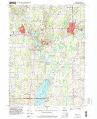 1994 Burton2000 Print · USGSGeauga County in the 1990s showcases a blend of established village centers and protected natural areas. Genealogists and historians can trace family locations near Welton Cem and Welshfield, or explore the development around Punderson Lake State Park.
End of results
Showing maps 1-5 of 5
Top cities near Troy Township
- Kent historical maps
- Willoughby historical maps
- Streetsboro historical maps
- Aurora historical maps
- Ravenna historical maps
- Newton Township historical maps
See more
Top neighborhoods of Troy Township
Frequently asked questions
- What are the different types of historical maps available for Troy Township?
- What is the oldest map of Troy Township?
- Where can I purchase historical maps of Troy Township for my home or office?
- Where can I download high-res historical maps of Troy Township?
- Are there historical topographic maps available for Troy Township?
- Is there historical aerial imagery available for Troy Township?
- Where are historical maps of Troy Township sourced from?