2020s Maps of The Woods at Wright Field, Bath Township
Explore 1 historic maps of The Woods at Wright Field from the 2020s. These maps offer a rare glimpse into what life looked like during the 2020s — showing old roads, neighborhoods, homes, and landmarks that have changed or disappeared over time.
Whether you're researching your family's past, planning a metal detecting trip, or studying how The Woods at Wright Field's landscape evolved across the 2020s, these high-resolution maps are a powerful tool for exploring the history of this region.
- Focus on a specific era: All maps on this page are from the 2020s, giving you a focused view of this time period.
- See what’s changed: Compare century-old streets, trails, and buildings to today's modern landscape using overlays and satellite layers.
- Research with precision: Use these maps for genealogy, historical research, land use analysis, or educational projects.
- View, download, or print: Maps are fully viewable online in high resolution, and can be downloaded or printed for your own records.
Start exploring The Woods at Wright Field's history through authentic maps from the 2020s. This is your window into the past.
The Woods at Wright Field, Bath Township maps
(1)- 2023 Map of Fairborn, 2023 Print
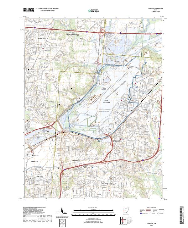 2023 Fairborn2023 Print · USGSGreene and Montgomery counties appear in the twenty-first century as a major hub of military and academic activity. Trace local roots through sites like Bath Cem, Aley Cem, and the Dayton Aviation Heritage National Historical Park.
End of results
Showing maps 1-1 of 1
Top cities near The Woods at Wright Field
- Dayton historical maps
- Springfield historical maps
- Kettering historical maps
- Beavercreek historical maps
- Huber Heights historical maps
- Fairborn historical maps
See more
Top neighborhoods of The Woods at Wright Field
Frequently asked questions
- What are the different types of historical maps available for The Woods at Wright Field?
- What is the oldest map of The Woods at Wright Field?
- Where can I purchase historical maps of The Woods at Wright Field for my home or office?
- Where can I download high-res historical maps of The Woods at Wright Field?
- Are there historical topographic maps available for The Woods at Wright Field?
- Is there historical aerial imagery available for The Woods at Wright Field?
- Where are historical maps of The Woods at Wright Field sourced from?