Old Maps of Fairborn, Ohio for Genealogy
Trace your family roots with 26 historic maps of Fairborn. These high-res maps reveal old neighborhoods, homesites, landmarks, and streets — helping you uncover where your ancestors lived and how the area evolved over time.
- Explore historic neighborhoods: Identify where your relatives may have lived in the 1800s or 1900s.
- Compare maps over time: Trace the changes in streets, buildings, and landmarks for multi-generational research.
- Perfect for genealogy & ancestry research: Used by family historians and researchers to map out lineage and migration.
These maps are an incredible resource for exploring your personal connection to Fairborn's past.
Fairborn, OH maps
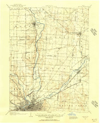
(26)- 1904 Map of Springfield, 1952 Print
 1904 Springfield1952 Print · USGSWest-central Ohio was a bustling network of electric railways and turnpikes at the opening of the twentieth century. Researchers can trace the early industrial footprint of Springfield or locate family roots near Yellow Springs, Pitchin, and the Masonic Home.2 unique versions available
 - 1904 Map of Dayton, 1956 Print
 1904 Dayton1956 Print · USGSThe Miami Valley at the dawn of the 1900s shows a landscape transformed by the Miami and Erie Canal and a dense network of interurban electric railways. Researchers can trace historic river communities like Osborn and Tipp City or follow the early path of the National Road.
 - 1906 Map of Dayton, 1935 Print
 1906 Dayton1935 Print · USGSThe Dayton region in the early twentieth century shows a landscape transitioning from the canal era to the age of electric interurbans and railroads. Trace the original sites of Osborn and Fairfield or locate the path of the Miami and Erie Canal.2 unique versions available
 - 1906 Map of Springfield, 1942 Print
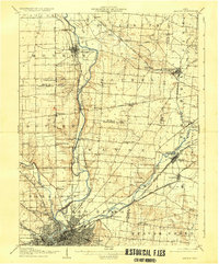
 1906 Springfield1942 Print · USGSSpringfield and the surrounding Clark and Greene County townships are shown here during the peak era of electric traction and steam rail. Genealogists can trace family footprints through Ferncliff Cemetery, the Masonic Home, and settlements like Yellow Springs and Enon.
 - 1947 Map of Columbus, 1948 Print
 1947 Columbus1948 Print · USGSCentral Ohio in the late 1940s is captured in this survey, showing the post-war transition of its rail hubs and military airfield expansions. Genealogists and historians can trace the paths of the Ohio Canal, the Pennsylvania RR lines, and the Camp Sherman Military Reservation.
 - 1953 Map of Cincinnati, 1965 Print
 1953 Cincinnati1965 Print · USGSThe Ohio River valley and the industrial heartland of Indiana and Ohio are captured here during the mid-century peak of rail and river commerce. Genealogists and historians can trace connections between Cincinnati and outlying military sites like Camp Atterbury and Bakalar AFB.3 unique versions available
 - 1955 Map of Yellow Springs, 1956 Print
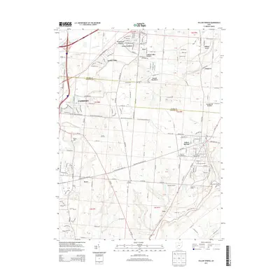
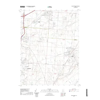
 1955 Yellow Springs1956 Print · USGSMid-century Greene County centers on the academic and social landscape of Yellow Springs as it appeared in the mid-fifties. Local researchers can trace family landmarks and rural life at Antioch College, Pleasant Grove Ch, and the small settlement of Goes.2 unique versions available
 - 1955 Map of Fairborn, 1957 Print
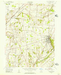
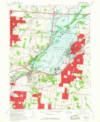
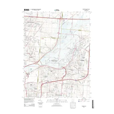
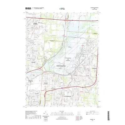
 1955 Fairborn1957 Print · USGSGreene County is defined by the massive expansion of the Wright-Patterson Air Force Base during the mid-fifties. Researchers can trace the growth of Fairborn, locate the Wright Bros Memorial, and find family-named landmarks like the John Cox Cemetery.
 - 1957 Map of Cincinnati
 1957 Cincinnati1957 Print · USGSThe Ohio River valley and its surrounding highlands thrived during the mid-fifties industrial peak, centered on the bustling Cincinnati and Dayton metropolitan hubs. Researchers can trace the extensive rail networks and military sites like Wright-Patterson AFB and Camp Atterbury.
 - 1961 Map of Columbus
 1961 Columbus1961 Print · USGSCentral and Southern Ohio are captured here in the early sixties, as the region's industrial rail hubs and military bases reached their peak. Genealogists and historians can trace the transition from urban Columbus to rural townships along the Scioto River, locating Lockbourne USAF and old junctions like Washington Court House.
 - 1962 Map of Columbus
 1962 Columbus1962 Print · USGSCentral Ohio during the early sixties reveals a transition from the industrial corridors of Columbus to the forested ridges of the south. Genealogists and historians can trace the rail networks of the Baltimore & Ohio RR and find local landmarks like Washington Court House and Camp Sherman Military Reservation.
 - 1965 Map of Fairborn, 1967 Print
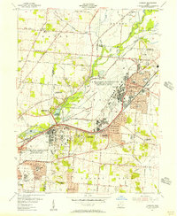
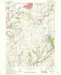
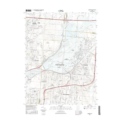
 1965 Fairborn1967 Print · USGSThe Dayton suburbs and Fairborn area undergo rapid postwar expansion during the mid-sixties, centered on the massive Wright-Patterson Air Force Base. Researchers can trace the early layout of Wright State University and vanished rail stops along the Erie Lackawanna.6 unique versions available
 - 1967 Map of Columbus, 1969 Print
 1967 Columbus1969 Print · USGSCentral Ohio during the late sixties serves as a vital corridor of rail and aviation, from the industrial streets of Springfield to the hangar lines of Lockbourne Air Force Base. Genealogists and researchers can trace the growth of towns like Circleville and London or locate rural landmarks such as St Paul church and the London Correctional Institution.2 unique versions available
 - 1968 Map of Yellow Springs, 1970 Print
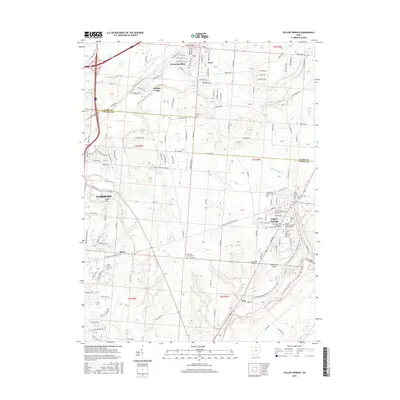
 1968 Yellow Springs1970 Print · USGSThe Yellow Springs and Fairborn corridor is captured here in the late sixties as suburban growth met historic academic and rural landscapes. Genealogists and historians can locate legacy sites like Antioch College, the Mud Run Cem, and several local schools like Hustead Sch.4 unique versions available
 - 1986 Map of Springfield
 1986 Springfield1986 Print · USGSCentral Ohio in the mid-1980s shows the bustling rail-and-road network connecting Springfield and Xenia to the western outskirts of Columbus. Researchers can trace old family sites and transit routes through Glen Haven Mem Cem, Madison Lake State Park, and the CONRAIL line.2 unique versions available
 - 1986 Map of Dayton
 1986 Dayton1986 Print · USGSThe Miami Valley and the Indiana-Ohio borderlands reached a peak of suburban and industrial connectivity in the mid-eighties. Genealogists and historians can trace family burial sites at Miami Memorial Garden (Cem) and the development surrounding Wright-Patterson Air Force Base.2 unique versions available
 - 2010 Map of Fairborn, 2010 Print
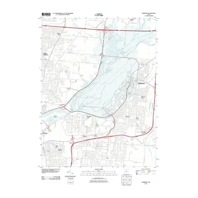 2010 Fairborn2010 Print · USGSCovers Fairborn, including Dayton, Beavercreek, and other nearby areas
 - 2010 Map of Yellow Springs, 2010 Print
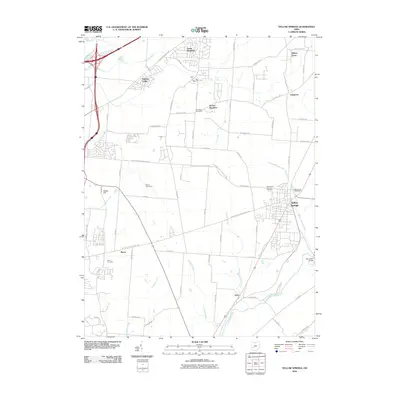 2010 Yellow Springs2010 Print · USGSCovers Fairborn, including Yellow Springs, Enon, and other nearby areas
 - 2013 Map of Fairborn, 2013 Print
 2013 Fairborn2013 Print · USGSCovers Fairborn, including Dayton, Beavercreek, and other nearby areas
 - 2013 Map of Yellow Springs, 2013 Print
 2013 Yellow Springs2013 Print · USGSCovers Fairborn, including Yellow Springs, Enon, and other nearby areas
 - 2016 Map of Yellow Springs, 2016 Print
 2016 Yellow Springs2016 Print · USGSCovers Fairborn, including Yellow Springs, Enon, and other nearby areas
 - 2016 Map of Fairborn, 2016 Print
 2016 Fairborn2016 Print · USGSCovers Fairborn, including Dayton, Beavercreek, and other nearby areas
 - 2019 Map of Fairborn, 2019 Print
 2019 Fairborn2019 Print · USGSCovers Fairborn, including Dayton, Beavercreek, and other nearby areas
 - 2019 Map of Yellow Springs, 2019 Print
 2019 Yellow Springs2019 Print · USGSCovers Fairborn, including Yellow Springs, Enon, and other nearby areas
 - 2023 Map of Yellow Springs, 2023 Print
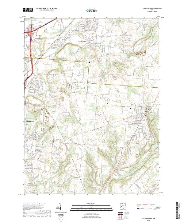 2023 Yellow Springs2023 Print · USGSThe village of Yellow Springs and its surrounding Greene County townships are captured in this modern survey. Researchers can trace local history through Antioch College and numerous burial grounds including Glen Forest Cem and Byron Cem.
Showing maps 1-25 of 26
Top cities near Fairborn
- Dayton historical maps
- Springfield historical maps
- Kettering historical maps
- Beavercreek historical maps
- Huber Heights historical maps
- Xenia historical maps
See more
Top neighborhoods of Fairborn
- Buckeye Trailer Court historical maps
- Five Points historical maps
- Red Oak Mobile Home Park historical maps
- South Point Village Mobile Home Park historical maps
- Wrightview historical maps
- Thomas Trailer Park historical maps
See more
Frequently asked questions
- What are the different types of historical maps available for Fairborn?
- What is the oldest map of Fairborn?
- Where can I purchase historical maps of Fairborn for my home or office?
- Where can I download high-res historical maps of Fairborn?
- Are there historical topographic maps available for Fairborn?
- Is there historical aerial imagery available for Fairborn?
- Where are historical maps of Fairborn sourced from?